Backpacking Travel Southern Africa – A Travel Experience Report
A Travel Experience Report
by Manfred Suchan
1. Introduction
From 28 October 2025 to 28 December 2025, I undertook a two-month backpacking travel in the geographical region of southern Africa (1). When I travel, I do not visit countries or states, but rather geographical regions (2) that I have defined myself, and this is a matter of scientific categorisation (3) and classification (4). While, for example, in the historical sciences, categories are formed in the form of historical ages and epochs, which, like any scientific categorisation, must be distinguished from one another according to significant, comprehensible and convincingly justified criteria, in geography these are geographical spaces (5) and geographical regions.
Since reality (6) in the world (7) can be understood as a process occurring in four dimensions (space and time) (8), my interest in cognition (Erkenntnisinteresse) (9) is focused on getting to know these geographical regions both as natural and cultural geographical units and as historical units, also in order to be able to compare them with other geographical regions (10). I use travel guidebooks (11) to plan and carry out my travels. My travels include city excursions and visits to museums and memorials. The aim is to conduct historical research at the original geographical sites of historical events, a method that can be traced back to the historian and geographer Herodotus of Halicarnassus (c. 480 – 430 BC) (12).
The modern history of southern Africa has been shaped by its location on the global shipping and trade route between Europe and southern and south-eastern Asia, which has existed since early modern times (13). Very little is known about the period before the arrival of Europeans in southern Africa, and with a few exceptions, such as Egypt, this applies to the entire African continent (14). While the history of Egypt (15) has been extensively researched and documented, little has been done to date in this regard for the history of Nubia (16), Ethiopia (17) and other neighbouring regions in Africa. As a result of the so-called „Islamic expansion“ (18), the history of Nubia was buried, and the history of Ethiopia was cut off and isolated from the common historical developments in Europe and Asia.
This travel was my first travel to southern Africa. Previously, I had only travelled to northern and north-western Africa, particularly Egypt and Morocco, furthermore Mauritania, Senegal and Gambia. Now I visited South Africa, Namibia, Botswana and Lesotho on a round travel.
My travel through parts of southern Africa I carried out as a backpacking travel (19) using public transport. Backpacking has been particularly popular since the 1960s and 1970s, when young people with rucksacks and small travel budgets undertook long-distance travels, overland journeys (20) and adventure travels (21), e.g. on the so-called „hippie trail“ (22) from Europe through Asia and often on to Australia. As usual on my travels, my travel through parts of southern Africa was self-organised. I am convinced that only self-organised travels guarantee the indispensable immediacy that enables the greatest possible authenticity of perceptions, adventures (lived experiences) (Erlebnisse) (23), experiences (Erfahrungen) (24) and insights (Erkenntnisse) (25), whereby travel is a means to (Welterlebnis), world experience (Welterfahrung) and world insight (Welterkenntnis).
Modern tourism has its roots in the educational ideal of the Age of Enlightenment (Aufklärung) (26) and the desire to experience, explore and understand the world, as any theory of tourism can confirm (27). Today, global tourism, based on the general freedom to travel (28) as a global civil right and a universal human right, makes a significant contribution to civil society in terms of international understanding (Völkerverständigung) (29) and contributes to the formation of a peaceful global society. This means that tourism, like education, is untimely actual, insofar as tourism, like education, succeeds in escaping industrialisation.
Today, however, tourism largely fails to fulfil its intention of providing a world experience, world knowledge and world awareness (Welterlebnis, Welterfahrung, Weltrerkenntnis), as tourism is undergoing progressive industrialization through the tourism industry. The tourism industry is part of the consumer culture (30) of advanced industrial society, and it markets distractions, diversions and shallow pleasures. Tourists are incapacitated and manipulated by the tourism industry, which prevents intellectual reflection. In the tourism industry, booking figures determine what can be achieved and implemented, and in line with the general social trend, this is becoming increasingly meagre and low-brow, because our consumer culture in advanced industrial society, and thus the horizon of our perceptions, experiences and insights, is characterised by distractions, diversions and shallow pleasures. This overall social trend is reinforced by the fact that, following the technocratic „Bologna Reform“ (31), the social role of education and science has been transformed into that of a mere appendage to the economic process in the European large economic area (Europäischer Großwirtschaftsraum) administered by the European Union.
Thus, self-organised backpacking travels are an alternative both to the mainstream tourism industry, which is pursuing the progressive industrialisation of tourism, and to the education sector, which is standardised according to educational economic premises and designed for specific purposes as part of the consciousness industry (Bewußtseins-Industrie) (32).
In southern Africa, travel by public transport is limited to the main routes between major cities, and it is not possible to reach remote and peripheral destinations and attractions by public transport in southern Africa. As the tourist infrastructure in southern Africa is highly geared towards travelling in private vehicles, most tourists there hire a car, which allows them to reach remote places and attractions that would otherwise be almost impossible to reach. Expensive off-road vehicles with roof tents are particularly popular with tourists in southern Africa. Public transport, i.e. coaches, is limited to the main routes between the larger cities, or you can book a place on an organised tour, which is comparatively expensive.
In contrast to the ubiquitous rental cars that almost all tourists use to get around in southern Africa, I was impressed by the few bicycle travellers I encountered during my travel to southern Africa, who were on long-distance cycling travels (33) lasting several months with their touring bikes. They particularly impressed me because I myself enjoy cycling travels. In Swakopmund, I met Clément from Bordeaux, who was on a two-year travel around the world, covering the distances over land with his touring bike and the distances across the oceans as a crew member on sailing ships. When we met in Swakopmund, he was on his way back from Cape Town through western Africa to Bordeaux (34). In Windhoek, I met Gustavo from Mexico, who was travelling from Morocco through West Africa to Cape Town on his touring bike (35). I also met Wiebke in Botswana with her touring bike, who had recently cycled from Freiburg through West Africa to Cape Town (36).
During my travel to southern Africa, it proved useful to bring a small tent that I could use at campsites, and also hostels often offer camping facilities on their premises. Camping with a small tent is the most cost-effective form of accommodation in southern Africa, even compared to hostel dormitories. It also gives me an alternative place to stay when the peak travel season begins in southern Africa in early December and accommodation can be fully booked.
I write travel reports about my journeys, my adventures, experiences and insights (Erlebnisse, Erfahrungen und Erkenntnisse), such as this travel report about my travel through parts of southern Africa. Such travel experience reports are necessary and essential because in modern mass societies, the mass media determine public opinion and thus determine what we should accept and take for granted as unquestionable facts and what we should believe to be the truth. Others, in particular the mass media, the state, especially through compulsory education, and, increasingly worldwide, religions, determine and shape our world view (Weltbild) and our world outlook (Weltanschauung). In all areas today, we are being incapacitated by specialists and experts, and our own research and investigation are essential in order to be able to form our own independent and competent, well-founded and reasoned opinions without guidance from others. We are called upon to inform ourselves about what is ihe case in the world and to find out for ourselves how the world is constituted. This is a prerequisite for enlightenment (Aufklärung) to be possible and successful, and for the project of enlightenment (37) to be continued after its interruption in the extreme 20th century (38). Only those who have seen the world for themselves can reach at their own world outlook (Weltanschauung). That is why inspirations for eventful, experiential, insightful, boundary-crossing and horizon-broadening journeys are necessary and essential today, and my travel reports are intended to provide such inspiration.
Such suggestions are particularly necessary and important today: we are increasingly living alienated from nature in artificial, urban environments and virtual realities of the digital age, which predispose, shape and form our perceptions, experiences and encounters. The urban lifestyle is characterised equally by alienation from nature, alienation from the body and lack of exercise. Decades of car-friendly planning have made our cities inhospitable, noisy, hectic, aggressive and ugly. The architectural violence of urban planning landscapes pre-forms urban society. In urban ghettos, people are managed, monitored and controlled. Consumer culture produces and markets distractions, diversions and shallow pleasures, and we are constantly subject to the influence and manipulation of the mass media in a mass society. The ability and willingness to be alone and lonely, to enjoy peace and quiet, to find oneself, to reflect and to think has been lost. In a permanently accelerated society, we rush through the landscapes in our cars, which, shielded from our sensory perceptions, are only fleetingly noticed through the windscreen. Any intensity and authenticity in the perception and experience of the „world“, “nature” and „reality“ has been lost in advanced industrial society, and this is now reaching entirely new dimensions, intensities and qualities of human alienation in the dawning digital age.
2. Contents
1. Introduction
2. Contents
3. Cape Town, port metropolis on the maritime route between Europe and India
4. Windhoek and Swakopmund: cities founded in the wake of the Berlin Congo Conference of 1884/85
5. Etosha and the myth of Africa as a natural paradise
6. Through the „Caprivi Strip“ to Victoria Falls
7. Pretoria or: The Boer republics and the „scramble for Africa“
8. Johannesburg: From gold rush to megacity
9. Diamond rush and geopolitics in Kimberley
10. Bloemfontein: The Second Boer War, a primordial catastrophe of the extreme 20th century
11. Through the highlands of Lesotho and over the Drakensberg Mountains
12. Along the coast of the Indian Ocean back to Cape Town
13. Notes
3. Cape Town, port metropolis on the maritime route between Europe and India
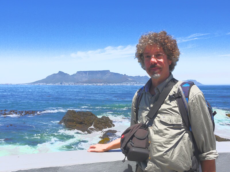
I began my journey through southern Africa in the port metropolis of Cape Town (39), which today has a population of around 450,000. I flew to Cape Town from Berlin-Brandenburg Airport (BER) via Paris (CDG). The flight distance from Paris to Cape Town is approximately 10,000 kilometres. This flight took place at an altitude of approximately 12,000 metres, with an outside temperature of up to -55 °C and a flight speed of up to 1000 km/h at times. As usual, my luggage for this backpacking travel consisted of a large rucksack, which weighed 11.7 kilograms when I checked it in at the airport, a small daypack, and my Panasonic Lumix DMC G2 digital camera.
We arrived at Cape Town International Airport (CPT) on 29 October 2025 at 5:50 a.m. local time. The local time in southern Africa corresponds to our summer time (MEZ+1), so the clocks are set forward one hour. In the arrivals hall of CPT Airport, large posters featured South Africa‘s presidency of the G20 from 1 December 2024 to 30 November 2025. Passport control upon entry into South Africa at the airport was quick: passports were scanned electronically and travellers were then given an entry stamp, granting me a period of stay in South Africa from 29 September 2025 to 27 January 2026. Citizens of the Federal Republic of Germany do not require a visa to enter South Africa. There was no additional collection of biometric data, such as fingerprint and iris scans, which has been the case at many border crossings also in Europe since the events of 11 September 2001. The distance from CPT Airport to the city centre of Cape Town is approximately 21 kilometres, and I wanted to take the MyCiti bus, which is recommended in my travelguidebooks as reliable and safe. There is a bus stop for this bus directly in front of the airport building. However, I learned that this bus had ceased operating on the route to the airport about two years ago. I then travelled from CPT Airport to Cape Town city centre in an Uber taxi, which are considered reputable and safe there, unlike other taxis. As the taxi driver told me, Uber taxis in Cape Town are not allowed to accept cash, and the fare agreed before the journey must be paid by card only.
I spent seven days in Cape Town at the beginning of my travel and another three days at the end, going on excursions and visiting various museums and memorials. Cape Town presents itself as a cosmopolitan and international metropolis, located on a global shipping and trade route between Europe and South and Southeast Asia that has existed since early modern times. The city of Cape Town was founded in 1652 at the instigation of the Dutch East India Company (VOC) (40), which established a supply station here on the sea route from Europe to India.
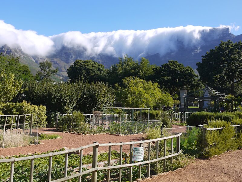
During my city excursions in Cape Town, the Dutch East India Company (VOC) and its history were a recurring theme. First, I arrived at Company‘s Garden, which formed the centre of the Dutch settlement at the Cape. The garden was laid out in 1652 to supply fresh vegetables to the sailing ships of the Dutch East India Company (VOC) travelling between the Netherlands and India.
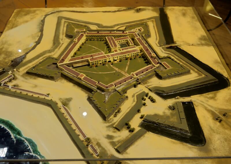
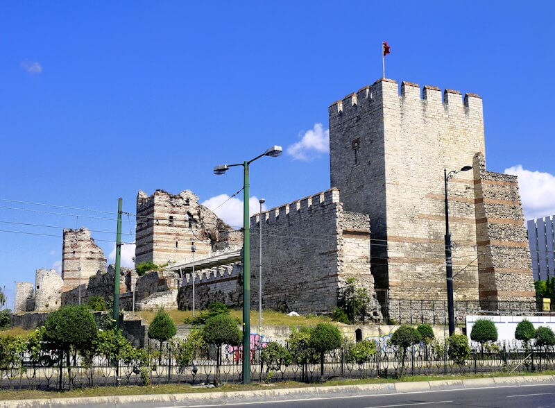
Then, on 29 October 2025, I visited the „Castle of Good Hope“, an early modern citadel built by the Dutch East India Company (VOC) between 1666 and 1679 (41). This citadel was the headquarters of the VOC, and today it is the oldest surviving building in Cape Town and South Africa. The walls and bastions of the citadel are accessible, offering a panoramic view of parts of Cape Town. The rooms of the citadel house several museums and exhibitions, which I visited. As a historical exhibition in the citadel explains, the construction of the citadel was preceded by the VOC‘s commissioning of Jan van Riebeeck in 1651 to establish a supply station at the Cape for the VOC‘s sailing ships on their way from Europe around Africa and on to South and Southeast Asia. Portuguese sailors had already explored a sea route around Africa to India (42). Especially after the conquest of the world city (43) of Constantinople (44) in 1453 (45), the most important western terminus of the transcontinental Eurasian Silk Road trade (46), efforts in Europe to find alternative maritime trade routes from Europe to South and Southeast Asia had intensified. America was discovered as part of these efforts. At that time, Herodotus‘ report was well known in Europe, which states that Phoenicians circumnavigated Africa by ship around 600 BC.
The historical foundations and the cause of these developments, which gave rise to our current global conditions, lie in the decline of the Byzantine Empire (47) and the rise and expansion of the Ottoman Empire (48), a so-called Gunpowder Empire (49). The key date in this development is 1204, with the conquest of the world city of Constantinople (50) at the instigation of the maritime republic of Venice (51), which marked the beginning of the decline of the Byzantine Empire, culminating in the conquest of Constantinople in 1453. The global historical role and function of the world city of Constantinople, protected since 413 AD by the Theodosian Wall (52) and the most important western terminus of the transcontinental Eurasian Silk Road trade, in late antiquity and the Middle Ages is the subject of both political geography (53) and global history (54).
The (Eastern Roman) Byzantine Empire, and in particular the world city of Constantinople, the most important western terminus of the transcontinental Eurasian Silk Road trade, which had been protected by the Theodosian Wall since 413 AD, played a role and function as a bulwark towards the East in Europe during late antiquity and the Middle Ages for many centuries until the fall of the Byzantine Empire. In 447 AD, the Theodosian Wall held back the invasion of the Huns (55) during the Migration Period, who then invaded the Western Roman Empire (56) instead of the Eastern Roman Empire. Then, during the Arab expansion (57) in the seventh and eighth centuries, the two sieges of the world city of Constantinople, protected by the Theodosian Wall, by Arab armies in 674–678 (58) and 717/718 (59) failed, ending the advance of the Arab armies towards Europe. The repelled sieges prevented the conquest of the Byzantine Empire and thus an Arab invasion of Europe via the Balkans. The Arabs now bypassed the Byzantine Empire to the south during their expansion, reaching Europe via the Iberian Peninsula. The Mongols bypassed the Byzantine Empire to the north during their expansion in the 13th century (60), although their expansion in Europe could not be stopped (61). Such an invasion of Europe later became possible only for the military empire (Gunpowder empire) of the Ottoman Empire following the conquest of the world city of Constantinople in 1453, enabling the Ottoman Empire to expand with its slave armies (62) to the gates of the city of Vienna (63).
The beginning of the decline of the Byzantine Empire was marked by the conquest and sacking of the world city of Constantinople in 1204 at the instigation of the maritime republic of Venice, a historic milestone with far-reaching consequences that shaped the global conditions of the present day. The conquest and sacking of the world city of Constantinople in 1204 during the Fourth Crusade (64), in which the maritime republic of Venice played a decisive role, and the establishment of the Latin Empire (65) heralded the decline of the Byzantine Empire, and this decline came to an conclusion with the conquest of Constantinople by the expanding military empire of the Ottoman Empire in 1453. The conquest of Constantinople in 1453 is considered a milestone in the transition from the Middle Ages to modern times. As a result of the conquest of the world city of Constantinople, the most important western terminus of the transcontinental Eurasian Silk Road trade, maritime trade routes shifted from the Mediterranean to the Atlantic, where new maritime and trading powers emerged and gained international standing, and the maritime republic of Venice lost its role as the dominant maritime and trading power.
Throughout the Middle Ages, the princes and states of Christian Europe, located in the shade of the protection by the Byzantine Empire, were able to compete with each other for territorial and economic advantages and wage war against each other for these reasons, until the Byzantine Empire itself fell victim to this practice, as the events of 1204 and their far-reaching global historical consequences show. Under the protection of the Byzantine Empire, Christian Europe existed in self-centred isolation from the rest of the world during the Middle Ages, and compared to antiquity, knowledge of the world in Christian Europe was considerably less extensive during this period. First with Marco Polo‘s journey (66) that interest in Asia increased again in Europe. With the fall of the Byzantine Empire, Europe was now confronted with the rest of the world and had to improve its extremely inadequate knowledge of the world and broaden its horizons.
The consequences of the conquest of the cosmopolitan city of Constantinople and the fall of the Byzantine Empire, especially for the maritime republic of Venice, which was the dominant maritime and trading power in the Mediterranean at the time, were not foreseeable at the time, but were very far-reaching: Maritime trade and shipping routes shifted from the Mediterranean to the Atlantic, the maritime republic of Venice lost its importance as the dominant maritime and trading power in the Mediterranean, and new maritime and trading powers rose in the Atlantic. First, it was the Kingdom of Portugal (67) that replaced the Maritime Republic of Venice as the dominant maritime and trading power (68). Later, the Kingdom of Portugal was displaced and replaced as the dominant maritime and trading power by the Dutch East India Company (VOC).
In addition to the historical exhibition, the early modern citadel „Castle of Good Hope“ houses the „William Fehr Collection“, which mainly displays paintings offering historical views of landscapes, people and social conditions in the Cape region. There is also a „Military Museum“ here, which focuses on military conflicts in the Cape region. There is also the „Camissa Museum – a Camissa African centre for restorative memory“ (69). This museum focuses on the diverse migrant society that has developed in southern Africa, and particularly in the metropolis of Cape Town, over several centuries. The extensive information provided by this museum presents and discusses aspects of historical development and its impact on society.
On 1 November 2025, I also visited the slavery museum in the former „Slave Lodge“ (70). This Slave Lodge was built in 1679 by the VOC to house the slaves it kept, whose initial task was to tend the Company‘s Garden. The museum focuses primarily on the history of slavery in the Cape, which is covered extensively in 18 themed rooms. At the back part of the museum, a timeline places the beginning of this history of slavery in 1444 in Portugal, in the city of Lagos at the Mercado de Escravos (slave market). No reason is given as to why this particular point in time and space within the history of slavery has been singled out and highlighted. However, in order to deal with the phenomenon of slavery (71) appropriately and understand it meaningfully, the horizon of observation must be broadened in terms of its geographical breadth and historical depth.
Within human history, slavery became a mass phenomenon and a mass fate in the early civilisations in the wake of the Neolithic Revolution and the subsequent emergence of cephalic, hierarchical, division-of-labour, bureaucratically administered and state-organised societies. Particularly in the form of slavery, whereby humans are turned into beasts of work, the process of domestication engulfs humans themselves (72). In Europe, the institution of slavery largely came to an end in late antiquity with the spread of Christianity. However, slavery continued to exist in the Middle Ages in the peripheries of Europe and especially in the expanding Islamic empires, which were oriental despotisms and slave-owning societies (73), such as the military empire of the Ottoman Empire, which engaged in extensive slave import trade, especially with slaves from Eastern Europe and Africa. Among those involved in this slave import trade to the Ottoman Empire was the maritime republic of Venice, which maintained slave markets on its territories in the Mediterranean region.
The basis for the emergence of modern (colonial) slavery was the establishment of long-distance trading companies (74) in European states as part of a mercantilist economic and trade policy (75) during the age of absolutism (76). The best-known long-distance trading companies were the British East India Company (77), founded in 1600, the Dutch East India Company (VOC), founded in 1602, and the French Compagnie des Indes Orientales (78), founded in 1664. These long-distance trading companies sought to control and monopolise large parts of maritime trade, and they were granted extensive, quasi-state privileges by the kings of the states, including trade monopolies, the right to equip merchant and warships, the right to establish and maintain their own military forces, ownership rights to conquered territories, the right to mint their own coins, and the right to their own jurisdiction. In their conquered overseas territories, these long-distance trading companies practised slavery, which had been banned and frowned upon in Europe since late antiquity, as part of their business model and to maximise their profits, beyond any controls and ethical barriers, and they participated in the slave trade with slaves they bought at slave markets passed and found outside Europe (79). This modern (colonial) slavery spread outside Europe along with the expansion of the plantation economy (80). Modern (colonial) slavery, as well as slavery worldwide, came to an end with the success of the global civil rights movement of abolitionism (81).
This connection between the emergence of modern (colonial) slavery and the establishment of long-distance trading companies is explored in a current special exhibition in the entrance foyer of the Slavery Museum in the former Slave Lodge, entitled „The Names of Freedom“. It shows how slaves lost their previous identity and were turned into objects, among other things by having their names changed. Using the example of the island of Réunion and the French „Compagnie des Indes Orientales“, founded in 1664, the exhibition shows how absolutist rulers, in this case Louis XIV, established and promoted long-distance trading companies with far-reaching powers as part of a mercantilist trade and economic policy. In their conquered overseas territories, these long-distance trading companies practised slavery, which had been banned and frowned upon in Europe since late antiquity, as part of their business model and to maximise their profits, beyond any controls or ethical barriers.
The French long-distance trading company „Compagnie des Indes Orientales“ is a central theme in the town of Lorient in southern Brittany and in the small neighbouring town of Port-Louis (82), which I visited during my cycling travel through the southern North Sea region in the summer of 2022. Following the founding of the Compagnie des Indes Orientales in 1664, the port city of Lorient was established as a trading port in 1666, which then served as „France‘s gateway to the world“ for around a century. The basis for the establishment of long-distance trading companies within the framework of a mercantilist economic and trade policy in the age of absolutism was the increasing need for money on the part of the absolutist state, because the absolutistical ruling king needed ever more extensive financial resources for the expansion and development of his unlimited power both externally and internally.
Growing financial resources were needed in particular to maintain standing armies (83) in the new territorial states (84) that emerged during the age of absolutism, and to secure the borders of these new territorial states with numerous new and expensive citadels. For example, the Kingdom of France, a modern territorial state, was surrounded during the reign of King Louis XIV (1638-1715) (85) by more than 160 modern fortifications (citadels) planned by master builder Sébastian Le Prestre de Vauban (1633 – 1707) (86). Vauban had developed modern fortification (citadel) construction into a modern science. Twelve of Vauban‘s fortifications have been UNESCO World Heritage Sites since 2008 (87). These modern fortresses, together with standing armies and precisely measured and permanently militarily guarded border lines, are a characteristic feature of the modern, absolutist and centralised state, in contrast to the medieval person association state (Personenverbandsstaat) (88). The architecture of the modern citadel was particularly influenced by the advent of cannons with great destructive power (Gunpowder Empires). The advent of cannons with great destructive power also heralded the decline of free and independent cities (89), whose freedom and independence could no longer be protected by city walls as they had been in the Middle Ages.
In the citadel of the small town of Port Louis, the „Musée de la Compagnie des Indes“ is dedicated to historical contexts, which I visited on 27 August 2022. Modelled on the Dutch East India Company (VOC), which was founded in 1602, the French Compagnie des Indes Orientales was founded in 1664 and had its headquarters in Port Louis at the mouth of the Blavet River. As early as 1666, the port city of Lorient had been built on the opposite side of the river as a planned city and trading metropolis. From here, the Compagnie des Indes Orientales participated in trade with Asia, importing spices, tea and porcelain in particular, as well as in trade across the Atlantic, where slaves, sugar and coffee were the most important commodities. The exhibition at the „Musée de la Compagnie des Indes“ highlights the growing importance of maritime trade, the establishment of long-distance trading companies in Europe, the significance of the city of Lorient for France‘s maritime trade, as well as the commodities and the conditions and circumstances of this maritime trade. In the course of this maritime trade, the plantation economy expanded and with it the slave trade, especially across the Atlantic to America, and this slave trade is also the subject of the exhibition.
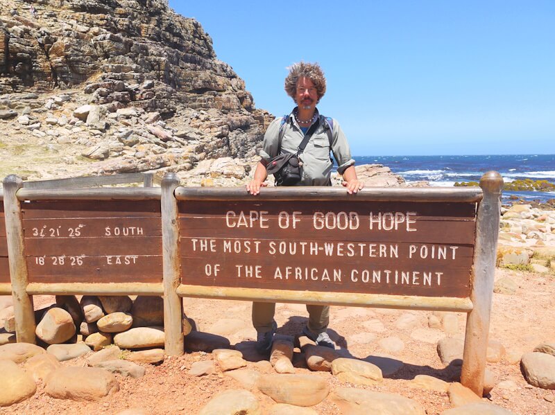
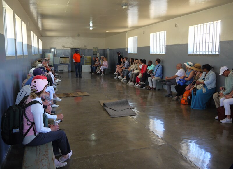
In Cape Town, the Victorian-era harbour area, the „Victoria & Alfred Waterfront“, is a popular tourist destination. There is a „Nelson Mandela Gateway“ here, from which you can take a ferry to Robben Island (90), about 11 km away. I took such a tour with a visit to Robben Island on 3 November 2025. Robben Island was used as a penal colony from the 17th century onwards, most recently until the early 1990s as a prison for opponents of the apartheid regime (91), including Nelson R. Mandela (1918-2013). The „Nelson Mandela Gateway“ building houses an exhibition on the theme of „Robben Island of the 20th Century“, which focuses on developments on Robben Island in the context of political change in South Africa. The exhibition begins with the founding of the Union of South Africa in 1910 and ends with the establishment of a museum on Robben Island and its declaration as a UNESCO World Heritage Site in 1999. Undoubtedly, the history depicted in this exhibition is part of the „extreme“ 20th century (92).
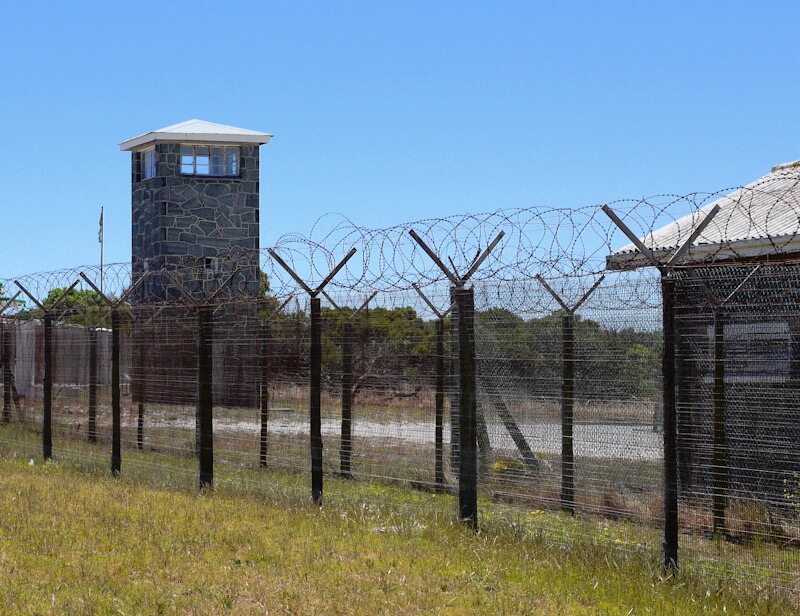
Robben Island can be visited as part of organised tours and guided tours. These include a bus tour that passes the prison buildings, the buildings for the guards, and a quarry where prisoners were forced to perform forced labour. The highlight of the tour is the subsequent visit to the prison complex as part of a guided tour led by former prisoners.
This total institution (93) represents three manifestations or types of total institutions simultaneously: 1. The prison (94), 2. The camp (95), 3. The penal colony (96). Such total institutions, including NS concentration camps, are similar in structure; they are built according to the architectural concept of panopticism (97) with the aim of total surveillance and control of prisoners. In order to analyse the respective regimes within such total institutions, among which there can be considerable differences, it is not sufficient to consider their very similar architecture. The reports of (former) prisoners are of paramount importance in this regard, as they enable us to grasp the respective character of the regime of the respective total institution and to compare it with the regimes of other total institutions.
Total institutions are still regarded today as a matter of course, as necessary and without alternative for the „normal functioning“ of industrial society, but in fact they are forms of organised crime. The example of the condemnation and abolition of slavery shows that existing social conditions and circumstances can be changed and humanised, and with an appropriate policy of abolitionism, total institutions, especially prisons, criminal law and punishment can also be abolished (98).
On 30 October 2025, I also visited the excellent South African Museum in Cape Town, which offers a wide variety of exhibitions in its two departments, a large and extensive natural history department and an ethnographic department (99). This museum is undoubtedly one of the best and most worth seeing museums in southern Africa. Among the best and most worth seeing museums in southern Africa, I would also highlight the Swakopmund Museum in the city of Swakopmund, the Kimberley Mine Museum in the city of Kimberley, the Anglo-Boereoorlog Museum (War Museum of the Boer Republics) in the city of Bloemfontein, the East London Museum in the city of East London and the Maritime Museum in the city of Mossel Bay, which I visited during the course of my travel, along with other museums.
The ethnographic section of the South African Museum focuses primarily on rock art (100), which is found in abundance in southern Africa and throughout the rest of the continent. Rock art has been produced since the Upper Palaeolithic period and can be found on every continent except Antarctica. The San (Bushmen) (101) and Aborigines continue to produce rock art to this day. Our knowledge of prehistoric cultures is extremely limited, and archaeologists painstakingly reconstruct aspects of what is known as „material culture“ (102). However, archaeologists cannot make any statements about so-called „immaterial culture“. Rock paintings are used to draw conclusions about aspects of „immaterial culture“.
The museum‘s extensive natural history department offers a wide variety of exhibitions. The main exhibition focuses on the habitats of the sea and the savannah. The marine section provides a detailed presentation of sharks and their diverse biological characteristics. Whales are also a key theme, with several giant whale skeletons on display in a large hall. The savannah section (103), a landscape that covers a quarter of the African continent, focuses on the ecological relationships between the numerous different animals that live in the savannah, which also shape the landscape. The South African Museum also has a mineral gallery and an exhibition entitled „The Sea and Us“, which focuses on the importance of the Atlantic and Indian Oceans for South Africa. Another extensive exhibition is dedicated to the South Polar region in the context of South Africa‘s membership of the Antarctic Treaty (104) and the polar research taking place within this framework, with South Africa maintaining research stations in Antarctica, on Marion Island and on Gough Island. Other exhibitions focus on dinosaurs and the origin of mammals. A small exhibition entitled „Darwin and the Cape“ presents in detail the naturalist Charles R. Darwin (1809-1882) (105), his biography as a scientist and his research voyage on the ship „Beagle“ from 1831 to 1836 (106), during which Darwin also visited the city of Cape Town and its surroundings.
On 31 October 2025, I also visited Kirstenbosch Botanical Gardens (107). I got there on the „Blue Mini Peninsula Tour“, which is offered daily by City Sightseeing Cape Town and runs every 20 minutes on double-decker buses. City Sightseeing Cape Town also offers another, slightly shorter „Red City Tour“, which also runs daily at 20-minute intervals. On both tours, you can interrupt the tour at various stops and get off, then continue the tour with one of the buses that follow at 20-minute intervals. One of the City Sightseeing bus stops is located at the Cape Town Tourism information centre at 81 Long Street (stop no. 5), where I boarded. The „Blue Mini Peninsula Tour“ bus travels clockwise around Table Mountain (1086 m), passing the University of Cape Town campus, among other sights. The visitor centre of the Kirstenbosch Botanical Gardens (Gate 1) is located at stop no. 20, where I got off to visit the botanical gardens.
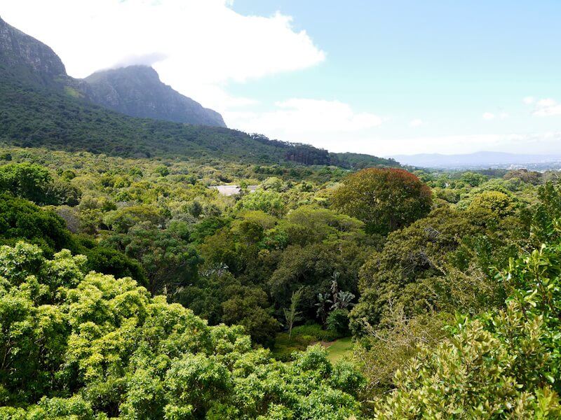
This large botanical garden, opened in 1913, stretches across a hillside in the south-east of Table Mountain and has been a UNESCO World Heritage Site since 2004. An extensive network of paths connects the sprawling garden, including a tree canopy walkway through the treetops. There are connections to the network of hiking trails in the vicinity of Table Mountain (1086 m), which also lead up to it. Numerous information boards (mostly in English, some also in three languages) provide information on individual plants and various other topics. You can easily spend a whole day in this extensive botanical garden without seeing everything.
The Kirstenbosch Botanical Garden represents in particular the plant community known as „fynbos“ (108), a species-rich plant community restricted to the Cape region. Kirstenbosch Botanical Garden provides a good impression of this diverse plant community, which occupies a large part of the botanical garden‘s area. The fynbos plant community is characterised by an extremely high diversity of species, most of which are endemic, occurring only in a small area of the Cape region and nowhere else. The „fynbos“ is an important part of the Cape flora. The flora of the Cape region (109) is known as „Capensis“ and is by far the smallest of a total of six floristic regions (110) worldwide, with predominantly endemic species that occur only here in the limited area of the Cape region and nowhere else. Due in particular to their spatially limited occurrence, many of the endemic plant species of the Cape flora are now threatened with extinction. The expansion of settlement and transport areas is further restricting the limited habitat of the plants of the Cape flora, and in the past, extensive pine monocultures have been planted in the Cape region in place of the „fynbos“ in order to obtain timber.
I ended my visit to Kirstenbosch Botanical Gardens in the late afternoon so that I could catch the last City Sightseeing bus at 4:51 p.m. from stop no. 20. The journey now took me south of Table Mountain (1086 m) in a south-westerly direction to the harbour town of Hout Bay. The forest areas we passed through consist mainly of pine monocultures. Today, efforts are being made to reduce these pine stands in order to give the endangered Cape flora and fynbos more space to regenerate. Eucalyptus is also common, invasive neophytes (neobiota) (111) from Australia, which are now frequently found throughout southern Africa. The weather was now cool and cloudy, with occasional rain. The bus journey now followed the north-west coast below the cliffs of the „Twelve Apostles“ back to Cape Town.
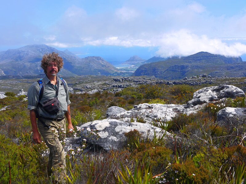
On 4 November 2025, I climbed the 1,086-metre-high Table Mountain (112), which towers over the city of Cape Town, as part of a hike that I started in Cape Town city centre. On my way through Cape Town to Table Mountain, I passed through residential areas where the properties are surrounded by electric fences, as indicated by signs. Other signs refer to „Neighbourhood Watch“ concepts and security services with an „Armed Response“ concept. The reason for such security regimes is the extremely high crime rate in southern Africa, especially in the Republic of South Africa, which has had the highest crime rate in the world since the end of apartheid. As in all cities in South Africa, the city centre of Cape Town has been largely abandoned by residents of European origin, who have retreated to guarded residential estates outside the city centres behind high, often multi-row fences and walls. The high crime rate shapes and determines the daily routine of people in South Africa, which begins at sunrise if possible so that it can be finished before sunset, because when it gets dark, no one in South Africa stays outdoors anymore, but only in secure and guarded buildings. Tourists are also strongly advised to make this a habit, which I consistently adhered to during my travel through southern Africa.
The hiking trail I took to Table Mountain (1,086 m) leads through the Platteklip Gorge on the north face of Table Mountain, near a cable car built in Switzerland that goes up to the plateau of Table Mountain. This hiking trail is in good condition and well signposted. Stones on this path are often arranged in steps and loose scree is secured with wire mesh. There were a few hikers here, although the majority of tourists use the cable car.
I reached the plateau of Table Mountain at Fontain Peak (1,051 m). The terrain on the plateau is rocky, and only low vegetation grows here. The marked hiking trails are mainly used by tourists who have taken the cable car up. I followed a hiking trail that leads across the plateau towards the southeast to the highest point, Maclear‘s Beacon (1086 m). Then I reached the western summit of Table Mountain (1073 m) near the cable car station. Various vantage points on the plateau of Table Mountain offer sweeping views over the city of Cape Town and the surrounding landscape of the Cape. There are numerous other hiking trails in the vicinity of Table Mountain. Table Mountain, together with the Cape of Good Hope to the south, is now a nature reserve.
4. Windhoek and Swakopmund: Cities founded as a result of the Berlin Congo Conference of 1884/85
I travelled by coach from Cape Town to the city of Windhoek in Namibia. I travelled with the coach company „Intercape“. It is the only coach company in southern Africa whose coaches travel from South Africa across borders to neighbouring countries, including Namibia and through Namibia. Intercape‘s routes cover the main routes in a large part of southern Africa, comparable to Flixbus in central Europe. Intercape‘s coaches are in consistently good condition and the timetables are usually adhered to. Unlike Flixbus, Intercape also has offices at almost all bus stations and stops, where tickets can be purchased easily without having to use the internet.
Due to the long distance of around 1,400 km from Cape Town to Windhoek, many travellers prefer to fly. However, I was interested in seeing the changing landscape on this route from Cape Town to Windhoek. Fortunately, I had a seat at the front of the upper deck of the double-decker bus. During this long bus journey of more than 24 hours, there were several breaks, which can be used to divide the journey into sections.
The first stage from Cape Town to Piktberg led through a largely agricultural landscape dominated by cattle grazing and grain cultivation, with very large areas of agricultural land, giving the agricultural landscape a uniform monotony. Due to the particularities of the agricultural constitution (113) and the agricultural history (114) of rural areas (115) in Europe from the Middle Ages to the early modern period, such large-scale agriculture developed largely only outside Europe, in particular through the expansion of the plantation economy (116) and its monocultures (117), and in settlement colonies (118), such as in the USA, but also in South Africa and Namibia. It was not until the modern era that large-scale agro-industrial enterprises also began to emerge in Europe as a result of the ongoing industrialisation of agriculture, land consolidation and the decline in the number of farms. In the eastern half of Europe, this process took place in the course of industrialisation (119) and the forced collectivisation of agriculture (120), following the example of the Soviet Union.
The permanent expansion of monocultures of industrial agriculture and forestry at the expense of traditional subsistence farming is the main reason for the rapid decline in species worldwide (121). Species extinction is the world‘s biggest ecological problem, ahead of so-called „climate change“, making it a key feature of the new geological epoch of the Anthropocene (122).
In this agricultural landscape between Cape Town and Piktberg, which originally had the character of an African savannah, a landscape type that covers a quarter of the African continent, there are now no woodland at all, and if there are a few scattered trees, they are almost exclusively eucalyptus trees, invasive neophytes (neobiota) from Australia.
Beyond Piktburg, the landscape along the N7 road becomes mountainous, and before reaching Citrusdal, the N7 crosses the Piekenierskloof Pass (519 m). The journey now continues through the Olifants River valley, which is framed by mountains. To the east, the Cederberg Mountains reach heights of up to 1971 m. The valley is dominated by citrus fruit plantations.
North of the village of Klaver, the mountains recede, the landscape becomes drier, and it takes on the character of a steppe. Agriculture is practiced only on a small scale here. The extensive sheep and goat farming found elsewhere in arid regions is here almost entirely absent. There are dry riverbeds, called “wadi” (123) in North Africa, which carry water only temporarily during rare rainfall events. This arid landscape, which in some parts resembles a semi-desert (124) and in others a dry savanna (125), continues northward into Namibia (126) as far as Windhoek.
The wait at the Noordoewer border crossing between South Africa and Namibia was unexpectedly lengthy, lasting 3.5 hours. In particular, the entry of all bus passengers into Namibia took a long time. Although South Africa and Namibia are part of a customs union, customs officers conducted extensive baggage checks on most passengers. My luggage was not inspected admittedly. In comparison, obtaining a visa on arrival was quick. Recently, citizens of the Federal Republic of Germany have required a visa to enter Namibia (fee: 1600 NAD), whereas previously, presenting a passport at the border was sufficient. At the border, the bus passengers learned that, currently, no food of animal origin was allowed into Namibia under the pretext of an animal disease outbreak.
My initial plan was to get off the bus in the small Namibian town of Keetmanshoop and then continue on to the port city of Lüderitz (127) to explore it. However, since the bus was scheduled to arrive in Keetmanshoop in the middle of the night, I abandoned this plan for the time being.
The landscape traversed during the journey is characterized by a semi-desert, partly by steppe. A vegetation cover that completely covers the ground is largely absent. North of the town of Mariental, the steppe-like landscape is characterized by low bushes spaced further apart. This arid landscape, clearly unsuitable for any agricultural use, is, as in South Africa, completely fenced off along the sides of the roads in Namibia. Before reaching the city of Windhoek, the bushes become larger, the ground is now completely covered with grasses, and the landscape takes on the character of a dry savanna. The city of Windhoek (128) is located at an altitude of 1650 meters in the central highlands of Namibia, which have an average altitude of 1700 meters. Here in the central highlands, the annual rainfall is approximately 300 to 500 mm. In the area surrounding Windhoek, the landscape is characterized by dry savanna.
As was the case most of my travel, I stayed in a backpacker hostel in Windhoek. These hostels are a place where you meet travelers from all over the world, often with extraordinary and impressive travel plans. There are usually opportunities to exchange experiences. In Windhoek, I met Gustavo from Mexico, who was cycling through West Africa from Morocco to Cape Town. He told me he had been waiting in Windhoek for five weeks for a visa to be issued for South Africa. He attributed this to his Mexican passport, which he said wasn’t highly regarded worldwide in terms of the freedom of travel it afforded, whereas, for example, citizens of EU member states with their passports have considerably better travel options globally. Indeed, the passports of different countries vary considerably in the degree of freedom of travel they grant their holders, with EU citizens faring comparatively well, as comparative studies show (129).
In Windhoek, I took city excursions of the historic city center, visiting sightseeings and museums. Several buildings from the period between the Berlin Congo-Conference of 1884/85 (130) and the First World War have been preserved here, when the territory of present-day Namibia was administered as a “protectorate” (131) by the German Empire (132) under the name “German South West Africa” (133). During my city tour, I visited Windhoek’s railway station, built in 1912, in front of which are several historic railway vehicles. I then reached the so-called “Turnhalle” (gymnasium). This building, constructed in 1913, now serves as a courthouse and was the site of the “Turnhallen-Konferenz” (134) in 1975, which initiated the process toward the independence of South West Africa. I then followed Independence Avenue through the city center, passing, among other things, the historic clock tower. Fragments of the Gibeon meteorite (135), discovered by geologists between 1911 and 1913, are on display there. I continued past the Zoo Park, where a memorial commemorates war dead who died in 1893-94, and then on to the former “Ausspannplatz”. This was formerly a turning point for ox-drawn carts, which were used for transporting goods before the construction of the railway.
I also visited the “Windhoek City Museum” in Windhoek on November 7, 2025. The focus of the exhibitions in the museum’s six exhibition rooms is the history of the city of Windhoek. It is noteworthy that a large part of the exhibitions are bilingual, in English and Finnish. The exhibition also explains that missionaries from Finland were active in Namibia in the past, and obviously a significant portion of the museum’s exhibits were created in cooperation with church organizations in Finland.
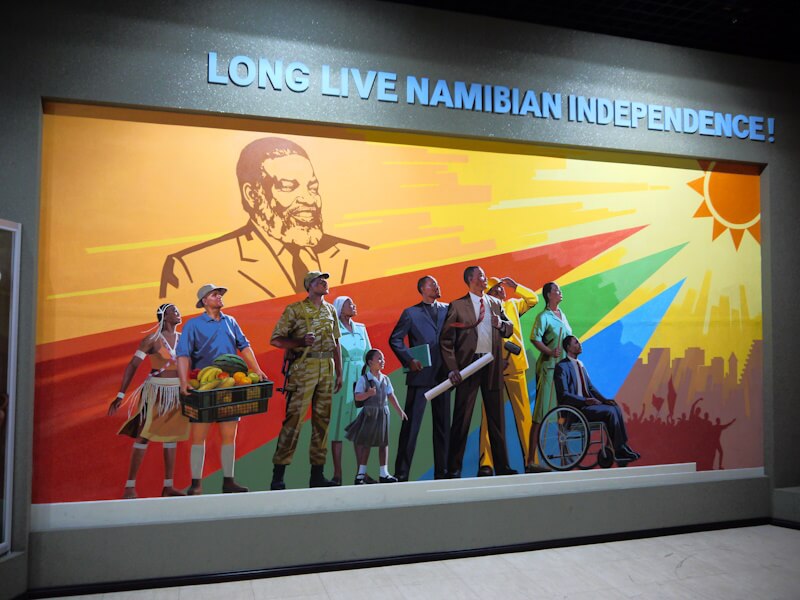
Furthermore, on November 8, 2025, I visited the “Independence Memorial Museum” (136). It is located between Christ Church, built between 1907 and 1910, and the „Alten Feste“ (Old Fort), built from 1890 onwards. Northwest of the museum lies the so-called „Tintenpalast“ (Ink Palace), the administrative building of the “protectorate” German South West Africa, completed in 1913, which today houses the Namibian Parliament. The viewing terrace on the upper floor of the museum building offers a panoramic view of the city of Windhoek and its surroundings.
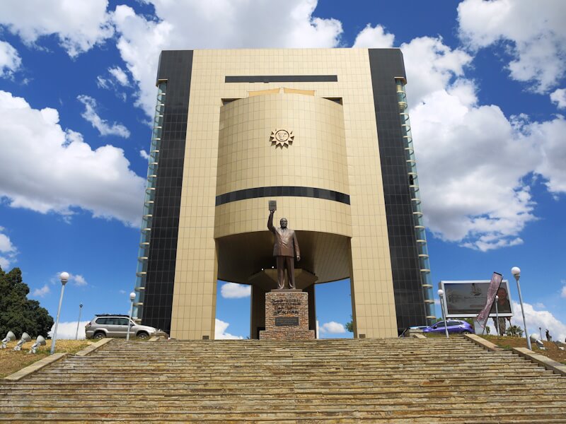
Unlike the “Windhoek City Museum”, the Namibian “Independence Memorial Museum’s” exhibitions were not created in cooperation with church institutions in Finland. Instead, this museum was built and designed by a North Korean company and opened in 2014. Spread across three floors, this free-to-enter museum presents three exhibition sections: 1. Colonial Repression, 2. Liberation War, 3. Road to Independence, History Panorama. Using Namibia as an example, the museum depicts a process of “nation-building” (137), that is, the creation of a nation-state modeled on European examples – a process that is always lengthy and often accompanied by violent conflict. In the case of Namibia, this process of nation-building took place on a territory that had been created in the course of the “Scramble for Africa” and on the basis of the Berlin Congo-Conference of 1884/85, without regard for ethnographic circumstances, and which was administered as a protectorate by the German Empire until the First World War. Subsequently, this territory was administered on behalf of the League of Nations (138) by the Union of South Africa (139), founded in 1910. The museum presents in detail the resistance of SWAPO (140), which also involved military action, against South African rule and the apartheid policies practiced in Namibia from 1948 onwards. These developments, ultimately mediated by the UN, resulted in Namibia’s state independence on March 21, 1990.
The question arises as to what extent the North Korean builders of the museum also conceived and designed the museum’s exhibition and thus shaped the historical narrative (Geschichtsbild) (141) presented. Undoubtedly, the developments depicted could also be presented differently, with different emphases and more extensive information.
The “Alte Feste” (Old Fort), located to the south of the “Independence Memorial Museum”, was the headquarters of the German Empire’s “Schutztruppe” (protection force) in the “protectorate” of German South West Africa. After the First World War, the building served as the headquarters of the military of the Union of South Africa. A museum was established here in 1962, but it was closed for renovations during my visit to Windhoek. Plans are in place to establish a “National Museum of Genocide and Colonial History” here. A “Genocide Memorial” already stands in front of the building. It commemorates the Herero (142) and Nama (143) uprisings in the German South West Africa “protectorate” between 1904 and 1908 and their suppression by the German Empire’s “Schutztruppe”. Whether these events fall under the definition of genocide (144) is the subject of ongoing controversial debate. The historian Hans Hilpisch demonstrates that these discussions are predominantly conducted with unverified claims and without knowledge of precise figures, especially the population size of the various ethnic groups and the development of these population figures in the past, without knowledge of the detailed course of historical events, and without knowledge of the geographical conditions, particularly in the Omaheke region (145).
Furthermore, it must be noted that genocides, colonial crimes, and also wars and tyranny often receive vastly different levels of attention in the public consciousness. For example, the undoubtedly largest colonial crime in Africa by far, the so-called “Congo atrocities” (146) in the “Congo Free State” (147) during the reign of Belgian King Leopold II (1835-1909) (148), with eight to twelve million dead, which corresponds to about half of the population of the Congo region at that time, is almost entirely absent from public awareness. The “Congo Free State” was assigned to King Leopold II, who presented himself as a philanthropist and promoter of scientific exploration of Africa (149), as a private colony in Berlin during the Berlin Congo Conference of 1884/85. This Berlin Congo Conference of 1884/85 took place in Berlin from November 15, 1884, to February 26, 1885, at the invitation of Chancellor Otto von Bismarck, in the age of imperialism (150) and within the framework of the geopolitical (151) “Scramble for Africa” (152).
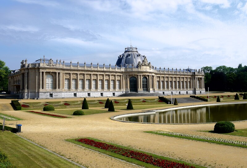
Even in the European city of Brussels, the topic of the so-called “Congo atrocities” is consistently avoided, as was my impression during my multi-day visit to Brussels in July 2022, during my cycling travel through the southern North Sea region in the summer of that year 2022. For example, the Africa Museum (153), which was redesigned and reopened in 2018, largely ignores the issue under the pretext that there are no precise figures on the events, as I noticed during my visit to the museum on July 9, 2022. On the site where the Africa Museum is located, King Leopold II had organized a colonial exhibition on the “Congo Free State” during the 1897 Brussels World’s Fair (154).
The European Quarter of the European Union in Brussels lies between the “Leopold Quarter” and “Leopold Park”, surrounded by prestigious buildings commissioned by King Leopold II with the “proceeds” from his “Congo Free State”. But nowhere is there any indication of the historical context. Among these prestigious buildings stands out the Palace of Justice (155), financed by King Leopold II and inaugurated by him on October 15, 1883, as a symbol of the rule of law. In it, King Leopold II celebrated himself as a custodian of justice, while in his “Congo Free State” he subjected the people to a state of rightlessness and “special conditions of violence” (Besondere Gewaltverhältnisse) and forms of “special treatment” (Sonderbehandlung) in order to promote raw material extraction, and in particular rubber production (156), using genocidal methods. Comparable conditions and developments to those in the “Congo Free State” existed, albeit on a somewhat smaller scale, in the Amazon region with the “genocide in Putumayo” (157).
During the rubber boom, a system of debt slavery (aviamento) arose in the Amazon region as a consequence of rubber extraction, forcing large segments of the indigenous population to perform forced labor, resulting in the deaths of tens of thousands. For example, the forced labor regime of the “Peruvian Amazon Rubber Company”, headed by Julio César Arena del Águila, alone claimed the lives of more than 40,000 people on the Rio Putumayo (158). This brutality is surpassed not in its quality, but in its sheer quantity, only by the methods of rubber extraction in the Congo Free State during the reign of King Leopold II, which resulted in approximately 8-12 million deaths. The genocidal methods of rubber production have received little scientifically studied to date, and as I observed in Brussels, no effort is being made to address them.
The Great Terror in both the Congo region and the Amazon region, like Stalin’s “Great Terror”, proves to be part of the terror of the age of industrial modernity (159).
Southeast of the “Alte Feste” (Old Fortress) in Windhoek, there are three other large buildings dating from the period between the Berlin Congo Conference of 1884/85 and the First World War: Schwerinsburg, Heinitzburg, and Sanderburg. These are not open to the public, however, as they are privately owned. Conditions in the surrounding residential areas are similar to those in Cape Town: properties are enclosed by electric fences, as indicated by signs. Further signs refer to “Neighbourhood Watch” initiatives and security services with an “Armed Response” concept. The reason for such security measures is the extremely high crime rate in southern Africa, particularly in the Republic of South Africa, which has had the highest crime rate in the world since the end of apartheid. The Ludwig von Estorff House, built in 1898 and home to the Goethe-Institut, is also surrounded by an electric fence. The statue of former Governor Curt von Francois, which my guidebook indicated was located in front of the Windhoek City Hall, is no longer there. I also came across the so-called “Boer Monument” (Oudstryder Bittereinder Monument), which commemorates Boers who migrated from South Africa to South West Africa after the Second Boer War (1899-1902).
I also visited the Botanical Garden in Windhoek on November 8, 2025, where numerous plants and especially trees can be seen that are superbly adapted to the dry climates and habitats of Namibia, including various succulents (160) and so-called bottle trees. I was particularly impressed by the various acacia species, which can actively fold and unfold their pinnate leaves as needed.
Reference is also made to the connection between vegetation and climate, which is well known to geographers: the trees of the dry savanna in Namibia create a micro-habitat with a climatic zone where the temperature is up to 21 °C lower than in the (unforested) surrounding area. This confirms my own findings from various parts of the world regarding the climate impact of woods. Unfortunately, only geographers consider and study vegetation, climate, and soil in relation to one another. This integrative perspective in geography can be traced in particular to the geographer Alexander von Humboldt (1769–1859) (161). Regrettably, in contrast to the holistic (162) approaches of geographers, reductionist (163) perspectives dominate in other scientific disciplines. A special feature of this botanical garden is a separate “Desert House” showcasing plants from the Namib Desert.
On Monday, November 10, 2025, after a three-day stay in Windhoek, I continued my journey by bus to the coastal town of Swakopmund. The drive took me west along the B2 highway, close to a railway line. Gradually, the dry savanna that characterizes the area around Windhoek gives way to a steppe with small bushes. Beyond the town of Usakos, a semi-desert with only sparse vegetation dominates. It is striking that here, as on the drive from Cape Town to Windhoek, almost the entire landscape alongside the road is fenced off, even though it is clearly useless wasteland and desert. Nevertheless, there is no indication that this fenced land is used for any significant agricultural purpose; for example, I didn’t see any livestock during my drive. However, the herds of large animals that are typical of the savannah landscapes of Africa, including dry savannahs, are also absent here. From the Great Escarpment (164) in the west of the highlands, the terrain gradually descends to sea level on the Atlantic coast. Along the Atlantic coast, the Namib Desert (165) forms a desert strip 80 to 120 kilometers wide. The climate on the southwest coast of Africa is influenced by the cold Benguela Current (166), which makes temperatures in Swakopmund considerably cooler than in other parts of southern Africa. Fog is also very common and often persists throughout the day.
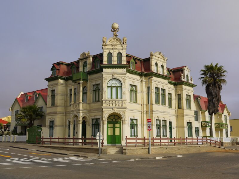
The town of Swakopmund (167) has approximately 70,000 inhabitants today. Swakopmund is a popular tourist destination, as numerous well-preserved buildings, including Art Nouveau buildings, from the historical period between the Berlin Congo Conference of 1884/85 and the First World War can be seen in the historic town center; the most famous are the Old Railway Station, the Hohenzollern House, and the Woermann House.
What impressed me most in Swakopmund was the Swakopmund Museum (168), which exist since 1951 and which I visited on November 11, 2025. The museum is considered the best museum in Namibia. All the exhibits relate to Swakopmund and Namibia. Visitors are provided with comprehensive and detailed information on each topic in three languages (English, German, and Afrikaans). The museum is particularly impressive due to its wide range of exhibits, including Namibia’s flora and fauna and vegetation zones, geology, mineralogy and earth history, archaeology, ethnography, settlement history, and maritime history. In the field of seafaring and maritime trade history, it is also pointed out here that the shift of maritime trade routes from the Mediterranean to the Atlantic and the establishment of new maritime trade routes around Africa at the transition from the Middle Ages to the modern era originated in the decline of the transcontinental Eurasian Silk Road trade, and this decline is linked to the fall of the Byzantine Empire and the expansion of the Ottoman Empire.
I also visited the “Living Desert Snake Park”. Numerous terrariums there house reptiles, especially snakes, native to southern Africa. Such opportunities to observe and learn about snakes up close in terrariums are undoubtedly a valuable tool for combating and dispelling widespread ignorance and prejudice about snakes. Unfortunately, I encountered very few other visitors there.
There are several tour operators in Swakopmund, and among them, a half-day tour into the adjacent Namib Desert called the “Living Desert Tour” is offered by several of them. I participated in this tour on November 13, 2025. Participants have the opportunity, guided by experienced and knowledgeable local tour guides, to learn about the unique flora and fauna of the Namib Desert, which is largely a full and true desert. The tour begins south of Swakopmund at the dry Swakop River. We learned that the river had last carried water briefly in April 2025. However, the gravel bed of the riverbed still contains water, so bushes and trees grow there, and animals graze there, including dromedaries belonging to tour operators.
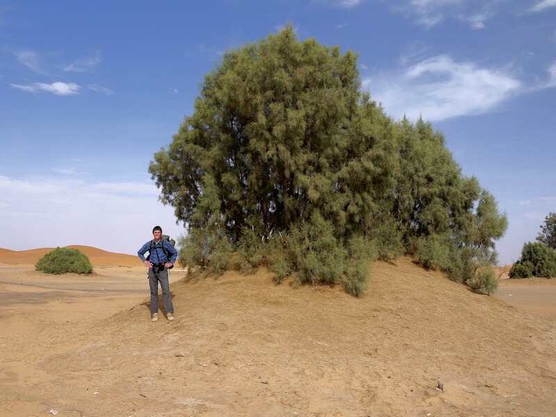
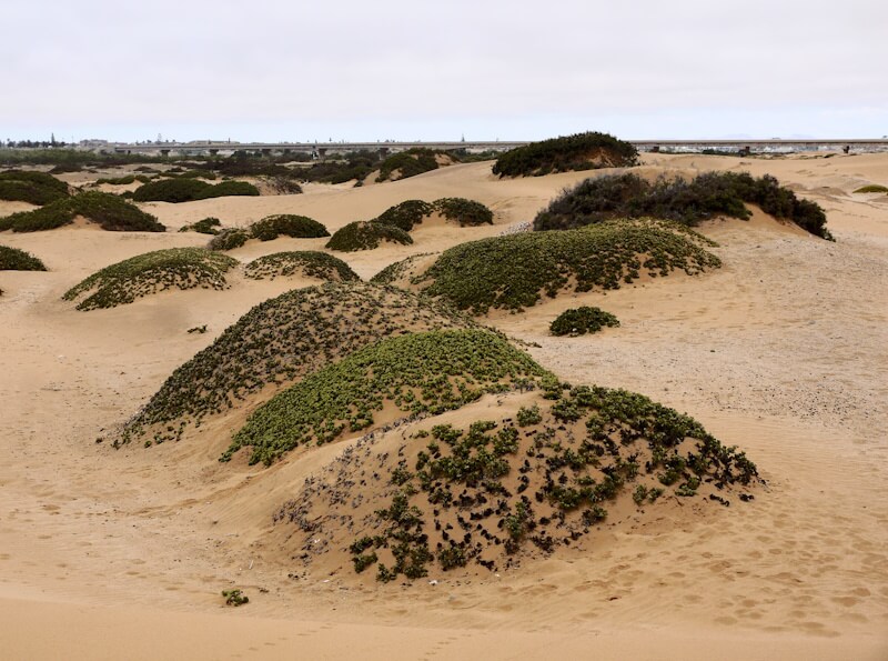
To the south, the vegetation quickly becomes sparser. First, there are numerous small, vegetation-covered hills, the largest of which, known as “tamarisk hills”, can reach heights of several meters. These are the same tamarisk trees that shape and define the landscape in the arid regions of North Africa. Smaller, vegetation-covered hills and dunes are formed by various other drought-resistant plants. While the tamarisk trees can access deep soil moisture through their very deep roots, other plants in the Namib Desert rely primarily on the moisture available near the surface in the mornings in the form of fog and dew.
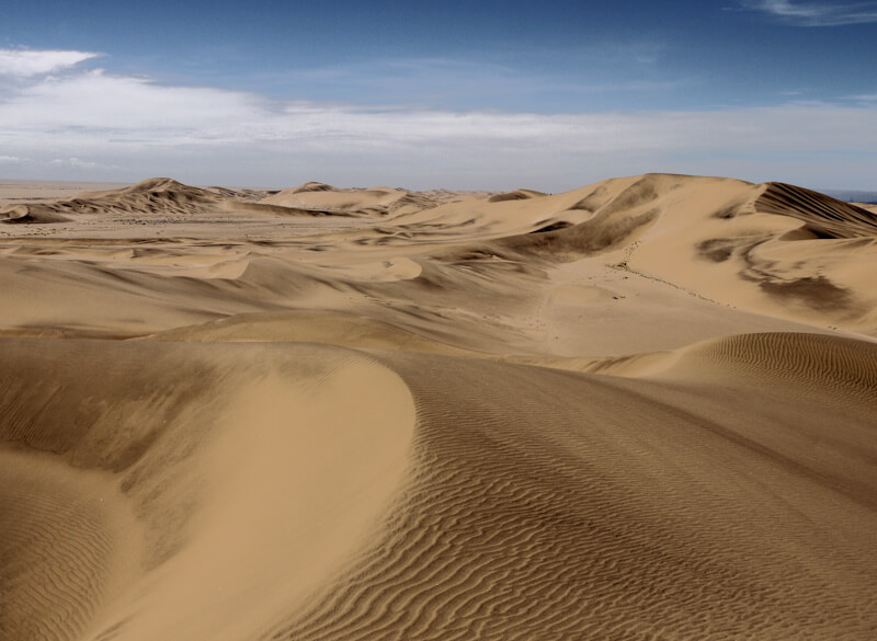
The Namib is a geologically ancient desert, approximately 50 million years old. The sand that forms the Namib dunes has a long journey, as we learned on the tour. A large portion of the sand originates in the Drakensberg Mountains; it was transported by the Orange River (169) to the coast of southwest Africa and then distributed along the coast by the Benguela Current. Over long periods, the prevailing westerly winds blew the sand eastward from the coast, creating the Namib dunes, which are slowly migrating eastward in accordance with the prevailing wind direction. The predominantly fine sand can be various colors, including black components of iron oxides with magnetic properties, which was demonstrated to us with a magnet.

The tour focuses on various small desert animals such as lizards, geckos, chameleons, snakes, slow worms, and others, which are adapted to desert life in different ways. Thanks to the guides’ local knowledge, we were able to find and observe them. For example, a chameleon used its extremely long tongue to take mealworms from the hand. These reptiles feed primarily on insects, which also inhabit the Namib Desert. A significant food source for these insects is wind-dispersed plant seeds, which are blown into the Namib Desert in larger numbers by rare easterly winds.
On my travels, I constantly meet interesting and open-minded travelers with extraordinary travel plans. I take advantage of these opportunities to exchange experiences, often including email addresses and other contact information, so I can continue this exchange. Many travelers with exceptional travel plans now share their journeys on their own websites and online accounts. Not only young people can find inspiration here to undertake similar adventurous, enriching, insightful, and horizon-broadening journeys. Such inspiration is particularly needed today, and travelogues of extraordinary and noteworthy trips can provide just that.
At the hostel where I stayed in Swakopmund, I met Clément from Bordeaux with his touring bicycle. Clément told me about his extraordinary two-year world tour, which he is undertaking overland by bicycle and across the oceans as a crew member on sailing ships. When we met in Swakopmund, he was on his way back from Cape Town through West Africa to Bordeaux, where his circumnavigation around the world will end. I was particularly impressed that Clément managed to cover all the distances across seas and oceans as a crew member on sailing ships, without using airplanes, as it is common practice today. Apparently, this kind of crewed sailing works far better across oceans than I had previously imagined, and Clément spoke at length about his own experiences. What you need is flexibility and patience, as it can sometimes take several weeks to find a suitable crewing opportunity, especially off the main routes.
During my stay in Swakopmund, my Samsung Galaxy J5 smartphone was stolen on the night of November 13th to 14th, 2025, resulting in a multitude of significant problems that jeopardized the continuation of my travel. It became clear to what a vast and alarming extent our lives have become dependent on smartphones and their constant, flawless operation.
On November 20, 2025, I travelled back from Swakopmund to Windhoek with one of the minibus transport companies based in Walvis Bay and Swakopmund. They offer a door-to-door service, picking you up at your accommodation and dropping you off at your destination. The journey to Windhoek followed the same route as my travel to Swakopmund on November 10, 2025. This time, I was able to observe the changing landscape in the opposite direction. The first part of the journey took me through dense fog in a section of the Namib Desert. Dense fog is a very common phenomenon in the coastal part of the Namib Desert, and the moisture from the fog is the most significant form of precipitation there. I wonder why, during the geologically long period of the Namib Desert’s existence of around 50 million years, no vegetation has developed and become established here that actively generates its own rain based on this very frequent dense fog, as, for example, the Canary Island pines do in the Canary Islands, which in the mountainous regions there utilize the moisture of the trade wind clouds, which condenses on their long needles and falls as rain, thus actively generating most of the fresh water of the Canary Islands, something I was able to confirm for myself during my excursions in the Canary Islands in the spring of 1995.
5. Etosha and the myth of Africa as a natural paradise
After my visit to the town of Swakopmund, I travelled from Windhoek to my next destination, Etosha Nature Park (170), located in northern Namibia, which I was eager to explore. Etosha Nature Park and its large animals are considered one of the touristic main attractions in Namibia.
At first, it was uncertain whether I would be able to reach Etosha Nature Park, as it is somewhat off the main routes and I was dependent on public transport for my travel. Since the tourist infrastructure in Southern Africa is highly geared towards private vehicle travel, and consequently most tourists travel in rental cars, which are indeed the only way to reach most of the remote and peripheral destinations and attractions in Southern Africa, I was initially unsure whether I could get to Etosha Nature Park by public transport. In Southern Africa, public transport is limited to the main routes between major cities, and it is not possible to reach remote and peripheral destinations and attractions by public transport. Therefore, I was pleased that after considerable research, I found a transport option from Windhoek to Etosha Nature Park, which enabled me to visit it. The main purpose of my travel to Etosha Nature Park was to get to know it as part of a one-day tour offered by various tour operators.
The five-hour journey from Windhoek to Etosha Nature Park on November 22, 2025, was made quickly in a minibus on a well-maintained country road. Approximately 65 kilometers north of Windhoek, the route passed an extensive settlement of corrugated iron shacks, a social reality in both Namibia and South Africa, which, however, remains almost entirely hidden from tourists. Breaks were made in the towns of Okahandja, Otjivarongo, and Outjo. The landscape traversed is largely characterized by dry savanna, and here, too, the land on both sides of the road is almost entirely fenced. At least here, with only a few small exceptions, there is no attempt to clear this dry savanna landscape of shrubs to create a uniform, monotonous grassland for cattle grazing, as is common practice elsewhere. The numerous termite mounds, ubiquitous in the landscape, are noticeable. Beyond Outjo, the landscape flattens out.
Etosha Nature Park lies in the western part of the Kalahari landscape (171), which is predominantly covered by thornbush savanna (Dornbusch-Savanne) (172). At the heart of Etosha Nature Park lies the 4,760 sq km Etosha Pan (173), a saltclay pan that comprises about 23% of the park’s current area. It is 129 km long and 72 km wide, situated at an elevation of 1,077 to 1,085 meters above sea level. The Etosha Pan has no outlet and only three major tributaries. Springs along the southern edge of the pan are a source of the park’s abundant wildlife. The Etosha Pan is entirely devoid of vegetation; in the rest of Etosha Nature Park, vegetation varies, including tree savanna, thornbush savanna, and grass savanna. The afternoon temperatures I measured here were 37°C, which were the highest temperatures I measured during my travel through southern Africa.
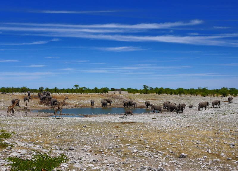
Arriving at Etosha Nature Park, I pitched my small tent at a campsite a few kilometers from the main southern entrance, the Anderson Gate. This campsite is surrounded by hills and dry savannah. At night, zebras frequented the campsite, grazing among the tents. I managed to arrange a guided day tour through parts of Etosha Nature Park at short term on November 23, 2025. Numerous tour operators offer tours in open 4×4 vehicles. The tour I was able to join exceeded my expectations: I saw many large animals of numerous species, including giraffes, ostriches, plains zebras, large numbers of springbok, wildebeest, oryx, kudu, a large herd of elephants, a black rhinoceros, lions, and various smaller animals and birds.
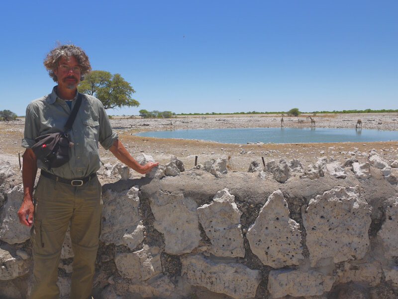
On our tour, we entered Etosha Nature Park through the Anderson Gate (Ombika) in the south of the park, which is open daily from 7:00 a.m. A paved road leads from there through a savannah landscape to the Okaukuejo Resort. From there, gravel roads with a slight corrugation lead in various directions. Except at fenced camps and rest areas, vehicles must not be left while driving in Etosha National Park, and a speed limit of 60 km/h applies. We soon saw the first large animals: giraffes, as well as springbok, which are very numerous in Etosha National Park, then ostriches and wildebeest. Our drive initially took us along the western edge of the endorheic Etosha Pan. The landscape here is largely open and has the character of a steppe. We saw oryx, more giraffes, an owl, a secretary bird, guinea fowl, meerkats, and large colonies of weaver birds. Our tour then led us to a viewpoint at a waterhole on the edge of the Etosha Pan (site point “Okondeka”). Various animals could be seen in the distance, including springbok, ostriches, plains zebras, oryx, and wildebeest.
In the early afternoon, we had a lunch break at the Okaukuejo Resort. There is a waterhole there frequented by giraffes, zebras, oryx, and springbok. In the afternoon, we continued our tour eastward along the southern edge of the Etosha Pan. We reached a waterhole (site “Olifantsbad”) with a large herd of elephants, giraffes, and a black rhinoceros, which was certainly the highlight of our tour. Finally, after some searching, we came across two lions resting in the shade of trees at the site “Aus”. This day trip to Etosha National Park was undoubtedly one of the highlights of my two-month tour through parts of southern Africa.
Encountering and observing the large animals characteristic of the African continent in their natural habitat is a highlight of most travels to Africa. However, the African large animal fauna has been severely decimated and is now confined to a few remaining reserves and nature parks, including Etosha Nature Park. In the rest of the country, these animals were almost completely hunted down in southern Africa many decades ago.
The landscape in South Africa and Namibia, as I observed throughout my travels, is almost entirely fenced and privately owned, a phenomenon that particularly characterizes and shapes the landscapes of settlement colonies, such as in the USA, where all land along the roads is consistently fenced off. This is also the case in South Africa and Namibia. In contrast to settlement colonies, such as the USA, this phenomenon is virtually nonexistent in Europe due to the specific characteristics and differences of the agrarian constitution and history of rural areas in Europe from the Middle Ages to the early modern period. As a result, the landscapes in Europe, including agricultural landscapes, are generally accessible and open to the public.
The basis for the unlike in Europe almost entirely fenced in landscapes in settlement colonies, particularly in the USA, is a totalitarian intensified understanding of property rights and ownership. This understanding developed in settlement colonies due to their specific characteristics and differences in agrarian constitution and the agricultural history of rural areas. In settlement colonies, especially in the USA, the sphere of the design of personal life and the free development of the personality, based on the personality rights, is not limited, as in Europe, to house and farm properties, where these rights are protected as fundamental and human rights. Rather, this private sphere proliferates and extends across the entire landscape it occupies. This development is most advanced in the USA, where virtually the entire landscape is fenced off as private property, and private owners assert a right of self-defense against those who disregard and cross these fences. This right includes the right to shoot on intruders, as signs throughout the USA clearly indicate, as I discovered during my bicycle travel through North America in the summer of 1990. To exercise this right of self-defense, private owners in the USA must always be armed. In effect, only the street remains as public space. This totalitarian intensified understanding of property and ownership entails unrestricted, absolute, and total control over all fenced private property, as well real estate, land, as also movable property, including (formerly) slaves, and the private owner can do unrestricted whatever he wants with this property.
As settlement colonies, the conditions in the USA are comparable to those in South Africa and Namibia. In both cases, the settlers were inspired by a pleasing to God and missionary zeal to conquer and subdue the “wilderness” (174) and the “savages” and to treat the landscape according to “instrumental reason” (175). In both cases, before their settlement, the settlers encountered pre-state societies living as hunter-gatherers (176): in North America, the Indians (Native Americans) (177), and in southern Africa, the San (Bushmen) (178). These societies did not recognize private land ownership, which had only emerged in the course of the Neolithic Revolution, but rather customary rights of land use of the character of a everyman’s right (179). These pre-state societies, along with their understanding of land use and their customary rights of land use, were displaced and largely eradicated, in North America, the Indians (Native Americans) (180), and in southern Africa, the San (Bushmen) (181). In this newly created, historyless and lawless space, where no traditions or relics of either an agrarian history or a rural agrarian constitution remained, the settlers’ totalitarian intensified understanding of property and ownership could freely develop and spread, along with plantation economy, monocultures, and slavery. The example of plantation economics, in particular, makes it clear that the instrumental manipulation of the landscape and nature continues in the instrumental manipulation of people, forming a system of violence, and this shapes and influences current conditions.
As these examples of settlement colonies show, power is used to enforce claims to dominion over landscape and space, restricting or even completely preventing the original free access to, free movement within, and residence in the landscape. The degree and extent of general accessibility to the landscape can be used to determine the degree and extent of the realization of “structural freedom” within a society. Undoubtedly, this “structural freedom” has been increasingly lost since the Neolithic Revolution, and this historical process of enforcing claims to dominance over landscape and space has been associated with extreme, often genocidal, violence (182).
In contrast to the settlement colonies of South Africa and Namibia, the landscapes in Botswana and Lesotho, which I also visited during my travel, are largely unfenced in southern Africa. This points to significant differences in both the agrarian constitution and the agricultural history of the rural areas. A habitat for large animals no longer exists in these fenced landscapes of the settlement colonies; instead, sterile monocultures of the agricultural and forestry industries are rapidly expanding across the fenced and enclosed areas.
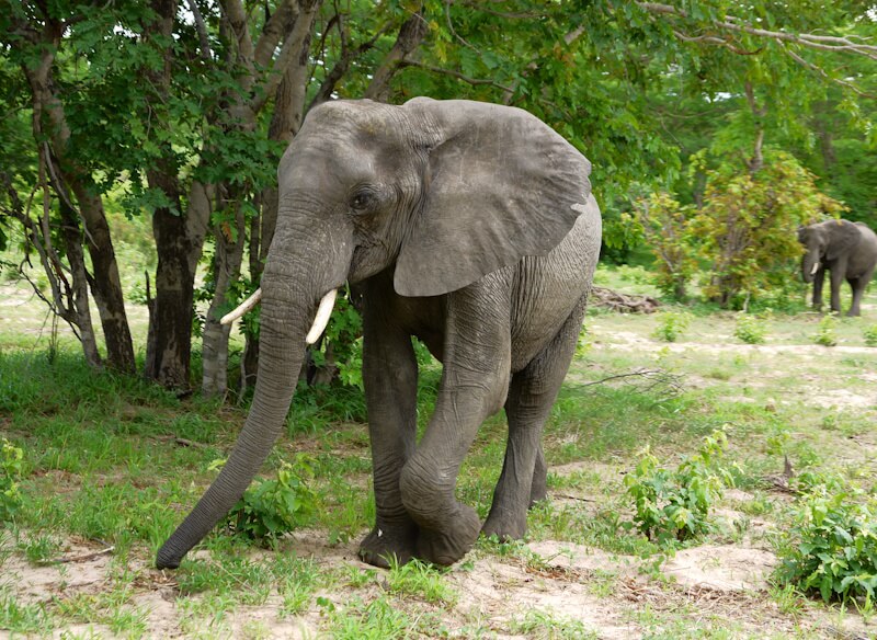
Etosha Nature Park is also fenced today, giving it the character of a large, isolated wildlife enclosure. Etosha National Park was established on March 22, 1907, when the then Governor of German South West Africa, Friedrich von Lindequist, declared 99,526 square kilometers a nature reserve. This area was later reduced several times, so that Etosha National Park now covers 22,935 square kilometers. The considerably smaller Etosha Nature Park was then fenced to prevent wildlife migrations. The fencing of both Etosha Nature Park and the surrounding landscape prevents animal migrations (183), which are an essential part of the animals’ way of life. Furthermore, animal migrations are a crucial and constitutive element of the ecology of the savannah landscapes, which make up about a quarter of the African continent. As one of the few examples where animal migrations were largely taken into account when establishing a nature park, the Serengeti (184) can be cited, which was made possible in particular by the commitment of Bernhard and Michael Grzimek (185).
An alternative to fenced landscapes and the grazing of livestock such as cattle or sheep in these fenced areas, which are typically deforested (186), cleared of scrub (187), and converted into monotonous grasslands for pasture, would be the use of the diverse natural wildlife populations, monitored and controlled by wildlife biologists. These diverse wildlife populations would be able to move freely in the unfenced natural landscapes of Africa, particularly during migrations. To this end, Africa’s natural landscapes are preserved and restored through renaturation (188), including, in particular, the savanna landscape type, which originally covered a quarter of the African continent. The diverse natural wildlife populations are also regenerated through rewilding (189).
The vegetation of the savanna, in contrast to the monotonous, deforested, and scrub-cleared pastureland, is diverse and has several vegetation layers. This diversity of vegetation corresponds to the diversity of different wildlife species, which occupy different ecological niches (190) and utilize the diverse natural vegetation differently as food. The plants and animals of the savanna together form an ecosystem (191) as a component of the biodiversity (192) of the biosphere (193). Since the net primary production of biomass of the diverse natural vegetation, in this case the savanna, is greater than that of a deforested and scrub-cleared monotonous grassland, more large animals can coexist in the savanna than is possible on a scrub-cleared monotonous grassland where only one animal species, usually cattle or sheep, is kept. This means that with the controlled use of the savanna’s natural animal population by wildlife biologists, higher meat production is possible than with the raising of a single livestock species on a cleared, monotonous grassland, which is classically considered the ideal pasture, but is not factually the case.
Such alternative land-use concepts ideally realize nature conservation (194), process protection (195), and landscape protection (196), into which the traditional way of life and economic practices of the San (Bushmen), who to this day have been displaced, driven out, discriminated and marginalized, can be integrated. The Amazon region in South America provides an example of this, where the integration of the indigenous populations of the Amazon rainforest with their traditional ways of life and economic practices into nature conservation concepts is both demanded and pursued (197). The existing cross-border concept of “Peace Parks” (198) can also be integrated into such concepts and further developed. In this way, nature conservation and tourism become an integral part of détente policy (199).
Today, the tourism industry profitably markets the myth of an “African natural paradise”, but this has long since ceased to exist. The “African natural paradise” must first be reconstructed and restored by renaturation and rewilding.
On November 25, 2025, I travelled back to Windhoek from Etosha National Park to continue my journey to Victoria Falls on the Zambezi River by Intercape coach. While Etosha National Park had enjoyed clear, sunny weather, the cloud cover increased during the drive to Windhoek, and showers began to fall in the distance.
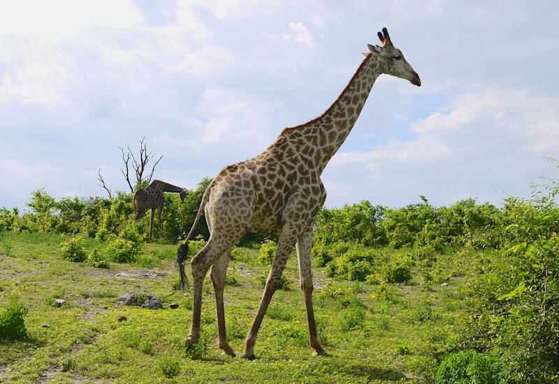
6. Through the “Caprivi Strip” to Victoria Falls
From Windhoek, I travelled to northeastern Namibia on November 26, 2025, by Intercape coach. It was election day in Namibia, and, as on a Sunday, there was very little traffic on the roads. In northeastern Namibia, the so-called “Caprivi Strip” (200) extends far into the center of southern Africa. The Caprivi Strip is named after Leo von Caprivi (201), Otto von Bismarck’s successor as Chancellor of the German Empire from 1890 to 1894, who sought reconciliation with the United Kingdom of Great Britain. The Caprivi Strip dates back to the Heligoland-Zanzibar Treaty (202), signed on June 1, 1890, between the United Kingdom of Great Britain and the German Empire. The border rivers of the Caprivi Strip are the Zambezi (203) to the north and the Chobe River (Cuando River) (204) to the south. At the eastern end of the Caprivi Strip lies a quadripoint where the present-day countries of Namibia, Botswana, Zambia, and Zimbabwe meet. Victoria Falls is only a short distance from here.
The regular Intercape Mainliner buses have seats for 60 passengers, and I traveled on one of these Intercape coaches from Windhoek through the Caprivi Strip to the border town of Katima Mulilo, passing through Okahandja, Otjivarongo, Otavi, Tsumeb, and Rundu. For much of the way through the Caprivi Strip, the bus followed the Trans-Caprivi Highway (= country road B8), a well-maintained road. The weather was overcast, and the savanna landscape here is noticeably greener, with taller and denser trees, indicating higher rainfall. Small rural settlements, surrounded by small-scale farming, line both sides of the road.
Since 2004, the Sesheke Bridge has spanned the Zambezi River near Katima Mulino, connecting Zambia. The main route of the Intercape coach runs across this bridge and continues north along the Zambezi through Zambia to the town of Livingstone and then on to Victoria Falls in Zimbabwe. Passengers, including myself, traveling south of the Zambezi from Katima Mulino to Kasane and then on to Victoria Falls, transferred in Katima Mulino to a small, 23-seat Intercape Interconnect bus towing a luggage trailer.
After about an hour’s stop in Katima Mulino, the journey continued along the Trans-Caprivi Highway (= country road B8) for approximately 70 kilometers to the Ngoma Gate border crossing between Namibia and Botswana. At the Namibian border station, passports were scanned electronically, and passengers quickly received their exit stamps. Entry into Botswana was also swift. In my case, no visa was required for entry into Botswana, unlike the earlier entry into Namibia. Following the events of September 11, 2001, and at the initiative of the USA, it has become increasingly common worldwide for biometric data to be collected at border crossings (205), but this was not the case at this border crossing, nor at the other border crossings I passed through in southern Africa.
The small border town of Kasane lies on the southern bank of the Chobe River in Botswana (206). In Kasane, I was the only passenger who got off as scheduled; the other passengers continued on to the tourist resort of Victoria Falls in Zimbabwe. At my request, the bus driver kindly gave me a lift to the neighboring town of Kazungula, where the hostel where I was staying is located.
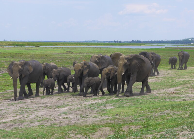
The Chobe Nature Park (207) borders the Chobe River here. Tour operators also offer tours in Chobe Nature Park, and I participated in one such tour, which also takes place in open off-road vehicles, on November 28, 2025. On this tour, we entered Chobe Nature Park near the town of Kasane at around 6:00 a.m. through the Seduda Gate. The tour initially followed the course of the Chobe River westward. The landscape along the riverbank is largely open, allowing for expansive views and facilitating wildlife observation. Away from the riverbanks, a comparatively dense and green savanna landscape dominates Chobe National Park. Unlike Etosha National Park, there are no roads or gravel tracks here; the vehicles travel on tracks and trails that crisscross the terrain. We encountered buffalo and antelope, and then a group of eight lions that passed close to several tour vehicles. We also encountered baboons, an osprey, various other birds, giraffes, a monitor lizard, and other antelopes, including impalas. Then we left the riverbank, and the journey continued through a dense savanna landscape dominated by trees. Here we saw elephants. Towards the end of the tour, we came across a large number of elephants, around 100, on the banks of the Chobe River. Hippos are common in the Chobe River, and Nile crocodiles also inhabit it.
Unlike Etosha Nature Park, Chobe Nature Park and the surrounding landscape are not fenced, so the animals are not hindered in their seasonal migrations. In contrast to the settlement colonies of South Africa and Namibia, the landscapes in Botswana and Lesotho in southern Africa are largely unfenced, which points to significant differences in both the agrarian constitution and the agricultural history of the rural areas. That these differences have persisted to this day is due to the fact that in 1895, three Tswana chiefs successfully prevented the annexation of the then British protectorate of Bechuanaland (208) by the British South Africa Company (BSAC) (209), founded by Cecil John Rhodes (1853-1902) (210), through negotiations with the British Empire. The “Three Chiefs Monument” in the town of Gaborone commemorates this historical event.
On November 29, 2025, I visited Victoria Falls (211) on the Zambezi River near the tourist town of Victoria Falls. East of Kazungula, I crossed the border between Botswana and Zimbabwe for this purpose, obtaining a one-day visa on arrival for Zimbabwe (fee: USD 30). Since 2009, due to the devaluation of the Zimbabwean dollar, the US dollar has been the official currency in Zimbabwe. Entrance to Victoria Falls cost USD 50. Victoria Falls is one of the most important tourist attractions in Africa and is a UNESCO World Heritage Site. These waterfalls on the Zambezi River were named “Victoria Falls” by the African explorer David Livingstone (1813–1873) (212), who visited them during several travels through southern Africa. A monument commemorating Livingstone stands before the waterfalls.
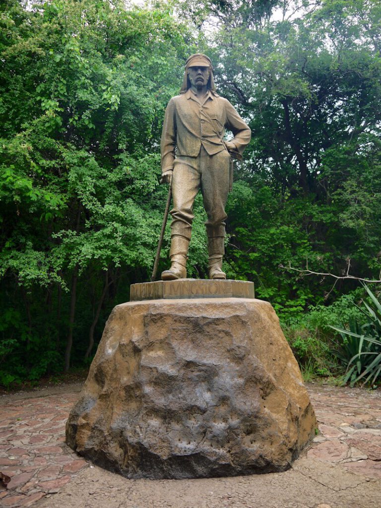
The border between Zambia and Zimbabwe runs through the Zambezi River and the Victoria Falls. On the Zimbabwean side, the Victoria Falls are part of Victoria Falls Nature Park. A trail approximately 1.5 kilometers long with 16 viewpoints runs along the edge of the gorge. Viewing the falls from the Zimbabwean side is more popular, as it offers a panoramic view. Currently, the Zambezi was low, nearing the end of the dry season. Nevertheless, it rained in some areas due to the spray, and rainbows were visible over the falls. The water plunges up to 107 meters. The trail ends at a steel arch bridge spanning the Zambezi River, where a border crossing between Zimbabwe and Zambia is located.
After visiting Victoria Falls, I continued my journey on November 30, 2025, traveling by minibus through eastern Botswana to the town of Nata. The drive took me through a green savanna landscape, which, unlike in South Africa and Namibia, is not fenced. It is surprising, then, that this savanna landscape is repeatedly interrupted by vast expanses of industrial agriculture stretching to the horizon. Among other things, maize is cultivated here in enormous, sterile monocultures. The drive also led past massive, industrial silage clamps. These large-scale industrial facilities with their vast monocultures contrast sharply with the small-scale subsistence farming prevalent in the Caprivi Strip, among other places. The question arises: who are responsible for establishing and maintaining these enormous industrial facilities and structures? It is known that various foreign actors, including the People’s Republic of China, are buying up large areas of land in many parts of Africa in order to carry out industrial agriculture, which is called “land grabbing” (213), since this land is no longer available for other purposes, such as nature conservation and subsistence farming for the local population.
The town of Nata lies on the banks of the Nata River. A dam with a road blocks the river near the town. Below the dam, the riverbed was largely dry, and no water was flowing. Above the dam, the Nata River forms a reservoir approximately six kilometers long. The riverbanks are used for grazing livestock (goats, cattle, horses), which are tended by herders. The hostel where I stayed in Nata has canoes, and I paddled one of them upstream on this reservoir. The banks of the Nata River are largely steep, reaching heights of up to five meters. Due to the high sediment content, the water of this reservoir is gray, matching the color of the soil along the river’s steep banks. The riverbed was also dry above the reservoir.

At the hostel where I stayed in Nata, I also met travelers with extraordinary and impressive travel plans. Among them were Wiebke and Lisa with their touring bikes, who were currently on a tour of Namibia and Botswana. Wiebke told me she had recently cycled from Freiburg through West Africa to Cape Town.
From the town of Nata, a road leads west to the tourist resort of Maun on the edge of the Okavango Delta (214). Maun is considered the center of safari tourism in Botswana. However, after my successful visits to Etosha Nature Park and Chobe Nature Park, my itinerary did not include another nature park visit, both due to the limited time available and the generally high costs associated with participating in tours organized by tour operators.
From Nata, I continued my journey on December 2, 2025, by minibus towards Francistown and Gaborone. The green savannah landscape, which I had been traversing since the Caprivi Strip, continued. From Francistown, I drove on to the town of Palapye, which served as a convenient stopover on my way from Nata to Gaborone. A wide grassy verge runs alongside the highway, cleared of trees and bushes, and numerous cattle graze on this verge. These cattle occasionally cross the highway, requiring slow and careful driving. According to the Central Places system (215) developed by geographer Walter Christaller, Palapye serves as a transportation hub and a supply center for its surrounding area.
From Palapye, I continued my journey in another minibus, passing through the town of Mahalapye, to Gaborone, the capital of Botswana. Up to this point, the landscape in Botswana had been flat, but near Gaborone it became hilly and some mountains came into view. In Gaborone, on December 4, 2025, I took a city excursion, which included a visit to the semicircular government district, the business center, the National Museum, which was undergoing renovations at the time, and the “Three Chiefs Monument Park”. In this park, the “Three Chiefs Monument” commemorates three Tswana chiefs who, in 1895, successfully prevented the annexation of the then British protectorate of Bechuanaland by the British South Africa Company (BSAC), founded by Cecil John Rhodes (1853-1902), through negotiations with the British Empire. This annexation would have meant that Bechuanaland would later have become part of the Union of South Africa, founded in 1910, and would therefore, like Namibia, have been subjected to the consequences of apartheid. This, too, was successfully prevented in 1895. Like Bechuanaland (Botswana), Basotholand (Lesotho) and Swaziland (Eswatini) also rejected incorporation into the Union of South Africa in 1910.
From Garborone, I reconnected to the coach routes of the Intercape coach company, with whom I continued my journey to Pretoria on December 5, 2025. After a short drive of about 30 minutes, I reached the border between Botswana and South Africa at the Tlokweng-Kopfontain border crossing. It is a frequently used border crossing, and there were long queues at passport control, although the checks themselves were quick on both sides. Passports were scanned electronically, and an exit or entry stamp was issued. Also here no biometric data were collected. The onward journey to Pretoria took me through a mountainous and green savannah landscape.
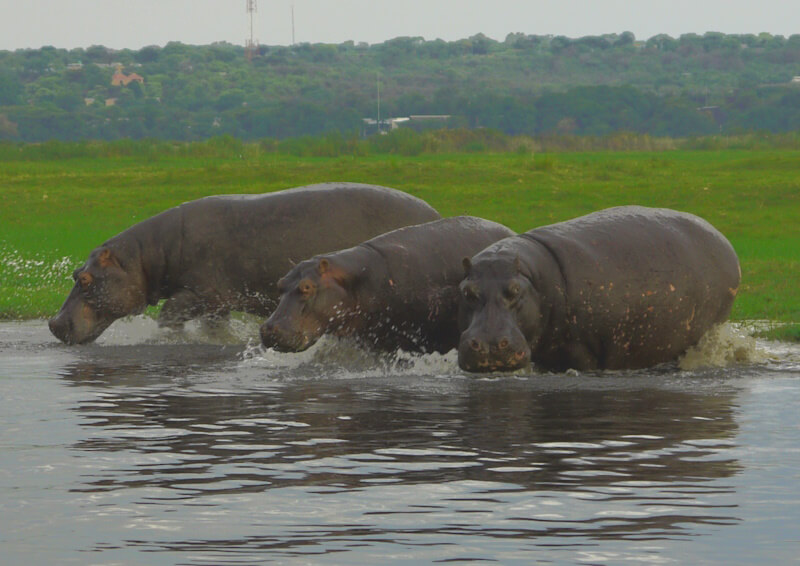
7. Pretoria or: The Boer Republics and the “Scramble for Africa”
The city of Pretoria (216) holds outstanding historical and contemporary significance, as it was the capital of the Boer Republic of the South African Republic (Transvaal) (ZAR) (217), and is now one of the three capital cities of South Africa, alongside Cape Town and Bloemfontein. Consequently, Pretoria boasts numerous historical buildings, museums, and attractions. During my city excursion on December 6, 2025, I also explored Pretoria’s historical sites. Here, too, the aim is to conduct historical research at the original geographical locations of historical events.
My city excursion of Pretoria began in the Hatfield district, where my hostel was located. I took the Gautrain, a commuter train considered reliable and safe, from Hatfield station to Pretoria station, which is situated next to the main train station and the bus station in Pretoria’s city center. As is common at bus stations in South African cities, numerous coach companies have their ticket offices at Pretoria’s bus station, where tickets can be easily purchased, and bus tours to numerous destinations throughout South Africa are offered. From there, I followed Paul Kruger Street north, passing the National Museum of Natural History. On the opposite side of the street, surrounded by a park with monuments, stands the City Hall, built in 1935. The entire area around the City Hall was fenced off and inaccessible. I then reached Church Square, which forms the architectural heart of Pretoria. It is surrounded by numerous large, impressive buildings, including the Raadsaal, built in 1891, the parliament of the Boer Republic of South Africa (ZAR) (Transvaal). In the center of Church Square, a monument commemorates Stephanus Johannes Paulus Kruger (1825-1904) (218), President of the South African Republic (ZAR) (Transvaal) from 1883 to 1900.
Afterwards, I visited the “Paul Kruger Museum” (219), located west of Church Square opposite Kruger’s Church. The museum is housed in the home where Paul Kruger lived when he was President of the South African Republic (Transvaal) from 1883 to 1900. His presidency fell squarely within the Age of Imperialism, a key feature of which was the “Scramble for Africa”. Paul Kruger’s time in office was particularly marked by this Age of Imperialism, which culminated in two world wars.
Consequently, imperial wars dominated Paul Kruger’s term as President of the South African Republic (Transvaal), a topic addressed in the Paul Kruger Museum I visited in Pretoria. The museum showcases, among other things, the widespread solidarity shown to Paul Kruger during these armed conflicts with the British Empire (220), the so-called Boer Wars (221), by both state actors and numerous civil society groups worldwide. However, in reality, nothing more happened beyond these expressions of solidarity. In the military conflict with the British Empire, then the leading world power, the Boers were left to fend for themselves, and no one dared to openly support them and thus risk a conflict with the then leading world power, the British Empire.
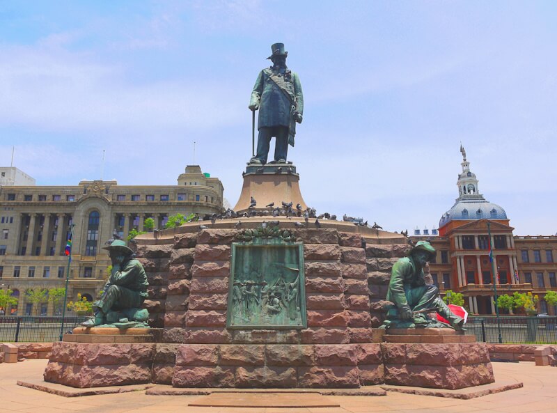
Numerous comparable examples can be found in recent history where victims of military aggression by world powers are left to fend for themselves, and among many, I would like to cite three outstanding examples: 1. The Abyssinian War (Second Italo-Ethiopian War) waged by Fascist Italy against the Ethiopian Empire, a member of the League of Nations, from October 3, 1935, to November 27, 1941 (222). 2. Finland in the so-called Winter War with the Soviet Union from November 30, 1939, to March 13, 1940 (223), and 3. the occupation and annexation of Tibet by the People’s Republic of China from 1950 onward (224). World powers continue to dominate the state system today, and in the UN Security Council, the world powers – almost exclusively victorious powers of the Second World War – as permanent members with veto power, represent their interests as world powers, with the consequence that power calculations and power politics, as well as geostrategy and geopolitics, determine world politics.
In order to defeat the Boer republics militarily, the British Empire deployed an overwhelming military force of around 450,000 soldiers in the Second Boer War of 1899-1902 (Anglo-Boer War, also: South African War) (225). Large parts of the civilian population were held in internment camps, which were called “Concentration Camps” (226), in which approximately 26,000 Boers died due to the conditions of detention. The Commander-in-Chief of the British Army, Horatio Herbert Kitchener, 1st Earl Kitchener (1850 – 1916) (227), gave the order to deprive the Boers of their livelihood as part of a “scorched earth” (228) strategy: 30,000 farms were burned down, villages destroyed, and the harvest ruined. The Boer republics were incorporated into the British Empire as colonies, and Paul Kruger went into exile in 1900. The Second Boer War became a more detailed topic during my subsequent visit to the town of Bloemfontein.
The previously independent Boer republics of the Orange Free State and the South African Republic (Transvaal) became colonies of the British Empire after the Second Boer War. On May 31, 1910, the Union of South Africa was formed through the union of four British colonies: the Cape Colony, Natal, the Orange River Colony, and Transvaal. The Union of South Africa became a Dominion (229) within the British Commonwealth (230). Like the other Dominions of the British Empire, such as Canada, Australia, and New Zealand, the Union of South Africa also participated in all subsequent (imperial) wars of the British Empire, including the First World War, as loyal vassals of the British king, just as in the time of William the Conqueror (231), even though these wars of the British Empire had no bearing on these Dominions and their populations.
After visiting the Kruger Museum, I continued my city excursion in Pretoria to the Union Buildings, completed in 1913. Along with Cape Town, these serve as the seat of government. The Union Buildings are situated on a hill in a terraced park, offering a view over the city of Pretoria. Below the Union Buildings is the Pretoria War Memorial, which commemorates the 11,000 soldiers of the Union of South Africa who lost their lives in the First World War. It is designed according to the uniform architectural standards of the British Commonwealth War Graves Commission (232).
8. Johannesburg: From Gold Rush to Megacity
On December 7, 2025, I took a day tour from Pretoria to the nearby city of Johannesburg (233), which grew as a boomtown (234) during the gold rush that began in 1886. Because Johannesburg is considered the city with the highest crime problem in South Africa, I did not undertake for my city excursion my usual walking tour, but instead took a day tour on the city sightseeing bus. Due to the high crime rate, tourists are strongly advised against walking tours in Johannesburg. According to statistics, South Africa has the highest crime rate in the world, and within South Africa, this rate is highest in Johannesburg. Just like in Cape Town, tours of the city area are also offered in Johannesburg using the city sightseeing bus. In Johannesburg, the city sightseeing bus tour starts in the Rosebank district at the station of the Gautrain, which I took from Pretoria.
The city sightseeing bus tour passes through suburbs and residential areas, which, as in all South African cities, are surrounded by walls and high fences, mostly electric, and are strictly guarded by security companies operating under an “armed response” concept. In the city center dominate high-rise buildings from the period when Johannesburg was a booming supra-regional business and economic center following the gold rush. Significant demographic changes are taking place in South Africa, and particularly in its cities (235). As in all South African cities, since the end of apartheid, the city center of Johannesburg has been abandoned by residents of European origin, who have retreated to gated communities outside the city centers behind high, often multi-tiered fences and walls. Today, people camp in tents and selfmade huts along the roadsides of Johannesburg’s city center. These people, who fled the townships (236) and former homelands (237) in large numbers after the end of apartheid, now constitute the majority of the population in South African city centers. In addition, a large number of illegal immigrants and economic migrants from neighboring countries also arrive in South Africa, and they too largely settle in the city centers. There, they contribute to the unemployment rate, which in South Africa is between 35 and 40 percent. Due to the highest population growth rate (238) in the world in all of Africa, increasing numbers of people are pushing from the townships and rural areas into the city centers. During the city sightseeing bus tour, a presentation of the sights visited is provided via headphones in a variety of selectable languages. This presentation also covers various aspects of Johannesburg’s past, present, and future. Among other things, it is mentioned that Johannesburg will have grown together with Pretoria and other cities and settlements in a few years to form a megacity (239) with possibly several tens of millions of inhabitants.
During the city sightseeing bus tour, you can get off at a total of 13 stops and continue your journey on one of the following city sightseeing buses, which depart every 40 minutes. I took advantage of this and got off at stop number 7 to visit the Apartheid Museum (240). The Apartheid Museum focuses on racial segregation (241) in South Africa and Namibia, which was practiced there until 1990 and is referred to as “apartheid” (242). In South Africa and Namibia, a distinction was made between “Little Apartheid” and “Great Apartheid”. The term “Little Apartheid” refers to racial segregation in public spaces, particularly in cities, while “Great Apartheid” refers to spatial segregation on a large scale, especially within the framework of homeland policies. Racial segregation was a phenomenon particularly prevalent in settlement colonies, such as in the USA (243), but also in South Africa and Namibia. In the USA, racial segregation was practiced until 1964, when a civil rights movement achieved its abolition (244). In South Africa and Namibia, racial segregation (apartheid) was abolished in 1990.
The Apartheid Museum’s motto is “Learn from the past, change the future”, and it impresses visitors with extensive exhibitions featuring numerous artifacts, primarily photographs, and comprehensive information. The exhibitions follow the historical developments chronologically. Among other things, they depict the prehistory of racial segregation in South Africa and Namibia, the implementation of apartheid policies from 1948 onward, how apartheid shaped and determined people’s lives, the opposition to apartheid, crimes committed by the apartheid regime to maintain apartheid and repress the opposition, the end of apartheid, the transition period from 1990 to 1994, which was marked by an increase in violence, and developments up to the present day.
The museum exhibition begins in the museum’s outdoor area with a highlighting of several key aspects of human history (245), particularly in the field of paleoanthropology (246). Undoubtedly, the interdisciplinary project of modern anthropology, whose shared cognitive interest (Erkenntnisinteresse) can be defined by Kant’s question “What is man?” (247), yields insights with far-reaching consequences for our worldview: The unity of humankind is thus no longer merely an intellectual and cultural achievement of unterstanding, as it was during the Age of Enlightenment, but a biophysical fact today. The findings of the interdisciplinary project of modern anthropology provide outstanding and compelling arguments against racial segregation and racism (248).
In addition to the main exhibition, there are two further exhibitions, one of which focuses on the life and work of Nelson R. Mandela (1918-2013) (249), and the other on the life and work of Desmond M. Tutu (1931-1920) (250). The latter exhibition, in particular, focuses on the “Truth and Reconciliation Commission” (251), established in 1996. This Truth and Reconciliation Commission is an expression and example of a new level of reflection in dealing with crimes committed in the context of war and tyranny, where the aim is enlightenment rather than punishment, as in tribunals and court trials (252). Thus, the focus is not on “perpetrators” but on the circumstances, which is what makes a change in these circumstances possible in the first place, corresponding to the museum’s motto: “Learn from the past, change the future.”
South Africa is considered an example of a successful transformation process from apartheid to democracy. Everyone now has the opportunity to participate in elections as an equal right. However, democracy cannot function if, as in South Africa and numerous other countries, voting is based on Criteria for affiliation to ethnic groups. In such cases, the election result is predetermined, so that we can also renounce of voting, as the outcome is not the result of prior public discussion and opinion formation, as expressed in the concept of deliberative democracy (253). The core idea of deliberative democracy is that through the exchange of arguments in a discourse free from domination (herrschaftsfreier Diskurs), understanding or consensus can be reached, and solutions thus found meet the demands of reason in both factual and moral terms (254). Solutions to the numerous pressing problems in South Africa can only be found if it is possible to achieve understanding or consensus through the exchange of arguments in a discourse free from domination. Currently, societal realities are far from this ideal.
Johannesburg is a young city, not even 150 years old, and it sprang up as a boomtown during the gold rush that began in 1886. In just a few years, Johannesburg, along with Pretoria and other towns and settlements, will have merged to form a megacity with potentially tens of millions of inhabitants, as was explained on the city sightseeing tour. The last time I experienced an expanding megacity was during my cycling travel through southeastern Europe in 2023: The megacity Istanbul-Bursa. Before that, I had visited and explored other megacities during my travels: Paris, London, Mumbai/Bombay, Delhi, Bangkok, Ho Chi Minh City/Saigon, São Paulo, Mexico City, Cairo, Los Angeles, and New York. The majority of the world’s population will live in megacities with 10 to 50 million inhabitants in a few decades, and in southern Africa we can visit such an emerging megacity with the Johannesburg-Pretoria metropolitan area and study the conditions prevailing in megacities, and it is under such conditions that the majority of the world’s population will live in a few decades.
The question arises as to the role of the world’s increasing and rapidly growing megacities in the current, existing world system. In my view, these megacities have the character and function of expulsion spaces and preservation asylums for the global surplus population, which is being displaced from rural areas as vast agro-industrial monocultures expand there at the expense of the traditional subsistence farming of people in rural areas. As expulsion spaces and preservation asylums, the megacities replace the total institution of the camp, which, in its various forms, experienced its uncanny expansion and radicalization in the extreme 20th century. Added to this is the continued rapid population growth, which is highest in Africa worldwide. People are not leaving rural areas and abandoning their traditional subsistence farming voluntarily; rather, they are being forced to do so. In search of a livelihood, people displaced from rural areas are settling in the growing slums on the outskirts of cities, or they are clearing land in nature reserves. Urbanization is increasing rapidly worldwide. In just a few decades, the majority of the world’s population will live in megacities with 10 to 50 million inhabitants. Most megacities are characterized by permanent ecological, social, and health crises and states of emergency. These various crises and states of emergency can be studied using the example of megacities that already exist today. These crises in today’s megacities will shape the future of humanity, and will very likely result in a totalitarian global regime for crisis management as well as for the surveillance and control of the population. Since the events of September 11, 2001 and the so-called “Corona crisis”, part of the way there has already been completed. Today, this development appears fateful, unchangeable, and inevitable.
From Johannesburg I had wanted to visit the nearby, due to the numerous paleoanthropological finds as the “Cradle of Humankind” (255) known caves Sterkfontein (256), Swartkrans (257), Wonder Cave and others, which are UNESCO World Heritage sites, but there is no public transport to them, so I had to abandon my plan.
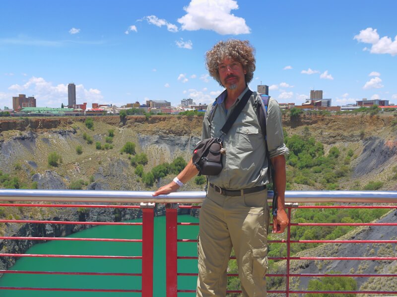
9. Diamond rush and geopolitics in Kimberley
From Pretoria, I travelled on December 8, 2025, by Intercape coach to the mining town of Kimberley (258), which emerged as a boomtown in 1871 during the largest diamond rush in human history. While Johannesburg arose as a boomtown during a gold rush and, surprisingly, did not disappear after the gold rush ended, as is typical for boomtowns, but on the contrary, is now rapidly developing into a megacity, Kimberley also originated as a boomtown, but during the largest diamond rush in human history.
On December 9, 2025, I also took a city excursion in Kimberley, where I once again embarked on a historical exploration. The aim is to conduct historical research at the original geographical locations of historical events. The focus of my city tour was a visit to the “Big Hole” and the “Kimberley Mine Museum” located there, as well as the adjacent Old Town open-air museum. On my way to the city center, I passed a statue of Cecil John Rhodes (1853-1902). I then passed the fenced “Oppenheimer Memorial Garden” and the “Harry Oppenheimer House”, the headquarters of the “De Beers Diamond Trading Company”. I then reached Market Square with the City Hall and, on my way to the “Big Hole”, passed the “De Beers Head Office” building, dating from 1898.
Today, the De Beers Group is the world’s largest diamond producer, accounting for approximately 40% of global diamond production, and the world’s largest diamond trader, with over 50% of the global diamond market (259). Founded on March 12, 1888, as “De Beers Consolidated Mines Limited” under the chairmanship of Cecil John Rhodes, the company secured a monopoly on diamond production in southern Africa. Today, the mining and raw material conglomerate “Anglo American” (260), founded in 1917 by Ernst Oppenheimer (1880-1957) (261) with the support of the US-american bank J.P. Morgan (262), owns 85% of the shares in the De Beers Group. The management of the Anglo American group was continued by Harry F. Oppenheimer (1908-2000) (263), after whom the “Harry Oppenheimer House”, the headquarters of the “De Beers Diamond Trading Company” in Kimberley, is named today.
The “Big Hole” (264) was created starting in 1871, after diamonds were discovered on the De Beers brothers’ farm in 1866 and the land was divided into claims during the Diamond Rush. The mining activities created a huge hole, the “Big Hole”, which is today filled with water and a tourist attraction. The “Big Hole” can be viewed from a platform. It is up today one of the largest hand-dug pits in the world. I took part in a guided tour offered by the Kimberley Mine Museum, which included a visit to a reconstructed mine shaft from the Diamond Rush era.
The open-air museum “Old Town”, adjacent to the “Big Hole”, is an open-air museum (265) in the tradition of the Skansen open-air museum (266) in Stockholm. Here in Kimberley, in the “Old Town”, existing historical buildings from the time of the diamond rush have been collected and reconstructed. Impressively, the interior furnishings have also been largely preserved. The adjacent “Kimberley Mine Museum” is excellent and informative, covering almost all aspects of the topic of “diamonds” (267) in detail, including aspects of geology, cultural history, and more recent history, specifically within the context of the age of imperialism, of which the “Scramble for Africa” was a part.
Within this context, Cecil John Rhodes (1859-1902) plays a particularly prominent role. Rhodes established a diamond monopoly here to realize his geopolitical project of a British Empire in Africa “from Cape to Cairo”, a project that included the Cape to Cairo Railway (268). The museum describes his world-historical role and significance as follows: “Cecil John Rhodes was a statesman and empire builder who had the greatest influence of any single person in the history of the African continent”. Rhodes systematically bought up the claims to the Kimberley diamond mine, financed by the Rothschild bank (269) in London, to implement his geopolitical and imperial plans for a British Empire “from Cape to Cairo”. The Kimberley Mine Museum also offers detailed and extensive material on this topic.
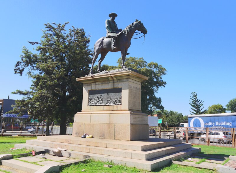
These plans for a British Empire “from Cape to Cairo” were thwarted, among other things, by the Boer republics of the “South African Republic” (Transvaal), the “Orange Free State”, and the “Republic of Natalia”. Britain waged wars, known as the “Boer Wars”, to subjugate and integrate these republics into the British Empire. Among these Boer Wars, the Second Boer War of 1899-1902 (also known as “Anglo-Boer War”, and “South African War”) stands out due to its geopolitical significance and the novel methods of warfare employed, in which the civilian population was extensively targeted through a “scorched earth” strategy. This war was the main focus of my subsequent visit to the town of Bloemfontein. The Second Boer War was waged by Great Britain to incorporate the diamond- and gold-rich Boer republics into the British Empire. The Second Boer War was preceded by a coup d’état attempt planned by Cecil John Rhodes in the South African Republic (Transvaal) from December 29, 1895 to January 2, 1896, which is known as the “Jameson Raid” (270).
Unfortunately, the Kimberley Mine Museum is one of many museums where, for inexplicable reasons, there is a lack of light, resulting in many photos being blurry and not turning out well. On the way back, I passed a memorial erected in 1976, commemorating those who died in concentration camps near Kimberley between 1899 and 1902 during the Second Boer War (also known as “Anglo-Boer War” and the “South African War”).
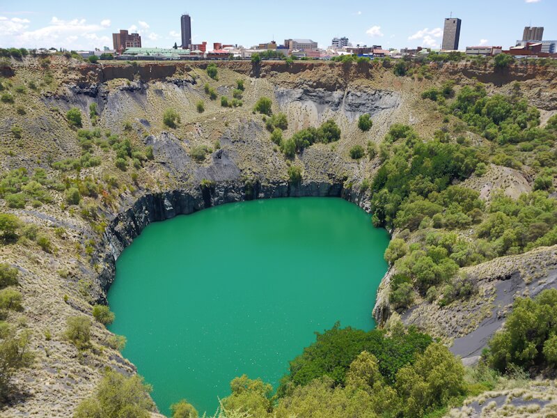
10. Bloemfontein: The Second Boer War, a primordial catastrophe of the extreme 20th century
From Kimberley, I continued my journey on December 10, 2025, to Bloemfontein (271), the capital of the former Boer republic of the Orange Free State, where I made another stop for a city excursion and to visit museums and memorials. The journey began from the bus station in Kimberley in a 22-seater minibus, which, like many others, only departed once all seats were occupied. This took an exceptionally long time this time, resulting in a four-hour delay. The flat landscape continued, the same one I had traversed on the way from Pretoria to Kimberley. The land on both sides of the road is fenced and largely used for agriculture, with vast expanses of agricultural land. Cattle grazing predominates on these lands. Unlike the typical landscape in Namibia, these areas are largely cleared of scrub, resulting in extensive, monotonous grasslands. In addition, there is also arable farming, which is likewise carried out on vast agricultural lands. Crops grown include maize and prickly pears. The journey passes several enormous silage clamps. The cultivated soil, as is typical throughout southern Africa, has a reddish hue. Ostriches were seen a few times in the fenced areas; otherwise, the large animals typical of Africa are completely absent.
The city of Bloemfontein holds outstanding historical and contemporary significance. Firstly, it was the capital of the Boer Republic of the Orange Free State, and secondly, it is now one of South Africa’s three capital cities, alongside Cape Town and Pretoria. Consequently, Bloemfontein boasts numerous historical buildings, museums, and attractions. During my city excursions, I also explored its historical sites. The aim is to conduct historical research at the original geographical locations of historical events.
My city tour of Bloemfontein began in the city center at Hoffman Square. This large square is surrounded by several large buildings, including a post office. A monument in the square commemorates Bloemfontein residents who died in the First World War, bearing the inscription “Who died for their Country”. In various cities across South Africa, including Cape Town and Pretoria, monuments commemorate the participation of the Union of South Africa, founded in 1910 as a dominion of the British Empire (along with Canada, Australia, and New Zealand), in the First World War. Given its prominent presence in South Africa’s public commemoration and remembrance culture, the Union of South Africa’s participation in the First World War as a loyal vassal of Great Britain is considered a founding event of the Union of South Africa.
From Hoffman Square, I continued my city tour westward and clockwise through the historic city center. I passed the National Afrikaans Literary Museum, the City Hall, and the Fouth Raadsaal, the parliament building of the Orange Free State, completed in 1893. I then reached Hertzog Square and visited the adjacent National Museum. This large and impressive museum has several departments: Nature study, natural history, archaeology, ethnography, and the history of the city of Bloemfontein. Nature study and natural history form the museum’s main focus. The exhibits in all departments are elaborately designed with numerous slide frames and display cases – a classic and proven museum education concept.
Well-designed museums with such a focus as the National Museum in Bloemfontein are significant and important because they make a substantial contribution to general public education. They are suitable for dismantling misinformation and prejudices in the spirit of social enlightenment and convey the foundations of a current, scientifically grounded worldview. Part of this current, scientifically grounded worldview is the understanding that humanity originated in Africa and spread from there across almost every continent through a process of migration; and southern Africa, in particular, became a site of migration again in modern times, with migrants from Europe and South and Southeast Asia, among other places. Later in my city excursion of Bloemfontein, I passed the “First Raadsaal”, the oldest surviving building in the city built in 1849, as well as the “Old Presidency”, the residence of the President of the Orange Free State, built in 1885.
The focus of my city excursions in Bloemfontein on December 11, 2025, was a visit to the “National Woman’s Memorial and War Museum of the Boer Republics” (272). I reached it from Hoffman Square, following Kerk Street (Church Street) southwest out of the city center. This street, like many in South Africa, has since been renamed. Berlin is an example of a city that has been repeatedly affected by street renaming in its recent history, and in my opinion, streets should generally only be named after geographical features so that they do not repeatedly become the subject of historical-political disputes. On the way to the museum, I passed a large industrial area, primarily home to car dealerships.
Opposite the Old Fort and the adjacent Military Museum, I came across an old cemetery called “Begraafplaas – President Brand Cemetery”. Among the various gravestones are two different monuments: one a monument of the British Empire, “In Memory of the Members of the British and Colonial Forces who lost their Lives during the Anglo-Boer War”. Numerous names are listed. This monument’s design does not entirely conform to the uniform standards of the British Commonwealth War Graves Commission for military cemeteries, possibly because it was erected at an early date. The second monument, erected in 1959, commemorates the victims of a concentration camp near Bloemfontein between 1899 and 1902, and here, too, numerous names are listed.
The “National Woman’s Memorial and War Museum of the Boer Republics” is located outside the city limits of Bloemfontein, approximately three kilometers from the city center. The memorial focuses on the Second Boer War (also known as “Anglo-Boer War” and the “South African War”) of 1899 to 1902. It features a “Garden of Remembrance” where numerous plaques list the names of 35,000 people, primarily women and children, who died in internment camps, the so-called “concentration camps” between 1899 and 1902 as a result of their imprisonment. The centerpiece of the site is the “Women’s Memorial”, a 36.5-meter-high obelisk erected in 1913. My particular interest lies in the „Anglo-Boereoorlog-Museum“ (Anglo-Boer War Museum). The museum, which is divided into several thematically organized rooms, proves to be extremely rich in material and informative, and it certainly offers the world’s most comprehensive and extensive existing presentations and collections on the subject of the Second Boer War, which is illuminated and explored in its various aspects.
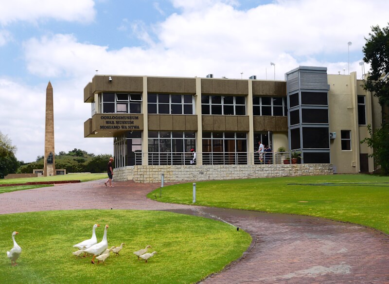
In Europe, we hardly notice the Second Boer War because it took place far away on a colonial periphery. However, the Second Boer War stands out in several respects from the events of its time and from world events at the turn of the 19th to the 20th century, and in my opinion, it is a significant part of the transition and change from the largely peaceful “long” 19th century to the “short” and “extreme” 20th century (273). The Second Boer War heralds the extreme 20th century, of which it is a part.
The Second Boer War was also part of the geopolitical “Scramble for Africa” in the age of imperialism, and in this “Scramble for Africa” the British Empire, then the leading world power, was most successful. To conquer the Boer republics of the Orange Free State and the South African Republic (Transvaal) and incorporate them into the British Empire in Africa “from Cape to Cairo”, the British Empire deployed an overwhelming military force of approximately 450,000 soldiers. Nevertheless, the Boers managed to hold out militarily for a considerable period.
Consequently, the British Empire and the British Army, under the command of the Commander-in-Chief of the British Army, Horatio Herbert Kitchener, 1st Earl Kitchener (1850–1916), employed various methods in South Africa that were particularly directed against the civilian population and their livelihoods, making the civilian population a military target and a victim of war. Furthermore, the British Empire deployed its superior potential as a leading industrial power in this war. Therefore, the Second Boer War can be described as a Total Industrial War, a radicalized form of warfare in the age of industrial modernity, which particularly characterized the extreme 20th century and the two World Wars. In this type of warfare, the belligerents deployed their entire potential as industrial powers as ruthlessly and unrestrainedly as possible, and military victory was achieved by the one who gained access to the greater raw material base, possessed greater industrial production, and, on that basis, could field the greater military-technical arsenal (274).
Kitchener employed a “scorched earth” policy, destroying more than 30,000 farms, 40 villages, and crops. Most notorious are the “concentration camps” he established, internment camps where large segments of the civilian population, particularly women and children, were imprisoned and detained. The death rate in these camps was extremely high due to the appalling conditions. The establishment and operation of these camps constituted a humanitarian catastrophe.
Between 1899 and 1902, approximately 350,000 civilians were interned in these concentration camps, which were primarily located along railway lines. This represents 28% of the population of the two Boer republics at that time, namely the Orange Free State and the South African Republic (Transvaal). Between 50,000 and 60,000 of these internees died as a result of the conditions of their imprisonment.
Among those interned in the concentration camps were not only Boers, as is generally portrayed, but also, in roughly equal proportions, Black Africans, a fact detailed in the museum. There were 47 concentration camps for Boers and 65 for Black Africans. Of the approximately 150,000 interned Boers, 26,379 died, and of the approximately 140,000 interned Black Africans, about 24,000 died. The museum suggests that the conditions of detention for Black Africans were considerably worse than those for the interned Boers, a fact not reflected in the aforementioned figures.
The total institution of the internment camp (275) emerged at the turn of the 19th to the 20th century. In its various forms, the total institution of the camp is the total institution for the purposeful rationality and instrumental administration, surveillance, control, and conditioning of masses of people; it is an invention of the modern age and an instrument of industrial society. The internment camp originated in the colonies, where it was used as an instrument of repression. During the First World War, the previously discredited internment camps of the colonies were used in Europe for the first time. With the First World War, the application of colonial methods of oppression began in Europe itself, and Europeans now became the object of colonial methods of oppression. “The First World War was an important laboratory for what was to come,” explains historian Karl Schlögel in his text: “Bugwelle des Krieges“ (Bow Wave of War): “Here, the methods and practices of total war were tested on a large scale for the first time. (…) Here, practices were perfected that had previously been tested on the periphery of imperialism, in the colonies – from concentration camps to border demarcation with razors to the casual routine of mass execution; racism, as Hannah Arendt had shown, migrated from the periphery back to the motherland” (276).
The total institution of the camp, as a modern form of terrorist coercion against large groups of people, permeates and shapes the history of the 20th century, and it is one of the essential and characteristic elements that make the 20th century an extreme century. The total institution of the camp emerged on the eve of the 20th century, and its trajectory is not yet over, providing an example of how “modernity, precisely in its normality, is the foster father of the excesses of this century”, as the social scientist Gerhard Armanski analyzes in his book: “Machines of Terror: The Camp (Concentration Camp and Gulag) in Modernity” (277).
The Anglo-Boer War Museum also illustrates that the Anglo-Boer War, the Second Boer War, had an international character. On the one hand, numerous volunteers from various countries fought on the Boer side, and on the other hand, the British Empire mobilized soldiers from various overseas territories, including Canada, Australia, and New Zealand. As loyal vassals of the Kingdom of Great Britain, these Dominions participated in every imperial war of the British Empire, just like in the time of William the Conqueror, even though these wars of Great Britain had no bearing on the Dominions and their populations.
These wars were waged at the instigation of the ruling elites and in their interests (278). The Second Boer War, in particular, can be cited as an example. It was specifically the gold from the mines near Johannesburg and the diamonds of Kimberley that the ruling elites of Great Britain wanted to possess and control in order to finance and promote their imperial plans for a British Empire in Africa “from Cape to Cairo”. In contrast, it was the members of the lower classes and the stupid ones who don’t understand anything, who had to be shot dead as soldiers in Britain’s wars, and nothing has changed in this regard to this day.
The Second Boer War is by far the largest war ever fought in southern Africa, and its impact on history and society there continues to this day.
In Europe, we hardly notice the Second Boer War because it took place far away on a colonial periphery. However, the Second Boer War stands out in several respects from the events of its time and from world events at the turn of the 19th to the 20th century, and in my opinion, it is a prominent and significant part of the transition from the largely peaceful “long” 19th century to the “short” and “extreme” 20th century (279). The Second Boer War heralds the extreme 20th century, of which it is a part. Furthermore, the Second Boer War is part of the geopolitical “Scramble for Africa” in the age of imperialism, and in this “Scramble for Africa”, the British Empire, then the leading world power, was the most successful geopolitical actor. The age of imperialism, whose most prominent feature was the geopolitical “Scramble for Africa,” culminated in two world wars, in which the geopolitical “Scramble for Africa” became a geopolitical “Scramble for Europe.” The fact that the geopolitical “Scramble for Africa” became a geopolitical “Scramble for Europe,” replacing the geopolitical “Scramble for Africa,” is illustrated by the war aims of the actors involved in the First World War (280).
Within this context, the Second Boer War was the first colonial war of conquest waged against states of Europeans in the age of imperialism. With the Second Boer War, the “Scramble for Africa” became a “Scramble for Europe”, the first climax of which was the First World War, considered the “primordial catastrophe” of the 20th century. The geopolitical “Scramble for Africa” continued with the Abyssinian War, waged by Fascist Kingdom of Italy against the Ethiopian Empire, a member of the League of Nations, from October 3, 1935, to November 27, 1941. This war ushered in the Second World War as a continuation of the geopolitical “Scramble for Europe”, which had reached its first climax in the First World War. In the Second World War, methods of warfare, first introduced and employed in the Second Boer War and then in the Abyssinian War, were further radicalized. In my opinion, the Second World War as a historical epoch begins with the Abyssinian War (Second Italo-Ethiopian War) (281).
11. Through the highlands of Lesotho and across the Drakensberg Mountains
From the bus station in Bloemfontein, I travelled on December 12, 2025, by 22-seater bus to the city of Maseru, the capital of Lesotho (282), a small country in a mountainous region. The journey there covered a distance of approximately 140 kilometers through predominantly agricultural land. Initially, cattle grazing predominates; in the second part of the route, arable farming, primarily grain cultivation, becomes more common.
Grey soils are striking here, whereas reddish soils otherwise predominate in southern Africa. Soil formation depends on the respective climate, so that different types of soils develop in different climate zones under varying climatic and weathering conditions (283) in interaction with the respective vegetation (284). Clay minerals are a product of the weathering process (285). The type and proportion of clay minerals in soils significantly determine their fertility. Reddish-colored soils form under tropical conditions. The rocks at the Earth’s surface are deeply decomposed under the influence of the high temperatures and rainfall of the tropics, whereby the minerals present in the parent rocks are largely dissolved and sands are washed out. During this chemical weathering, a high proportion of the more soluble elements are carried away in the percolating rainwater, resulting in a strong enrichment of the less soluble elements iron and aluminum (ferralitization), which gives the soils in the tropics their reddish color.
Near the city of Maseru, the landscape becomes mountainous. Shortly before reaching Maseru, the bus journey ended at the Maseru Bridge border crossing, where the bus stopped at the border between South Africa and Lesotho. The passengers then crossed the border on foot, with border formalities being completed quickly on both sides. Their passports were scanned electronically and stamped. After crossing the border, they continued their journey to Maseru city center by taxi. The central street, “Kingsway”, runs through Maseru city center and is a useful landmark for exploring the city.
Maseru is a suitable starting point for travels into the highlands of Lesotho. My guidebook presents several suggested tours, including one to Semonkong in the southwest, where you can see the highest waterfalls in southern Africa, with a drop of almost 200 meters. Another suggested tour is a circular route that passes by the Katse Dam, a key component of the Lesotho Highlands Water Project (286). However, at the end of my two-month tour through parts of southern Africa, I simply didn’t have the time for such undoubtedly impressive tours.
On December 14, 2025, I traveled by minibus along a route through northern Lesotho known as the “Roof of Africa Road”, crossing the Drakensberg mountain range (287). Up to the village of Butha-Buthe, the terrain is largely flat, where small-scale subsistence farming (288) is practiced, often on terraced fields on hillsides. It is evident that this terraced farming was once more extensive, and some terraces have been abandoned and are now falling into disrepair.
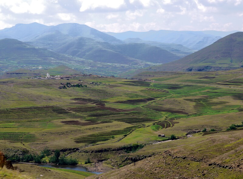
Terraced agriculture is an expression of land management and economics oriented towards a symbiotic (289) relationship with nature. If terraces are maintained, soil erosion does not occur; rather, the soil formation balance is positive, as under natural forest cover. Terraced agriculture is a component of traditional land management found almost worldwide, but it is declining almost everywhere, and the terraces fall into disrepair when traditional forms of land management are abandoned and the terraces are no longer maintained.
In particular, traditional farming methods and terraced agriculture were displaced by the colonial expansion of plantation economies, which predominantly used slave labor, and are being further displaced today by the expansion of agro-industrial farming practices on large farms that cultivate vast areas and transform agricultural landscapes into uniform and sterile monocultures. Both plantation economies and today’s agro-industrial farming methods are geared towards short-term yield maximization without striving for long-term sustainable land use.
The consequence is the destruction of the soil through soil erosion (290) and soil degradation (291). Approximately 24 million tons of soil are lost annually as a result of these destructive land management methods, so that the amount of arable land worldwide is constantly decreasing, while at the same time the world’s population continues to grow rapidly. Another consequence of these destructive land management methods is the displacement of people from rural areas, who now find themselves in the slums of the growing megacities with 10 to 50 million inhabitants. In these megacities, which have the character and function of expulsion spaces and preservation asylums for the global surplus population, and which are characterized by a permanent state of ecological, social, and health emergency, more than half of the world’s population will be living in just a few decades.
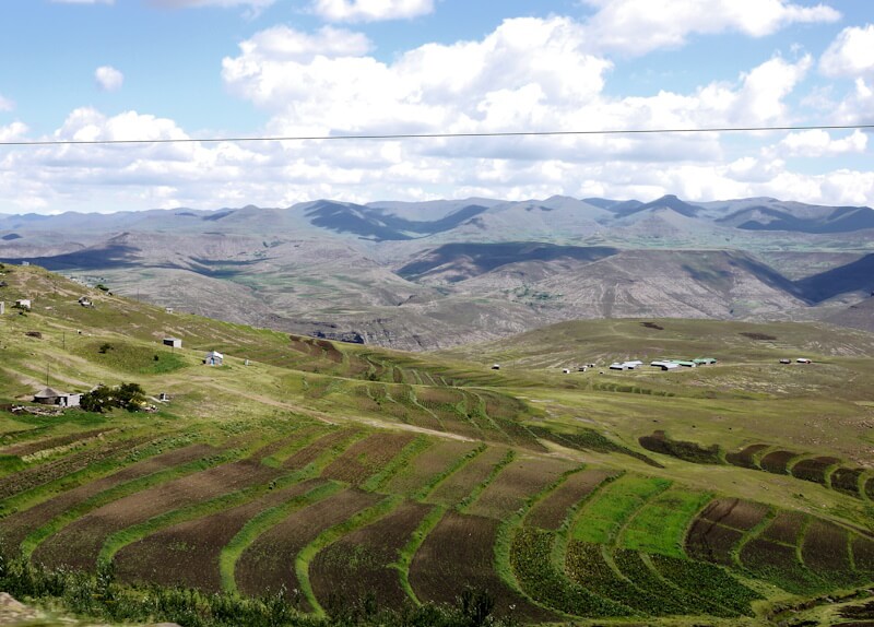
Small-scale subsistence farming in Lesotho contrasts sharply with the vast agro-industrial farms in the former Boer republics of the Orange Free State and the South African Republic (Transvaal), which I had previously traveled through. Such large-scale agro-industrial operations dominate most of the agricultural land in South Africa and Namibia. This points to significant differences in both the agrarian constitution and the agricultural history of rural areas between Lesotho on the one hand, and South Africa and Namibia on the other.
Southwest of Butha-Buthe, the high mountains begin, and the road climbs steeply. Several passes were crossed: the Moteng Pass (2820 m), the Tlaeeng Pass (3215 m), and the Kotisephola Pass (3240 m), before reaching the Sani Pass (2874 m) (292), which forms the border between Lesotho and South Africa. According to my guidebook, it is possible to climb Mount Thanana Ntlenyana (3482 m), the highest peak in southern Africa, from the Sani Pass (2874 m) on a day tour. Early in the morning of December 15, 2025, the temperature at the Sani Pass was +5 °C, the coldest temperature I recorded during my travel through southern Africa.
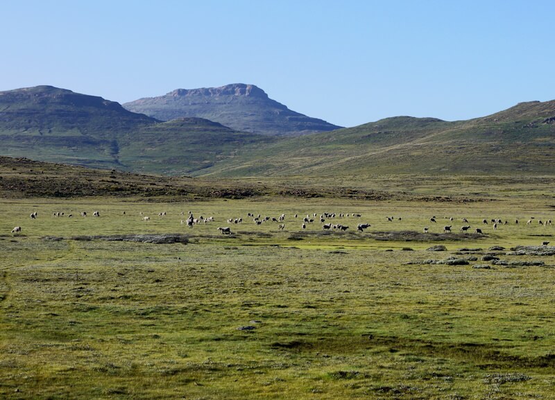
I am surprised that there is almost no forest in this highland region. The climatic treeline (293) should lie above these passes, which are at an altitude of around 3000 meters. I suspect that the entire highlands of Lesotho and the Drakensberg Mountains have been almost completely deforested for the purpose of expanding alpine pasture farming (294). This finding continues throughout the highlands southeast of the Drakensberg Mountains in the provinces of KwaZulu-Natal and the Eastern Cape. The entire highland area is predominantly used as pastureland. Erosion damage is evident, and the consequences of such large-scale deforestation are undoubtedly significant for both the region’s climate and its water balance. However, vegetation, climate, and soil are only considered and analyzed together by geographers; otherwise, reductionist perspectives prevail.
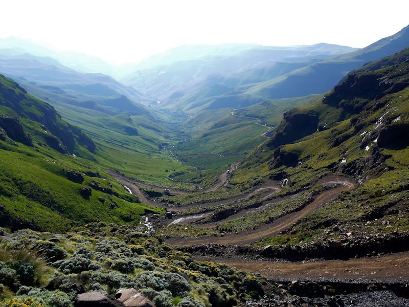
My journey through the Lesotho highlands on the “Roof of Africa Road” in minibuses ended just before the Sani Pass (2,874 m) in the Drakensberg Mountains. Here lies the border between Lesotho and South Africa. The paved road ends at the Lesotho border post located at the Sani Pass. On the morning of December 15, 2025, upon presenting my passport at the Lesotho border post, I was asked whether I wished to enter or exit. I chose to exit and received the corresponding exit stamp in my passport. Beyond the Lesotho border post, the terrain drops steeply to the southeast. A rocky gravel track, accessible only to off-road vehicles, winds its way down the steep slope on the southeastern edge of the Drakensberg Mountains. There is no public transportation here. Only at the foot of the mountains, several kilometers away, is the South African border post, from which a paved road resumes. In fact, there is no border line here (295), as is common in modern territorial states (296) since the early modern period, but rather a border area in the form of a no-man’s-land (terra nullius) (297). My route down to the South African border station led through a spectacular mountain landscape. From there, I hitchhiked to the next town, Underberg, from where buses resume service.
12. Along the coast of the Indian Ocean back to Cape Town
From the bus station in Underberg, I continued my journey by minibus through a green mountain landscape to the town of Pietermaritzburg. Pietermaritzburg had been the capital of the Boer Republic of Natalia (298), which was conquered and annexed by the British Empire in 1843. A well-maintained motorway leads from Pietermaritzburg to the port city of Durban (299). Near Durban, I reached the coast of the Indian Ocean, which I then followed for the remainder of my journey, with further stops in East London, Port Elizabeth, and Mossel Bay, before returning to Cape Town. The coastal stretch between Port Elizabeth and Cape Town, in particular, is known as the “Garden Route” and is popular with tourists.
With around four million inhabitants, Durban is now the third largest city in South Africa after Johannesburg and Cape Town, and like Johannesburg and Cape Town, Durban is growing rapidly. Durban has the largest port in Africa. During my city excursion on December 16, 2025, I visited, among other places, the historic city center near City Hall, the adjacent port area to the south, which is completely fenced off, and than the coast of the Indian Ocean to the east. The KwaMuhle Museum, which focuses on the era of racial segregation in South Africa and is therefore also known as the “Apartheid Museum”, and which I had planned to visit, was closed due to a public holiday.
On December 17, 2025, I travelled from Durban to the city of East London (300). The bus journey included two stops, one near Kokstad and the other near Umtata/Mthatha. The route led through a green, mountainous landscape on the edge of the Drakensberg Mountains, which receives abundant rainfall. This landscape is used for agriculture and forestry, and the original natural vegetation is almost entirely absent. There is pastureland for cattle, as well as arable farming. Extensive industrial timber plantations with monocultures of eucalyptus and pine planted in rows are also present. Areas with the original (potential) natural vegetation are completely absent from the route. Large parts of the mountainous landscape have been almost entirely deforested, particularly to expand grazing areas for alpine pasture farming, so that large sections are now characterized by extensive grasslands. These are often crisscrossed by erosion gullies (301), so that soil degradation and loss due to the large-scale deforestation pose a significant problem. Settlements, often scattered settlements in rural areas, increase from northeast to southwest in the mountainous landscape traversed.
During my city excursion to East London on December 18, 2025, I visited the East London Museum (302). This excellent museum is undoubtedly one of the best museums in southern Africa. Its extensive collections are divided into three sections: a natural history section, a cultural and settlement history section, and a maritime history section (303), which particularly fascinated and impressed me. The focus of this maritime history section is the exploration and establishment of the global seafaring and trade route between Europe and southern and southeastern Asia around Africa by Portuguese seafarers at the beginning of the early modern period. These voyages by Portuguese seafarers significantly broadened the knowledge and worldview of Europe at the transition from the Middle Ages to the early modern period, which had been considerably less extensive in the Middle Ages than in antiquity. Among the exhibits in the museum are several cannons from Portuguese ships that were found in the Indian Ocean near East London. This topic of the exploration and establishment of the global seafaring and trade route between Europe and southern and southeastern Asia around Africa by Portuguese seafarers at the beginning of the early modern period is covered in even greater detail at the Maritime Museum in Mossel Bay, which I visited later in my travel. Furthermore, the East London Museum has exhibition areas and exhibits that are unique and distinctive, such as an exhibition on coelacanths (304).
On December 19, 2025, I continued my journey to the port city of Port Elizabeth (Gqeberha) (305), passing through the town of Grahamstown. The drive took me through a landscape that was initially hilly, then became mountainous, and is now considerably drier and part of the Karoo region (306). The vegetation consists of low bushes and various succulents. Parts of this landscape are used as pastureland. During my city excursion in Port Elizabeth on December 20, 2024, I visited, among other places, the historic city center around Market Square and City Hall. I then intended to visit the museums of the “Bayworld Museum Complex” in the southeast of Port Elizabeth, but I discovered that the complex was closed and some of the buildings had been demolished.
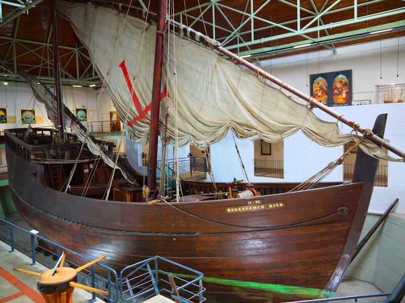
On December 21, 2025, I continued my journey to the town of Mossel Bay (307). At the beginning of the bus ride, we passed extensive shantytowns on the outskirts of Port Elizabeth. These settlements, known as townships, can cover several square kilometers and are common around many cities in South Africa and Namibia. This aspect of social reality in South Africa and Namibia is generally not noticed by tourists. The journey then continued through a coastal plain bordered to the north by mountains. The landscape became greener again, characterized by agriculture, primarily cattle grazing, with less arable farming, as well as industrial forestry with extensive pine monocultures. The weather here changed several times between dense cloud cover and cloudless sunshine, suggesting that each bay along the coast has its own distinct weather pattern, a phenomenon particularly pronounced on fjord coasts, such as those found in Scandinavia.
The city of Mossel Bay presents itself as a tourist center, and these tourists, mostly from South Africa, are almost exclusively of European origin. This contrasts sharply with the current situation in the centers of larger cities in South Africa and Namibia, where, unlike before 1990, people of European origin are almost entirely absent. The residents of European origin, whose share of the population is steadily declining, have withdrawn from the city centers to residential areas protected by elaborate security measures, such as walls and fences, including electric fences, as well as “neighborhood watch” and a ubiquitous security presence with concepts of “armed response”. Since the end of apartheid, approximately one million South Africans of European origin have left South Africa.
The highlight of my city excursion to Mossel Bay on December 22, 2025, was a visit to the Bartholomeu Dias Museum Complex. At the heart of this complex is the Maritime Museum, whose theme is maritime history, focusing on the exploration and establishment of the global sea route and trade route between Europe and South and Southeast Asia around Africa by Portuguese seafarers in the early modern period. The navigator Bartolomeu Dias (308) landed here in Mossel Bay in February 1488 to replenish his drinking water supplies while searching for a sea route from Europe to India (309). A replica of Dias’s caravel is located at the center of the Maritime Museum.
The causes, motivations, and historical context of the exploration and establishment of the global shipping and trade route between Europe and South and Southeast Asia around Africa have already been extensively discussed in Cape Town, a port city on the shipping route between Europe and India, and most recently at the excellent East London Museum. Undoubtedly, the Maritime Museum in Mossel Bay is one of the best and largest museums in the world dedicated to this subject.
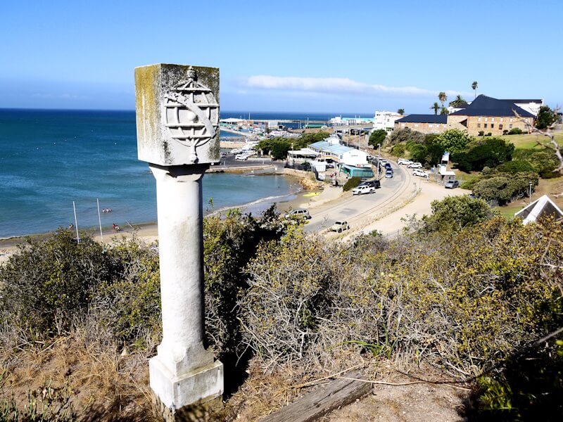
My subsequent second visit to the port metropolis of Cape Town, now at the end of my two-month tour through parts of southern Africa during the Christmas holidays at the end of December 2025, was shorter, lasting three days, than my first visit at the beginning of my travel.
On December 24, 2025, I visited the “Cape Town Holocaust Centre”, located east of the Company’s Garden, near the South African Museum and the South African National Gallery. Together with the South African Jewish Museum and the Great Synagogue, the Cape Town Holocaust Centre forms a complex of buildings surrounded by walls and fences. A paramilitary guard with a fully automatic rifle and a bulletproof vest stood on the street side of the complex, opposite the entrance. A security checkpoint, standard at airports since the events of September 11, 2001, must be passed through at the entrance. In recent years, I have visited numerous museums and memorial sites dealing with the National Socialist regime and the Holocaust. Here at the Cape Town Holocaust Centre, I am also interested in how the subject matter is addressed, how it is presented, and what the museum’s educational concept is. Most recently, I visited comparable institutions on the subject of the Holocaust on November 12, 2024, in the city of Vilnius, the Holocaust exhibition of the State Jewish Museum in the so-called “Green House”, and on September 29, 2022, the “Memorial de la Shoah” museum in Paris, which is considered the largest museum on the subject of the Holocaust in Europe (310).
The Cape Town Holocaust Centre’s exhibition begins with a presentation of its concept: “The Cape Town Holocaust Centre is dedicated to raising awareness of the consequences of racism, the dangers of indifference, and the evils of genocide. This exhibition tells the story of the Holocaust – an unprecedented and well-documented genocide. It remains a tragic warning for us all.” The Cape Town Holocaust Centre’s introductory themes are racism, antisemitism, and apartheid, before the main exhibition addresses National Socialist rule and the Holocaust. The question arises as to why the apartheid regime, as it existed in South Africa until 1990, is compared to the National Socialist regime, and not to the regime of racial segregation in the USA, as it existed until 1964. Both in terms of their historical origins and their structure, the regimes of racial segregation in South Africa and the USA share significant similarities, whereas they differ considerably from the National Socialist regime in many respects. The reason for this comparative selection is obviously the history politics (politics of memory) pursued in the USA in this regard (311), which is a component of identity politics (312).
Since the 1980s, the Holocaust has become a universally applicable subject of education in the USA under the term “Holocaust Education” (313). Within a few years, approximately 30 Holocaust museums were established in the USA, and similar institutions now exist in Argentina, Canada, Australia, and South Africa (314). In South Africa, there is another “Holocaust & Genocide Center” in Johannesburg. These developments have resulted in both a “globalization of Holocaust remembrance” and an “US-Americanization of the Holocaust” (315). The Holocaust has now become the epitome of mass crime and genocide worldwide. This “Holocaust education” focuses less on conveying facts, events, historical contexts, and background information, and less on presenting them within an elaborate museum education concept that avoids presenting the public with a pre-packaged view of history and, instead, aims to encourage and support the public in forming their own independent opinions on complex and complicated historical topics, in the spirit of enlightenment. Rather, this “Holocaust education” aims to generate emotions that can be instrumentalized for historical and identity politics.
Memorial sites are prominent locations for historical-political measures that serve the formation of national identity and the legitimization of one’s own state and its social order. History politics (politics of memory) aims to create imagined communities through unifying historical narratives, symbols, and practices. In the case of Holocaust memorials and museums, these serve to solidify Jewish identity (316). In 1990, a survey of the Jewish population in the United States revealed that civic engagement was declining, interfaith marriages were increasing, and Jewish identity was waning (317). Concerned about the future of their Jewish community, US-American Jews began developing numerous educational projects aimed at reconstructing, preserving, and strengthening Jewish identity. Holocaust remembrance is intended to unite the diverse diaspora identities of contemporary Jews by providing a platform where all identities can find expression (318). The Holocaust was incorporated into the project of constructing a Jewish identity, leading to the development of increasingly intensive Holocaust research. From then on, the Holocaust became a prominent subject of historical studies, particularly in the USA, Great Britain, Israel, Poland, and Germany.
Jews are not born, but are made, in particular, through identity politics. This raises the question of what makes a person “Jewish” (319). Unlike other religions, Jews understand themselves not only as a religious and faith community (320), but also as a nation (chosen by God). However, Jews are not born, but made, and this is a question of identity politics. In his book “Total Religion”, Egyptologist and religious scientist Jan Assmann explains the peculiarities of Jewish identity construction: “Jewish identity fluctuates between political, religious, and ethnic definitions. This is, as far as I can see, a rather unique case in human history. Ethnic identity is a question of ancestry (…), political identity is a question of association and dissociation, of joining and excluding, of group formation and demarcation from the outside, and religious identity is a question of cult and custom (…). What is special about the Jewish situation is the fusion of these three identity criteria. The symbolic figure of Abraham represents the fusion of religious and ethnic identity, the symbolic figure of Moses the fusion of religious and political identity. Through the Mosaic fusion, religion also becomes a question of association and dissociation. This gives rise to a religion of a completely new type, which then becomes the model for the new world religions. The characteristic feature of this new form of religion is its political character.” (321)
Most Jews today live in the USA (322) and in Israel, and their political lobby organizations (323), such as the American Israel Public Affairs Committee (AIPAC) (324), have a great influence on US politics, especially foreign policy, but also on other policy areas such as history politics (politics of mind).
Today, being Jewish is not an inescapable fate. Today, everyone can refuse and reject the assignment of a Jewish identity, by whomever, and freely shape their own identity and personality (325), for example, in reference to ideas of the Enlightenment (326). For representatives and lobbyists of a total and political religion, which is simultaneously a power-political project shaping society and the state, such as the Jewish religion, this freedom of people poses an central problem, and they seek ways to keep people in intellectual unfreedom, dependence, and immaturity, and to prevent enlightenment.
Based on a new way of thinking, the Enlightenment project, interrupted by the extreme 20th century, can be resumed and now re-established and further developed within a global framework of a peaceful world society. After the interruption caused by the extreme 20th century, a resumption and re-establishment of the Enlightenment project is called for, and a new, second, and now global Age of Enlightenment can be founded on a new and expanded foundation of knowledge and understanding (327). Just as in the Age of Enlightenment, the question today is: “How do we enlighten people so that they want to be enlightened? (328)”
On the two Christmas days I took part in two day tours offered daily by “City Sightseeing”, the “Cape Point & Penguins Tour”, a day tour which has the Cape of Good Hope (329) as its destination, and the day tour “Stellenbosch, Franschhoek & Paarl – 3 Regions Wine Tour”.
The “Cape Point & Penguins Tour” departed on December 25, 2025, at approximately 9:30 a.m. from the “City Sightseeing” bus stop at the tourist information center at 81 Long Street, using two fully occupied double-decker buses. The tour initially followed the route of the “Blue Mini Peninsula Tour”, which runs daily every 20 minutes and is operated by City Sightseeing buses. We passed the university campus and Kirstenbosch Botanic Gardens, which I had visited at the beginning of my travel on October 31, 2025, via this route. The tour then continued to the coast of False Bay near the locations Kalk Bay and Fish Hoek. The terrain on the Cape Peninsula is mountainous and covered with low, sparse shrub vegetation, a component of the “Fynbos” plant community, whose woody plants also form taller forest stands in Kirstenbosch Botanic Gardens.
This low-lying shrubland of the Cape Peninsula’s “fynbos” reminds me of the shrubland in the Mediterranean region, such as that found on the islands of Sardinia and Corsica, which I visited during my cycling travel to the central Mediterranean region in the summer of 2025. However, unlike in the Cape region of southern Africa, the shrubland in the Mediterranean region is a consequence of millennia of destruction and degeneration of the mixed deciduous forests that originally covered the Mediterranean region, and the associated destruction and degeneration of the soils throughout the entire Mediterranean region (330). The recent forms of degeneration of the original mixed deciduous forests are called “maquis” (331); and “garrigue” (332) is a more advanced stage of degeneration, the end stage of which is the bare rock of the karst landscape (333), which today particularly characterizes the once densely forested mountain regions of the Mediterranean region. The extensive deforestation of the entire Mediterranean region since early antiquity has led to a change in the Mediterranean climate, with summers in particular becoming hotter and drier. Today, the hot and dry summers in the Mediterranean region appear to us as a natural component of the Mediterranean climate zone of the Mediterranean subtropics (334), but in fact, they are the result of millennia of deforestation and environmental destruction, and thus a consequence of anthropogenic climate change. Both the current state of the vegetation and landscape, as well as the current climate of the Mediterranean region, appear to us as having always existed – a phenomenon based on ignorance and lack of knowledge, which the biologist Jared Diamond, in his book “Collapse: How Societies Choose to Fail or Succeed”, refers to as “landscape amnesia” (335).
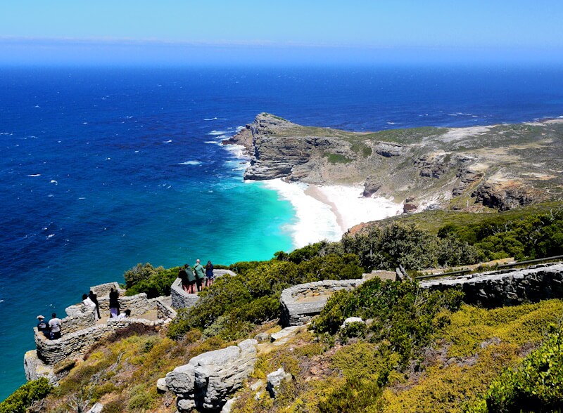
In the south of the Cape Peninsula, the road ends at a large parking lot. To the southeast, the terrain rises to the Old Lighthouse, built in 1860 at an altitude of 250 meters. The actual “Cape of Good Hope” lies southwest of here. A hiking trail leads up to the Old Lighthouse, offering panoramic views of the Cape landscape. A cable car also ascends to the Old Lighthouse. Afterward, we hiked with the tour guide of today’s tour along a trail to the “Cape of Good Hope”. We then met up with the buses northwest of the Cape, which had been driven there in the meantime, and continued the tour. The next stop was south of Simon’s Town near the location Boulders, home to a small colony of African penguins (Spheniscus demersus), a popular tourist attraction. Only a small portion of the once extensive population of these penguins remains today. The buses then returned to Cape Town.
On December 26, 2025, I participated in the “Stellenbosch, Franschhoek & Paarl – 3 Regions Wine Tour”, a day tour offered daily by “City Sightseeing”. My motivation for taking this tour was the opportunity to explore the historic town center of Stellenbosch (336), considered the second oldest town in South Africa, with a historic core featuring buildings dating from 1785 to 1820. The first stop on this tour was the small town of Paarl. Like the other places visited that day, it lies in the heart of a wine-growing region surrounded by high mountains. Wine has been cultivated here for over 400 years. However, Paarl itself is not a sightseeing destination; instead, there is a wine tasting at a winery in the surrounding area. During the tour, there are two further wine tastings, which take up a significant portion of the time from today’s tour.
Therefore, the next town, Franschhoek, will only be passed through. Franchhoek means “corner of the French”, and the settlement of the area dates back to 1688, when Huguenots (337) who had fled religious persecution in France settled here. Winegrowing came to southern Africa with the Huguenots. In Franschhoek, there is a Huguenot Monument and a Huguenot Memorial Museum.
The city tour of Stellenbosch’s historic city center, founded in 1679, is brief, lasting only half an hour. Numerous historic buildings in the Cape Dutch style (338) have been preserved in this relatively small town and characterize its cityscape. Stellenbosch is an important university town.
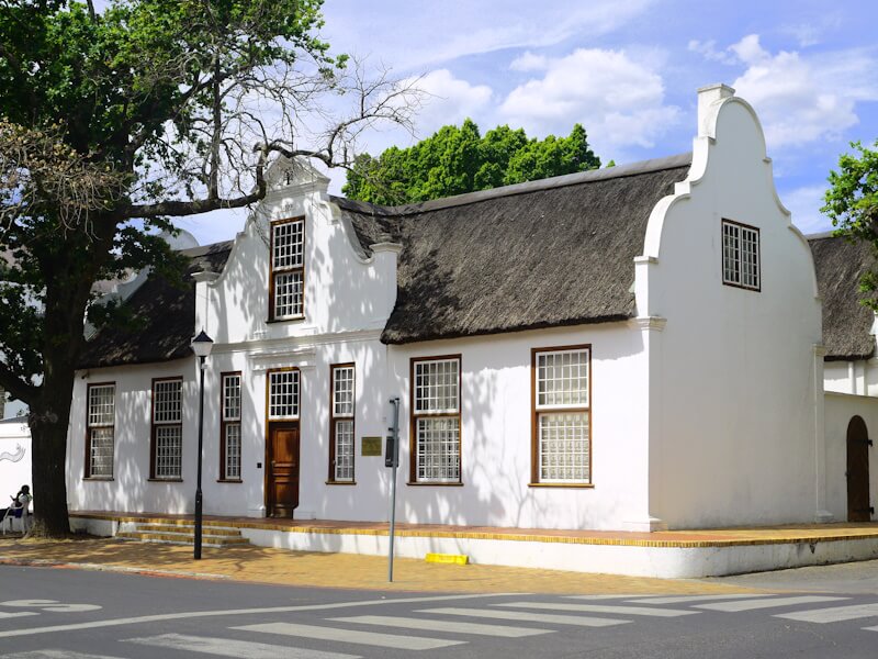
On the morning of December 27, 2025, I departed from Cape Town International Airport (CPT) for my return flight to Berlin, with a layover in Paris. The airport terminal offers various shops as well as other amenities such as a smoking room and a prayer corner with carpets. The flight distance to Paris is approximately 10,000 kilometers, and the flight time is about 10 hours. During the flight, the airplane reached an altitude of over 13,000 meters with an outside temperature of -58°C and a flight speed of over 900 km/h. The flight initially followed the course of the southwest coast of Africa, which I could track on a monitor, and I tried to locate the landscape the airplane was flying over on my map. Since my connecting flight from Paris to Berlin was delayed at short notice, I had to spend the night of December 27 to 28, 2025, in the terminal building at “Charles de Gaulle” Airport (CDG) near Paris. The landscape outside the terminal was shrouded in high fog, with a temperature of +4°C. On the afternoon of December 28, 2025, when I arrived at Berlin-Brandenburg Airport (BER) after a flight of almost two hours, the weather was clear and the temperature was +1 °C.
13. Notes:
1) Confer (Cf.): https://en.wikipedia.org/wiki/Southern_Africa
Cf. also: https://en.wikipedia.org/wiki/Africa
2) Cf.: https://en.wikipedia.org/wiki/Region
3) Cf.: https://en.wikipedia.org/wiki/Cognitive_categorization
Cf. also: https://en.wikipedia.org/wiki/Theory_of_categories
Categories are open conceptual systems for structuring the experiential
Cf.: https://en.wikipedia.org/wiki/Experience
world.
Cf.: https://en.wikipedia.org/wiki/World
Every act of categorization is a necessary reduction
Cf.: https://en.wikipedia.org/wiki/Reductionism
of the infinite complexity and interdependence of reality (Wirklichkeit)
Cf.: https://de.wikipedia.org/wiki/Wirklichkeit
There is no article on the English Wikipedia for the term “Wirklichkeit”.
The terms “Wirklichkeit” and “Reality” (Realität) are not synonym.
of the world, which, in its perception,
Cf.: https://en.wikipedia.org/wiki/Perception
is ultimately infinite and cannot be fully grasped by the human senses and the human mind
Cf.: https://en.wikipedia.org/wiki/Mind
in order to comprehend (begreifen) it.
Cf.: https://en.wikipedia.org/wiki/Concept
Category formation is a foundation of every scientific discipline, and the question arises as to what constitutes the scientific nature of scientific category formation: Every scientific category formation in every scientific discipline must be based on significant,
Cf.: https://en.wikipedia.org/wiki/Statistical_significance
comprehensible and convincingly justified criteria.
4) Cf.: https://de.wikipedia.org/wiki/Klassifizierung
5) Cf.: https://de.wikipedia.org/wiki/Geographischer_Raum
6) Cf.: https://de.wikipedia.org/wiki/Wirklichkeit
There is no article on the English Wikipedia for the term “Wirklichkeit”.
The terms “Wirklichkeit” and “Reality” (Realität) are not synonym.
7) Cf.: https://en.wikipedia.org/wiki/World
Cf. also: https://de.wikipedia.org/wiki/Weltbild
There is no article on the English Wikipedia for the term “worldview” (Weltbild).
8) Because reality is four-dimensional, with the present being a snapshot of a temporal-historical process, the spatial-geographical and temporal-historical dimensions must be combined and considered together. This distinguishes a dynamic worldview from a static one.
New insights from the geosciences and life sciences in recent decades have led to a paradigm shift and a new, dynamic understanding of global geological processes, amounting to a scientific revolution. As a result, the previous static worldview has been replaced by a dynamic one. The modern geodynamically grounded evolutionary-ecological worldview is a recent product of a synthesis of interdisciplinary scientific findings from the past few decades, to which geoscientists and life scientists have made particularly significant contributions. Confer chapters 4, 5, 6 and 7 of my text “Challenges of the Digital Technological Revolution”, which can be accessed and read on my website (only germen version available):
https://manfred-suchan.jimdosite.com/technologiepolitik
9) Cf.: https://de.wikipedia.org/wiki/Erkenntnisinteresse
There is no article on the English Wikipedia for the term “Erkenntnisinteresse”.
Cf. also: https://en.wikipedia.org/wiki/Knowledge_and_Human_Interests
10) Cf.: https://de.wikipedia.org/wiki/Vergleich_(Philosophie)
The method of comparison replaces the experimental method in the natural sciences, both in geography and history, as well as in other humanities and social sciences. In geography, the method of comparison was introduced and applied particularly by Alexander von Humboldt (1769-1859).
Cf.: https://en.wikipedia.org/wiki/Alexander_von_Humboldt
11) During my travels through parts of southern Africa, I used the following guidebooks, which proved to be informative and useful:
Philip Briggs, Ariadne Van Zandbergen: Südafrika, Lesotho und Eswatini. Ostfildern (DuMont Reiseverlag), 7. Edition 2025 (Stefan Loose Travel Handbücher).
Christine Philipp: Südafrika. Markgröningen (Reise Know-How Verlag), 9. Edition 2014.
Daniela Schetar, Friedrich Köthe: Namibia. Markgröningen (Reise Know-How Verlag), 12. Edition 2024.
Livia Pack, Peter Pack: Namibia. Ostfildern (DuMont Reiseverlag), 8. Edition 2018 (Stefan Loose Travel Handbücher).
Christoph Lübbert: Botswana mit Okawango-Delta. Markgröningen (Reise Know-How Verlag), 7. Edition 2019/20.
Regrettably, I must note that the various travel guide publishers, who a few decades ago produced guides for travelers who wanted to travel differently from the mainstream of mass tourism and the tourism industry, especially backpackers, have now largely adapted their guides to the mainstream of mass tourism and the tourism industry and are increasingly catering to a different target audience, obviously with the aim of increasing their editions. The tourism industry is part of consumer culture, and it markets distractions, diversions, and superficial pleasures. Younger travelers, in particular, are increasingly foregoing guidebooks altogether and traveling exclusively with the information they receive via their smartphones.
12) Cf.: https://de.wikipedia.org/wiki/Herodot
During my travels, I seek out the original geographical sites of historical events and also visit museums and memorials there in order to conduct historical research at these original locations. This method dates back to Herodotus of Halicarnassus (c. 490–425 BC), who used it to study the Persian Wars.
Cf.: https://en.wikipedia.org/wiki/Greco-Persian_Wars
What fascinates me about the historian and geographer Herodotus of Halicarnassus is that he bases his historical research, such as on the Persian Wars, on a broad, self-acquired foundation of knowledge encompassing nearly all the knowledge of his era across diverse academic disciplines, including geography, ethnology, social sciences, political science, philosophy, and many others. This allows him to practice history as an integrative science. Furthermore, he traveled to the original sites of historical events, interviewed eyewitnesses, and analyzed written sources.
Also the historian Thucydides (c. 460–400 BC)
Cf.: https://en.wikipedia.org/wiki/Thucydides
applied such a methodology in his historical research on the Peloponnesian War
Cf.: https://en.wikipedia.org/wiki/Peloponnesian_War
and, in his view, history makes one “wise forever,” because it teaches, using the past as an example, rules of political prudence for the present and future.
In this form, historical consciousness
Cf.: https://en.wikipedia.org/wiki/Historical_consciousness
gains a vast experiential space of historical depth and geographical breadth, and it transcends the narrow boundaries within which history is alive as tradition.
13) Cf.: https://en.wikipedia.org/wiki/Portuguese_discovery_of_the_sea_route_to_India
Cf. as well as: https://de.wikipedia.org/wiki/Indienhandel
There is no article on the English Wikipedia for the term “Indienhandel”.
Cf. further: https://en.wikipedia.org/wiki/Indo-Roman_trade_relations
Cf. also: https://en.wikipedia.org/wiki/Maritime_history
14) Cf.: https://en.wikipedia.org/wiki/History_of_Africa
Cf. also: https://en.wikipedia.org/wiki/European_exploration_of_Africa
15) Cf.: https://en.wikipedia.org/wiki/History_of_Egypt
Cf. as well as: https://en.wikipedia.org/wiki/Ancient_Egypt
16) Cf.: https://en.wikipedia.org/wiki/Nubia#History
17) Cf.: https://en.wikipedia.org/wiki/History_of_Ethiopia
18) Cf.: https://en.wikipedia.org/wiki/Early_Muslim_conquests#Conquest_of_Egypt:_639-642
Cf. as well as: https://en.wikipedia.org/wiki/Arab_conquest_of_Egypt#Invasion_of_Nubia
19) Cf.: https://en.wikipedia.org/wiki/Backpacking_(travel)
20) Cf.: https://en.wikipedia.org/wiki/Adventure_travel#Overland_travel
21) Cf.: https://en.wikipedia.org/wiki/Adventure_travel
22) Cf.: https://en.wikipedia.org/wiki/Hippie_trail
Cf. also: https://en.wikipedia.org/wiki/Overlanding#Hippie_Trail
23) Cf.: https://en.wikipedia.org/wiki/Lived_experience
Cf. also: https://de.wikipedia.org/wiki/Erlebnispädagogik
“Erlebnispädagogik” and “outdoor education” are obviously not the same thing:
Cf. https://en.wikipedia.org/wiki/Outdoor_education
24) Cf.: https://en.wikipedia.org/wiki/Experience
25) Cf.: https://de.wikipedia.org/wiki/Erkenntnis
There is no article on the English Wikipedia for the term “Erkenntnis”.
Cf. as well as: https://en.wikipedia.org/wiki/Epistemology
Cf. also: https://de.wikipedia.org/wiki/Erkenntnis_für_freie_Menschen
There is no article on the English Wikipedia for the term “Erkenntnis für freie Menschen”.
26) Cf.: https://en.wikipedia.org/wiki/Age_of_Enlightenment
27) Cf.: Hans Magnus Enzensberger: Eine Theorie des Tourismus. In: Derselbe: Einzelheiten I. Bewußtseins-Industrie. 1962, Frankfurt am Main. P. 179-205.
28) Cf.: https://de.wikipedia.org/wiki/Reisefreiheit
There is no article on the English Wikipedia for the term “Reisefreiheit”.
29) Cf.: https://de.wikipedia.org/wiki/Völkerverständigung
There is no article on the English Wikipedia for the term “Völkerverständigung”.
30) Cf.: https://en.wikipedia.org/wiki/Consumerism
31) Cf.: https://en.wikipedia.org/wiki/Bologna_Process
With the technocratic Bologna reforms, the entire education and science sector across Europe became a homogenized appendage of the economic process within the European Greater Economic Area (Großwirtschaftsraum), which is managed by the European Union. This technocratic Bologna reform is by far the most prominent example of the regulatory and homogenization zeal that drives the technocrats of the European Union.
Cf.: https://en.wikipedia.org/wiki/Technocracy
The technocratic Bologna reform was implemented without any protests.
Cf. https://en.wikipedia.org/wiki/Student_protest
Thus, the EU has developed into a technocratic empire
Cf.: https://de.wikipedia.org/wiki/Weltreich
There is no article on the English Wikipedia for the term “Weltreich”.
in which innovative and forward-looking concepts, as well as participation and democracy, are lacking. Innovative and forward-looking concepts, as well as participation and democracy, are no longer relevant topics in EU-Europe today, because the EU now wants to present itself as an effective, efficient, capable of intervention and assertive global actor in the context of the expected future geopolitical
Cf.: https://en.wikipedia.org/wiki/Geopolitics
crises and conflicts in the world system in order to be able to compete geopolitically with other worldpowers, and these new crises and conflicts in the world system have already begun, as we must determine in several ways. In the course of the redistribution of global spheres of interest and influence that has been taking place since 1989/90, the EU is expanding further and further as an imperial actor, the nation-state
Cf.: https://en.wikipedia.org/wiki/Nation_state
continues to be considered the ideal to be strived for in politics, and less and less consideration is given to minority rights
Cf.: https://en.wikipedia.org/wiki/Minority_rights
and human rights.
32) Cf.: Hans Magnus Enzensberger: Bewußseins-Industrie. In: Derselbe: Einzelheiten I. Bewußtseins-Industrie. 1962, Frankfurt am Main. P. 7-17.
Hans-Magnus Enzensberger (1929-2022)
Cf.: https://en.wikipedia.org/wiki/Hans_Magnus_Enzensberger
demonstrates, that in advanced industrial society, the progressive industrialization of consciousness is carried out by the “Bewußtseins-Industrie“ (consciousness industry). In advanced industrial society, more and more areas of society are subjected to economic calculation, instrumental-rationally adjusted, and according to technical rationality and “instrumental reason” (Max Horkheimer) standardized and industrialized.
Cf.: https://de.wikipedia.org/wiki/Instrumentelle_Vernunft
There is no article on the English Wikipedia for the term “Instrumentelle Vernunft” (instrumental reason).
Cf. as well as: Max Horkheimer: Zur Kritik der instrumentellen Vernunft. 1974, Frankfurt am Main.
“Instrumental reason” and its critique form the key analytical category of the “Critical Theory” of the “Frankfurt School” founded by the social philosopher Max Horkheimer (1895-1973), which provides a synthesis of social and cultural critique based on interdisciplinary analyses in the humanities and social sciences.
Cf.: https://en.wikipedia.org/wiki/Max_Horkheimer#Eclipse_of_Reason
Cf. also: https://en.wikipedia.org/wiki/Eclipse_of_Reason_(Horkheimer)
The critique of instrumental reason is a critique of the domination of nature, whereby the domination of nature finds its continuation in the domination of the inner and outer nature of the human beings, the domination of individuals, and the domination of society; this nexus of violence forms a transhistorical continuum.
According to Hans Magnus Enzensberger, the societal goal of the consciousness industry is the same everywhere: “to perpetuate existing power relations, of whatever kind they are. It is intended only to induce consciousness in order to exploit it”, and it begins with “the elimination of alternatives (…). That this state of affairs is accepted and voluntarily endured by the majority is today the most important achievement of the consciousness industry”. Thus, the consciousness industry is the key industry of the 21st century. With the technocratic Bologna reforms, the consciousness industry reaches its full potential, as it seizes control of its core element: the entire education sector, which is virtually brought into line and homogenized (gleichgeschaltet).
33) Cf.: https://en.wikipedia.org/wiki/Bicycle_touring
Cf. also: https://en.wikipedia.org/wiki/Touring_bicycle
The following cycling guides provide a good basis for planning cycling tours:
Herbert Lindenberg: Europa per Rad. Markgröningen, 8. Auflage 2022 (Reise Know-How Verlag).
Thomas Schröder, Helmut Hermann: Fahrrad Weltführer. Markgröningen, 4. Auflage 2016 (Reise Know-How Verlag).
Neil Pike, Harriet Pike: Adventure Cycle-Touring Handbook. Worldwide Cycling Route & Planning Guide. Hindhead (Surrey), 3. Auflage 2015 (Trailblater Publications).
Cf. also: https://en.wikipedia.org/wiki/Adventure_travel
34) Cf.: https://www.instagram.com/clementgmn_/
35) Cf.: https://www.youtube.com/@vagabundodelmundo1973
36) Cf.: https://www.wiebkeluehmann.com/
Cf. as well as: https://www.instagram.com/wiebkelueh/
37) Cf.: Notes 326, 327 and 328.
38) The historian Eric J. E. Hobsbawm (1917-2012) distinguishes between a “long” 19th century
Cf.: https://en.wikipedia.org/wiki/19th_century
Cf. also: https://en.wikipedia.org/wiki/Long_nineteenth_century
Cf. to this also note 273.
and a “short” and “extreme” 20th century:
Cf.: https://en.wikipedia.org/wiki/20th_century
Cf. also: https://de.wikipedia.org/wiki/Kurzes_20._Jahrhundert
There is no article on the English Wikipedia for the term “Short Twentieth Century”.
Cf. furthermore: Eric Hobsbawm: Age of Extremes. The Short Twentieth Century 1914-1991. 1994, London.
Cf. also: https://en.wikipedia.org/wiki/The_Age_of_Extremes
Today, the entire modern age, and especially the industrial age, is suspected of culminating in the extreme 20th century.
The following are characteristic elements that define and shape the 20th century in its entire historical depth and geographical breadth as an “extreme” century with a unique defining feature:
1. Ethnic cleansing.
Cf.: https://en.wikipedia.org/wiki/Ethnic_cleansing
2. The total institution
Cf. https://en.wikipedia.org/wiki/Total_institution
of the camp as the total institution for the instrumental management of masses of people in their various forms.
Cf. https://en.wikipedia.org/wiki/Camp
Cf. also: https://en.wikipedia.org/wiki/Internment
3. The state of emergency.
Cf.: https://de.wikipedia.org/wiki/Ausnahmezustand
A comprehensive world history of the state of emergency is still lacking.
4. The dual state.
Cf.: https://en.wikipedia.org/wiki/Dual_state_(model)
5. Total mobilization (Totale Mobilmachung).
Cf.: https://de.wikipedia.org/wiki/Die_totale_Mobilmachung
There is no article on the English Wikipedia for the term “Totale Mobilmachung”.
6. Total industrial warfare.
Cf. https://en.wikipedia.org/wiki/Industrial_warfare
Cf. also: https://en.wikipedia.org/wiki/Total_war
And others. As characteristic and defining elements, they possess the content of analytical categories, which must therefore be at the center of any analysis of the extreme 20th century.
39) Cf.: https://en.wikipedia.org/wiki/Cape_Town
40) Cf.: https://en.wikipedia.org/wiki/Dutch_East_India_Company
Cf. also: https://en.wikipedia.org/wiki/East_India_Company_(disambiguation)
Cf. further: https://en.wikipedia.org/wiki/Company’s_Garden
41) Cf.: https://en.wikipedia.org/wiki/Bastion_fort
Cf. also: https://en.wikipedia.org/wiki/Bastion
The architecture of the modern citadel is induced and determined in particular by the advent of cannons with great destructive power.
Cf.: https://en.wikipedia.org/wiki/Gunpowder_empires
42) Cf.: https://en.wikipedia.org/wiki/Portuguese_discovery_of_the_sea_route_to_India
43) Cf.: https://en.wikipedia.org/wiki/Global_city
44) Cf.: https://en.wikipedia.org/wiki/Constantinople
45) Cf.: https://en.wikipedia.org/wiki/Fall_of_Constantinople
These events of 1453 are the subject of a large diorama in the megacity of Istanbul called “Panorama 1453”, which I visited on September 4, 2023, during my cycling travel through southeastern Europe in the summer and autumn of that year 2023. In this diorama, Muhammad (570-632),
Cf.: https://en.wikipedia.org/wiki/Muhammad
the founder of Islam, is quoted, as having conceived and proclaimed the plan to conquer the world city of Constantinople: “Constantinople will definitely be conquered one day. What a great commander is the one who conquers it, what a great army it is”.
Undoubtedly, Muhammad knew that world city Constantinople, protected by the Theodosian Walls since 413, was the most important western terminus of the transcontinental Eurasian Silk Road trade, whose riches had to be seized and controlled for the purpose of further expanding his power. Moreover, Constantinople, protected by the Theodosian Walls, had served as a bulwark towards the East in Europe for many centuries during Late Antiquity and the Middle Ages, until the decline of the Byzantine Empire. Its successful conquest would thus enable the Arab armies led by Muhammad and his successors to subsequently conquer and forcibly Islamize all of (Christian) Europe, as had occurred in other conquered territories. This included the imposition of the state model associated with Islam – Oriental despotism – and the societal model associated with Islam – slave society – and the legal system associated with Islam – Sharia.
The conquest of the metropolis of Constantinople in 1453 demonstrates that historical events and developments can be traced back to intentions and plans that originated many centuries earlier. This example also shows that nothing in history happens by chance, but rather that everything that happens, and how it happens, is also intended.
Cf. also: https://en.wikipedia.org/wiki/List_of_sieges_of_Constantinople
46) Cf.: https://en.wikipedia.org/wiki/Silk_Road
Cf. also: Helmut Uhlig: Die Seidenstraße. Antike Weltkultur zwischen China und Rom. 1986, Bergisch Gladbach.
Cf. as well as: https://de.wikipedia.org/wiki/Helmut_Uhlig_(Autor)#Asien
There is no article on the English Wikipedia about Helmut Uhlig.
The transcontinental Eurasian long-distance trade route of the Silk Road not only transported and spread goods and merchandise, but also ideas, philosophies and religions. In particular, via the Silk Road in Central Asia
Cf.: https://en.wikipedia.org/wiki/History_of_Central_Asia#Ancient_era
and especially in the regions of Bactria
Cf.: https://en.wikipedia.org/wiki/Bactria#Alexander_the_Great
Cf. also: https://en.wikipedia.org/wiki/Seleucid_Empire
Cf. as well as: https://en.wikipedia.org/wiki/Greco-Bactrian_Kingdom
and Gandhara
Cf.: https://en.wikipedia.org/wiki/Gandhara
Cf. also: https://en.wikipedia.org/wiki/Indo-Greek_Kingdom
a syncretistic
Cf.: https://en.wikipedia.org/wiki/Syncretism
cultural exchange took place between Hellenism
Cf.: https://en.wikipedia.org/wiki/Hellenistic_period
Cf. also: https://en.wikipedia.org/wiki/Macedonia_(ancient_kingdom)#Alexander’s_Empire
Cf. as well as: https://en.wikipedia.org/wiki/Hellenization
and Buddhism
Cf.: https://en.wikipedia.org/wiki/Buddhism
Cf. as well as: https://en.wikipedia.org/wiki/History_of_Buddhism
in the form of Greco-Buddhism.
Cf.: https://en.wikipedia.org/wiki/Greco-Buddhism
Cf. also: https://en.wikipedia.org/wiki/Gandharan_Buddhism
From there, Buddhism spread to China, Korea, and Japan, among other places.
Cf.: https://en.wikipedia.org/wiki/Silk_Road_transmission_of_Buddhism
The philosopher Karl Jaspers (1883-1969)
Cf.: https://en.wikipedia.org/wiki/Karl_Jaspers
in his book “The Origin and Goal of History” (1949) calls this period of human history the “Axial Age”.
Cf.: https://en.wikipedia.org/wiki/Axial_Age
47) Cf.: https://en.wikipedia.org/wiki/Byzantine_Empire
Tolerating the settlement of the Turks in the Anatolian highlands proved fatal for the Byzantine Empire. The Turks began plundering the caravans of the Silk Road, whose most important western terminus was the metropolis of Constantinople, and the states they founded – the Sultanate of Rum
Vgl.: https://en.wikipedia.org/wiki/Sultanate_of_Rum
and its successor, the Ottoman Empire – successively conquered all the cities and territories of the Byzantine Empire until the Ottoman Empire had ultimately completely occupied and replaced the Byzantine Empire. The cultural-historical process of Hellenization
Cf.: https://en.wikipedia.org/wiki/Hellenization
Cf. also: https://en.wikipedia.org/wiki/Hellenistic_period#Hellenistic_culture
was then superseded by a counter-process of Turkification, which continues to this day.
Vgl.: https://en.wikipedia.org/wiki/Turkification
48) Cf.: https://en.wikipedia.org/wiki/Ottoman_Empire
49) Cf.: https://en.wikipedia.org/wiki/Gunpowder_empires
50) Cf.: https://en.wikipedia.org/wiki/Sack_of_Constantinople
Cf. also: https://en.wikipedia.org/wiki/List_of_sieges_of_Constantinople
51) Cf.: https://en.wikipedia.org/wiki/Republic_of_Venice
Cf. also: https://en.wikipedia.org/wiki/Maritime_republics
52) Cf.: https://en.wikipedia.org/wiki/Walls_of_Constantinople
In my opinion, the most impressive sight in the modern megacity of Istanbul, which I visited during my cycling travel through southeastern Europe in 2023, are the colossal Theodosian Walls, the largest medieval city walls in Europe. They were built to prevent a similar tragedy in Constantinople/Byzantium following the sack of Rome by the Goths in 410 AD. However, the sack of Constantinople itself occurred in 1204 AD during the Fourth Crusade, with the Maritime Republic of Venice playing a particularly decisive role. This sack of Constantinople in 1204 AD, along with the establishment of the Latin Empire, initiated the decline of the Byzantine Empire, a decline that culminated in the conquest of Constantinople by the expanding military empire of the Ottoman Empire, a so-called “Gunpowder Empire”, in 1453. These events of the year 1453 are in Istanbul the subject of a large diorama there called “Panorama 1453”.
The destruction of the Theodosian Walls and the conquest of Constantinople that it made possible in 1453 was achieved unexpectedly and to the surprise of the defenders with the help of a large number of the world’s largest cannons at the time, which had been specially made for this purpose of destroying the Theodosian Walls.
The conquest of the metropolis of Constantinople in 1453 is considered a milestone marking the transition from the Middle Ages to the modern era, and its consequences were far-reaching. In this context, I would like to highlight two aspects: a) the decline of cities and b) the shifting of global trade routes and centers of trade.
a) For nearly 1000 years, spanning Late Antiquity and the entire Middle Ages, the Theodosian Walls, the largest city walls in Europe during this period, effectively protected the metropolis of Constantinople. They served as a well-known example for other cities in Europe, which also fortified themselves with city walls, thereby maintaining a high degree of political independence and autonomy.
Cf.: https://de.wikipedia.org/wiki/Freie_Stadt
There is no article on the English Wikipedia for the term “Freie Stadt”.
Cf. also: https://en.wikipedia.org/wiki/Free_imperial_city
Consequently, the most significant socio-political divide in the Middle Ages existed between the mostly republican constituted cities and the autocratically ruled feudal area states. However, particularly due to the development of cannons with their increasingly destructive power, city walls offered less and less protection by the end of the Middle Ages.
Sultan Mehmet II (Mehmet the Conqueror) (1432-1481)
Cf. https://en.wikipedia.org/wiki/Mehmed_II
made the conquest of Constantinople his life’s work, meticulously preparing for it over many years with great effort. Among other things, he commissioned the production of a large number of the world’s largest cannons for the destruction of the Theodosian Walls. Their use unexpectedly and to the defenders’ surprise, the walls were indeed destroyed, and the city was captured. The destruction of the Theodosian Walls by these then-largest cannons was a far-reaching signal, as it made it unmistakably clear throughout Europe that traditional medieval city walls no longer offered any protection.
As a consequence, new fortress concepts were developed in the Early Modern period, particularly that of the citadel, and a new science of fortification emerged. Compared to the walls and castles of the Middle Ages, however, these new fortresses of the Early Modern period were more elaborate and costly, so that the princes in the Age of Absolutism strove to increase their revenues through mercantilist economic policies, a component of which was the establishment of long-distance trading companies. Cannon construction and fortress construction were interdependent: the development of cannons with ever more destructive power led to the construction of increasingly elaborate fortifications. The development of the destructive power of cannons later reached a (provisional) climax in the First World War, the first total industrial war and the primordial catastrophe of the 20th century, in which they, as weapons of mass destruction, caused 70% of all war deaths.
b) The conquest of Constantinople in 1453 largely disrupted the long-distance trade connections between Europe and Asia that had existed since antiquity. These connections ran through the Mediterranean and Black Seas and were linked to transcontinental trade routes in Asia, particularly the Silk Road. This disruption of transcontinental trade connections in Eurasia spurred the search for alternative maritime trade routes to South and Southeast Asia via the Atlantic and Indian Oceans around Africa, leading, among other things, to the discovery of the Americas. Trade across the Mediterranean declined in importance, as did the previously dominant long-distance trade centers in the Mediterranean region, such as Venice and Genoa. These were replaced by new long-distance trade centers in the southern North Sea region, such as Amsterdam, Antwerp, and London, where long-distance trade was conducted through trading companies endowed with extensive privileges and powers, including the right to conquer and quasi-state-govern overseas colonies. Prominent examples of these trading companies are the British East India Company (EIC), the Dutch East India Company (VOC), and the French East India Company.
53) Cf.: https://en.wikipedia.org/wiki/Political_geography
54) Cf.: https://en.wikipedia.org/wiki/World_history_(field)
55) Cf.: https://en.wikipedia.org/wiki/Huns
Cf. also: https://en.wikipedia.org/wiki/Migration_Period
56) Cf.: https://en.wikipedia.org/wiki/Western_Roman_Empire
57) Cf.: https://en.wikipedia.org/wiki/Early_Muslim_conquests
58) Cf.: https://en.wikipedia.org/wiki/Siege_of_Constantinople_(674-678)
59) Cf.: https://en.wikipedia.org/wiki/Siege_of_Constantinople_(717-718)
60) Cf.: https://en.wikipedia.org/wiki/Mongol_Empire
61) Mongol expansion in Europe was not halted, as the events at Wahlstatt/Legnica Pole on April 9, 1241, demonstrate.
Cf.: https://en.wikipedia.org/wiki/Battle_of_Legnica
These events of April 9, 1241, are the subject of the Museum of the Battle of Legnica,
Cf.: https://de.wikipedia.org/wiki/Museum_zur_Schlacht_bei_Liegnitz
There is no article on the English Wikipedia for the term “Museum zur Schlacht bei Liegnitz”.
which I visited on August 28, 2021. The museum’s richly detailed exhibition, entitled “Clash of Two Worlds”, explores the historical context and background of this event.
The question arises as to why the Mongols ended their successful expansion in Europe, which they might have been able to completely conquer after the events of April 9, 1241. Historians in Vietnam attribute the end of the Mongol expansion, during which the Mongols also conquered China in 1279, to their defeats in 1257/1258, 1284, and 1287/1288 in their attempts to conquer Vietnam and Champa. These Mongol defeats in Vietnam contributed significantly to the end of the Mongol expansion in Europe. This view of the historical events surrounding the Mongol expansion was conveyed both by the History Museum in Hanoi during my visit on March 14, 2017, and by the History Museum in Saigon/Ho Chi Minh City during my visit on April 2, 2017.
62) Cf.: https://en.wikipedia.org/wiki/Conscription#Military_slavery
Cf.: https://en.wikipedia.org/wiki/Mamluk
Cf. as well as: https://en.wikipedia.org/wiki/Janissary
Cf. also: https://en.wikipedia.org/wiki/Devshirme
63) Cf.: https://en.wikipedia.org/wiki/Ottoman_wars_in_Europe
Cf. as well as: https://en.wikipedia.org/wiki/Siege_of_Vienna_(1529)
Cf. also: https://en.wikipedia.org/wiki/Battle_of_Vienna
64) Cf.: https://en.wikipedia.org/wiki/Fourth_Crusade
65) Cf.: https://en.wikipedia.org/wiki/Latin_Empire
Cf. also: https://en.wikipedia.org/wiki/Reconquest_of_Constantinople
66) Cf.: https://en.wikipedia.org/wiki/Marco_Polo#The_Travels_of_Marco_Polo
Cf. also: https://en.wikipedia.org/wiki/The_Travels_of_Marco_Polo
67) Cf.: https://en.wikipedia.org/wiki/Kingdom_of_Portugal
68) Cf.: https://en.wikipedia.org/wiki/Portuguese_Empire
Cf. as well as: https://en.wikipedia.org/wiki/Portuguese_India_Armadas
69) Cf.: https://camissamuseum.co.za/
70) Cf.: https://en.wikipedia.org/wiki/Slave_Lodge,_Cape_Town
Cf. also: https://en.wikipedia.org/wiki/Slavery_in_South_Africa
71) Cf.: https://en.wikipedia.org/wiki/History_of_slavery
Cf. as well as: https://en.wikipedia.org/wiki/Slavery
72) Within the context of human history, the process of domestication
Cf.: https://en.wikipedia.org/wiki/Domestication
is a very recent phenomenon, and it is linked to the Neolithic Revolution.
Cf.: https://en.wikipedia.org/wiki/Neolithic_Revolution
The process of domestication encompassed not only animals and plants, but entire landscapes and ecosystems were domesticated and transformed. Humans themselves were also affected and changed by the process of domestication.
In his book, “Against the Grain. A Deep History of the Earliest States”, political scientist and anthropologist James C. Scott demonstrates the extent to which humankind itself was affected and transformed by the process of domestication. As with domesticated animals, the process of domestication led to both anatomical and behavioral changes in humans, including a novel herding behavior that enabled the emergence of mass societies and life within them. Furthermore, numerous novel diseases arose that were previously unknown in human history. Human reproductive behavior changed, resulting in significantly increased fertility rates that more than compensated for the increased mortality rate caused by the numerous newly emerging diseases and led to population growth. The newly formed states promoted this population growth for reasons of power politics, aiming to increase the number of workers, slaves, taxpayers, and soldiers subject to the power elites of the early states.
Cf.: James c. Scott: “Against the Grain. A Deep History of the Earliest States”. 2017, New Haven, London.
73) Cf.: https://en.wikipedia.org/wiki/History_of_slavery_in_the_Muslim_world
Cf. also: https://en.wikipedia.org/wiki/Islamic_views_on_slavery
As a result of the so-called “Islamic expansion”
Cf.: https://en.wikipedia.org/wiki/Early_Muslim_conquests
arose Islamic empires
Cf.: https://en.wikipedia.org/wiki/Caliphate
Cf. also: https://en.wikipedia.org/wiki/Ottoman_Empire#Government
Cf. further:https://en.wikipedia.org/wiki/Government_of_the_classical_Ottoman_Empire
Cf. furthermore: https://en.wikipedia.org/wiki/Mughal_Empire#History
These Islamic empires arose through military conquest and expansion. Initially, they possessed no territories, cities, or populations of their own, which they first subjugated through military conquest. The militarily subjugated populations, who practiced different cultures, religions, and languages, were re-educated and acculturated in a process that often took a long time – a process that continues to this day, even after the end of these Islamic empires.
These Islamic empires were oriental despotisms
Cf.: https://en.wikipedia.org/wiki/Oriental_despotism
slave-owning societies
Cf.: https://en.wikipedia.org/wiki/History_of_slavery_in_the_Muslim_world
Cf. also: https://en.wikipedia.org/wiki/Islamic_views_on_slavery
Cf. furthermore: https://en.wikipedia.org/wiki/Slavery_in_the_Ottoman_Empire
and military empires. The entire state apparatus and the military were based on the principle of slavery. As tribute, a portion of the children of the conquered and subjugated populations, predominantly Christians, were demanded and conscripted – the so-called “devshirme”.
Cf.: https://en.wikipedia.org/wiki/Devshirme
These abducted children were forcibly converted to Islam, indoctrinated, conditioned and raised to be loyal servants of the ruler. They were then employed in the state apparatus, where they administered the population subservient to the ruler, and in the military apparatus, which was based on slave armies. These military slaves were called Mamluks
Vgl.: https://en.wikipedia.org/wiki/Mamluk
and also Janissaries.
Cf.: https://en.wikipedia.org/wiki/Janissary
While Christianity, which arose in the eastern Mediterranean region, and which arose like Buddhism through a syncretistic cultural exchange with Hellenism, and which initially functioned as a social revolutionary movement in the Roman Empire before becoming the state religion, overcoming and abolishing the slavery of antiquity within its sphere of influence, Islam represents a radical counter-movement. Based on its foundation as a religion of conquerors and rulers, the slavery of antiquity is expanded and made into the fundamental principle of state power and its expansion. Thus, the slavery of antiquity is intensified, geographically expanded, and perpetuated and transmitted through the Middle Ages into the modern era.
74) Cf.: https://en.wikipedia.org/wiki/List_of_chartered_companies
Cf. also: https://en.wikipedia.org/wiki/East_India_Company_(disambiguation)
Cf. as well as: https://en.wikipedia.org/wiki/West_India_Company
75) Cf.: https://en.wikipedia.org/wiki/Mercantilism
76) Cf.: https://en.wikipedia.org/wiki/Absolutism_(European_history)
77) Cf.: https://en.wikipedia.org/wiki/East_India_Company
78) Cf.: https://en.wikipedia.org/wiki/Louis_XIV‘s_East_India_Company
79) Cf.: https://en.wikipedia.org/wiki/Atlantic_slave_trade
Cf. also: https://en.wikipedia.org/wiki/Slavery_in_Africa
The African explorer David Livingstone, among others, describes where and how the slaves came from and arrived at the slave markets:
Cf.: https://en.wikipedia.org/wiki/David_Livingstone
In 1871, Livingstone witnessed Arab slave traders, along with approximately 1,500 other people, charging into the marketplace of Njangwe. They had previously surrounded the village. Many locals were abducted by the Arabs, 400 people died, and 27 villages were burned down. Livingstone was outraged and broke with the Arabs.
For every person deported in the slave trade, an additional three to four people must be considered to have died during slave raids, in epidemics, through castration, and so on.
80) Cf.: https://en.wikipedia.org/wiki/Plantation_economy
Cf. also: https://en.wikipedia.org/wiki/Plantation
Cf. as well as: https://en.wikipedia.org/wiki/Slave_plantation
Plantation economies and their distinctive agricultural history
Cf.: https://de.wikipedia.org/wiki/Agrargeschichte
There is no article on the English Wikipedia for the term “Agrargeschichte”.
and agricultural constitution
Cf.: https://de.wikipedia.org/wiki/Agrarverfassung
There is no article on the English Wikipedia for the term “Agrarverfassung”.
continue to shape rural areas in large parts of countries outside Europe. In the modern era, plantation economies and their monocultures became the model for the worldwide mechanization and industrialization of agriculture, with slaves being replaced by machines. In the Soviet Union, the industrialization and collectivization of agriculture followed the model of the agricultural industry in the USA, which itself emerged from plantation economies, and was conceived by agricultural engineers from the USA.
Cf. for this: Florian Hurtig: Sowjetische Simplifizierung als Kopie des amerikanischen Modells. In: Derselbe: Paradise lost. Vom Ende der Vielfalt und dem Siegeszug der Monokulturen. 2020, München. P. 284-291.
The consequence was that agriculture and the peasantry in the Soviet Union were transformed into an “internal colony” which enabled the forced industrialization and modernization of the Soviet Union. This brutally pursued industrialization made the Soviet Union a world power, and at the same time, it underwent extensive military rearmament. Stalin’s “Great Terror” proved to be an integral part of the terror of the modern industrial age.
Cf. to this notes 119 and 120.
81) Cf.: https://en.wikipedia.org/wiki/Abolitionism
82) Cf.: https://en.wikipedia.org/wiki/Port-Louis,_Morbihan
83) Cf.: https://en.wikipedia.org/wiki/Standing_army
84) Cf.: https://en.wikipedia.org/wiki/Territorial_state
85) Cf.: https://en.wikipedia.org/wiki/Louis_XIV
86) Cf.: https://en.wikipedia.org/wiki/Sébastien_Le_Prestre,_Marquis_of_Vauban
87) Cf.: https://en.wikipedia.org/wiki/Fortifications_of_Vauban
88) Cf.: https://en.wikipedia.org/wiki/Territorial_state#Personenverbandsstaat
89) Cf.: https://de.wikipedia.org/wiki/Freie_Stadt
There is no article on the English Wikipedia for the term “Freie Stadt”.
As well as: https://en.wikipedia.org/wiki/Free_imperial_city
90) Cf.: https://en.wikipedia.org/wiki/Robben_Island
Cf. also: https://en.wikipedia.org/wiki/Robben_Island_(prison)
91) Cf.: https://en.wikipedia.org/wiki/Apartheid
92) Cf. Note 38.
93) Cf.: https://en.wikipedia.org/wiki/Total_institution
The term “total institution” was coined in particular by the sociologist Erving Goffman (1922-1982), who lists characteristics of total institutions in his study: “Asylums. Essays on the Social Situation of Mental Patients and Other Inmates”.
Cf.: Erving Goffmann: Über die Merkmale totaler Institutionen. In: Derselbe: Asyle. Über die soziale Situation psychiatrischer Patienten und anderer Insassen. Frankfurt am Main, 1972. P. 13-23.
Examples of total institutions include: prisons, camps in their various forms, barracks as well as conscription, factories, hospitals, and schools. Total institutions create a space of inclusion and exclusion and are characterized in particular by the “special power relations” (Besondere Gewaltverhältnisse) prevailing within them, which aim at extralegality and special treatment (Sonderbehandlung).
The “prerogative state” (Maßnahmenstaat) according to Ernst Fraenkel can be seen as a radicalized form of total institutions and the “special power relations” (Besondere Gewaltverhältnisse) prevailing in them, which aim at extralegality and special treatment (Sonderbehandlung).
Cf.: Ernst Fraenkel: The Dual State. A Contribution to the Theory of Dictatorship. 1941, New York.
Cf. also: https://en.wikipedia.org/wiki/The_Dual_State
Cf. as well as: https://en.wikipedia.org/wiki/Dual_state_(model)
In this analysis of the rule in the National Socialist state, first published at the turn of the year 1940/1941, the political scientist and jurist Ernst Fraenkel (1898-1975)
Cf.: https://en.wikipedia.org/wiki/Ernst_Fraenkel_(political_scientist)
distinguishes between the continuing existence of the institutions of a legal “normative state”, whose actions are guided by laws, and the newly created institutions of an extralegal “prerogative state” as an instrument of arbitrary power enfolding and unbridled violence cxecution. Historical examples of institutions of the “prerogative state” include, in particular, the NS concentration camps, as well as the SS, the Gestapo, the SD, the RSHA, “Action T4”, and the Einsatzgruppen of the Security Police and the SD. The “prerogative state” can be seen as a radicalized form of “total institutions” and the “special power relations” (Besondere Gewaltverhältnisse) prevailing within them, which aim at extralegality and special treatment (Sonderbehandlung).
In their various forms, total institutions are ubiquitous, accepted and tolerated as a self-evident foundation of society and as an integral part of societal and state power. Within the framework of the totalitarian concept of society and the state, the functional principle of total institutions is transferred and applied to potentially all areas of society. An end to the age of the totalitarian and totalitarianism is therefore impossible without overcoming and abolishing the concept of total institutions, for they are the sources from which the idea of the totalitarian and totalitarianism and the practice of totalitarianism can continually spread throughout society and shape people accordingly. The abolition of total institutions means nothing less than drawing consequences from the extremes of the 20th century and subjecting its foundations to revision.
94) Cf.: https://en.wikipedia.org/wiki/Prison
95) The total institution of the camp in its various forms is the total institution for the instrumental management, surveillance, control and conditioning of masses of people; it is an invention of the modern age, and it is an instrument of industrial society.
Cf.: https://en.wikipedia.org/wiki/Camp
Cf. also: https://en.wikipedia.org/wiki/Internment
The internment camp originated in the colonies, where it was used as an instrument of repression. During the First World War, the previously discredited internment camps of the colonies were used in Europe for the first time. With the First World War, the application of colonial methods of oppression began in Europe itself, and Europeans now became the object of colonial methods of oppression. “The First World War was an important laboratory for what was to come”, explains the historian Karl Schlögel in his text „Bugwelle des Krieges“: “Here, the methods and practices of total war were tested on a large scale for the first time. (…) Here, practices were perfected that had previously been tested on the periphery of imperialism, in the colonies – from concentration camps to border demarcation with a razor to the casual routine of mass execution; racism, as Hannah Arendt had shown, migrated from the periphery back to the motherland.”
See: Karl Schlögel: Bugwelle des Krieges. S. 185-186. In: Stefan Aust, Stephan Burgdorff (Hg.): Die Flucht. Über die Vertreibung der Deutschen aus dem Osten. 2003, Bonn. P. 194-195.
The total institution of the camp, as a modern form of terrorist coercion against large groups of people, permeates and shapes the history of the 20th century, and it is one of the essential and characteristic elements that make the 20th century an extreme one. The total institution of the camp emerged on the eve of the 20th century, and its trajectory is not yet over. It provides an example of how “modernity, precisely in its normality, is the foster father of the excesses of this century”, as the social scientist Gerhard Armanski analyzes in his book, “Machines of Terror: The Camp (Concentration Camp and Gulag) in Modernity”.
See: Gerhard Armanski: Maschinen des Terrors. Das Lager (KZ und GULAG) in der Moderne. Münster, 1993. P. 18.
96) Cf.: https://en.wikipedia.org/wiki/Penal_colony
The penal colony can be seen as the origin and prototype of the concentration camp as a component of the “prerogative state”, such as the NS concentration camps. The Guantanamo Bay detention camp can be cited as a recent example of such a concentration camp as a component of the “prerogative state”.
Cf.: https://en.wikipedia.org/wiki/Guantanamo_Bay_detention_camp
97) Cf.: https://en.wikipedia.org/wiki/Panopticon
Cf. also: https://en.wikipedia.org/wiki/Prison#Development_of_the_modern_prison
98) Cf.: https://en.wikipedia.org/wiki/Prison_abolition
99) Cf.: https://en.wikipedia.org/wiki/Iziko_South_African_Museum
Cf. as well as: https://www.iziko.org.za/museums/south-african-museum/
100) Cf.: https://en.wikipedia.org/wiki/Rock_art
101) Cf.: https://en.wikipedia.org/wiki/San_peoples
102) Cf.: https://en.wikipedia.org/wiki/Material_culture
Cf. also: https://en.wikipedia.org/wiki/Non-material_culture
103) Cf.: https://en.wikipedia.org/wiki/Savanna
104) Cf.: https://en.wikipedia.org/wiki/Antarctic_Treaty_System
105) Cf.: https://en.wikipedia.org/wiki/Charles_Darwin
106) Cf.: https://en.wikipedia.org/wiki/Second_voyage_of_HMS_Beagle
107) Cf.: https://en.wikipedia.org/wiki/Kirstenbosch_National_Botanical_Garden
108) Cf.: https://en.wikipedia.org/wiki/Fynbos
109) Cf.: https://en.wikipedia.org/wiki/Cape_Floristic_Region
110) Cf.: https://en.wikipedia.org/wiki/Phytochorion
111) Cf.: https://en.wikipedia.org/wiki/Introduced_species
112) Cf.: https://en.wikipedia.org/wiki/Table_Mountain
113) Cf.: https://de.wikipedia.org/wiki/Agrarverfassung
There is no article on the English Wikipedia for the term “Agrarverfassung”.
114) Cf.: https://de.wikipedia.org/wiki/Agrargeschichte
There is no article on the English Wikipedia for the term “Agrargeschichte”.
Cf. also: https://en.wikipedia.org/wiki/History_of_agriculture
115) Cf.: https://en.wikipedia.org/wiki/Rural_area
116) Cf. note 80.
117) Cf.: https://en.wikipedia.org/wiki/Monoculture
Cf. also: https://en.wikipedia.org/wiki/Extractivism
118) Cf.: https://en.wikipedia.org/wiki/Settler_colonialism
119) Cf.: https://en.wikipedia.org/wiki/Industrialization_in_the_Soviet_Union
Cf. also notes 80 and 120.
120) Cf.: https://en.wikipedia.org/wiki/Collectivization_in_the_Soviet_Union
Cf. also notes 80 and 119.
In the course of the Soviet Union’s industrialization, as part of the First Five-Year Plan
Cf.: https://en.wikipedia.org/wiki/First_five-year_plan_(Soviet_Union)
during forced collectivization, from 1929 to 1933 the so-called “dekulakization”
Cf.: https://en.wikipedia.org/wiki/Dekulakization
Cf.: https://en.wikipedia.org/wiki/Nazino_tragedy
was carried out. This resulted in a severe famine.
Cf.: https://en.wikipedia.org/wiki/Soviet_famine_of_1930-1933
This “dekulakization” continued with the so-called “Kulak Operation” of the NKVD,
Cf.: https://en.wikipedia.org/wiki/NKVD
which was carried out on the basis of NKVD Order No. 00447 of July 30, 1937.
Cf.: https://en.wikipedia.org/wiki/NKVD_Order_No._00447
The German-language article is more detailed:
Cf.: https://de.wikipedia.org/wiki/NKWD-Befehl_Nr._00447
From August 1937 to November 1938, between 800,000 and 820,000 people were arrested, of whom at least 350,000 – possibly up to 445,000 – were shot; the remainder were sent to Gulag penal camps.
Cf.: https://en.wikipedia.org/wiki/Gulag
The oppression of the peasantry and their exploitation as an “internal colony” enabled the Soviet Union’s rapid industrialization and modernization. This brutal industrialization transformed the Soviet Union into a world power, and it was accompanied by extensive military buildup. In the modernization terror, Stalin’s “Great Terror” proves to be part of the terror of the age of industrial modernity.
121) Cf.: https://en.wikipedia.org/wiki/Extinction#Modern_extinctions
Cf. as well as: https://en.wikipedia.org/wiki/Extinction_event#Sixth_mass_extinction
Cf. also: https://en.wikipedia.org/wiki/Biodiversity_loss
122) Cf.: https://en.wikipedia.org/wiki/Anthropocene
123) Cf.: https://en.wikipedia.org/wiki/Wadi
124) Cf.: https://en.wikipedia.org/wiki/Desert
Cf. also: https://en.wikipedia.org/wiki/Semi-arid_climate
125) Cf.: https://de.wikipedia.org/wiki/Trockensavanne
There is no article on the English Wikipedia for the term “Trockensavanne” (Dry savanna).
Cf. instead: https://en.wikipedia.org/wiki/Savanna
126) Cf.: https://en.wikipedia.org/wiki/Namibia
127) Cf.: https://en.wikipedia.org/wiki/Lüderitz
128) Cf.: https://en.wikipedia.org/wiki/Windhoek
129) Cf.: https://en.wikipedia.org/wiki/Henley_Passport_Index
130) Cf.: https://en.wikipedia.org/wiki/Berlin_Conference
131) Cf.: https://en.wikipedia.org/wiki/Protectorate
132) Cf.: https://en.wikipedia.org/wiki/German_Empire
133) Cf.: https://en.wikipedia.org/wiki/German_South_West_Africa
134) Cf.: https://en.wikipedia.org/wiki/Turnhalle_Constitutional_Conference
135) Cf.: https://en.wikipedia.org/wiki/Gibeon_(meteorite)
136) Cf.: https://en.wikipedia.org/wiki/Independence_Memorial_Museum_(Namibia)
137) Cf.: https://en.wikipedia.org/wiki/Nation-building
Cf. also: https://en.wikipedia.org/wiki/Nationalism
The idea of the nation and the nation-state is the most powerful idea ever to have originated in Europe, and today it is the only viable and alternativless option worldwide. The idea of nationalism, which originated in Europe, has spread across the globe in several major waves. The idea of the nation and the nation-state first spread on a larger scale beyond its European origins during the first wave of decolonization in the 19th century, particularly following the dissolution of the Spanish colonial empire in Central and South America. It then spread to Eastern Europe after the First World War, and after the Second World War, during the second wave of decolonization in Asia and Africa, the idea of the nation and the nation-state achieved its current global reach and unquestionable alternativless implementation.
Cf.: https://en.wikipedia.org/wiki/Decolonization
Cf. as well as: https://en.wikipedia.org/wiki/Decolonisation_of_Africa
In his book, “Nationalism: History, Forms, Consequences”, historian Hans-Ulrich Wehler poses the question: “Why did nationalism become such an attractive export commodity, even though the recipient countries had completely different socio-cultural and political conditions?” He elaborates: “These anti-colonial emancipation movements were a resounding success (…) after the Second World War, when massive US pressure to dissolve all Western colonial empires, combined with the explosive impact of militant intra-colonial guerrilla and liberation movements, ushered in the era of global decolonization. This was accompanied by a new wave of transfer nationalism. All these colonial territories, hastily released into a precarious state of autonomy, wanted to emulate the model of the Western nation-state. While the peace treaties after the First World War had declared it the norm for the entire European world of states, it was now elevated to a globally binding political entity for a considerable period.”
See: Hans-Ulrich Wehler: Nationalismus. Geschichte, Formen, Folgen. 2001, München. P. 15. and p. 93.
The so-called “national liberation movements” were the actors who helped the idea of the nation and the nation-state achieve its worldwide and, today, inescapable and alternativless imposition. Today, the idea of the nation is alternativless; the nation-state is regarded as the quasi-natural and alternativless organizational form of human society, and everywhere people are compelled to organize themselves according to the model of the nation and the concept of the nation-state.
Cf. to this my text: “Modern Nationalism as a Political Religion – On the Construction of the Nation in the Age of Modern Nationalism”, which can be accessed and read on my website (only in German language available):
https://manfred-suchan.jimdosite.com/geschichtspolitik
In my view, from a global historical perspective, decolonization, as it actually occurred, has failed because it was the vehicle for imposing the idea of the nation and the concept of order based on the nation-state worldwide and without alternative.
138) Cf.: https://en.wikipedia.org/wiki/League_of_Nations
139) Cf.: https://en.wikipedia.org/wiki/Union_of_South_Africa
140) Cf.: https://en.wikipedia.org/wiki/SWAPO
141) Cf.: https://de.wikipedia.org/wiki/Geschichtsbild
There is no article on the English Wikipedia for the term “Geschichtsbild”.
142) Cf.: https://en.wikipedia.org/wiki/Herero_people
143) Cf.: https://en.wikipedia.org/wiki/Nama_people
144) Cf.: https://en.wikipedia.org/wiki/Genocide
The debates surrounding the term “genocide” are mostly highly politically motivated. This is particularly evident in the case of the so-called “genocide of the Herero and Nama”:
Cf.: https://de.wikipedia.org/wiki/Völkermord_an_den_Herero_und_Nama
Obvious the apparent goal of the history politics (politics of memory)
Cf.: https://en.wikipedia.org/wiki/Politics_of_memory
is to elevate these historical events to the “seminal catastrophe” of the “extreme” 20th century, in order to allow this development to culminate in the Holocaust.
Cf. notes 311 to 328.
In this way, an imagined transhistorical collective subject, “the Germans”, can be held collectively responsible for the “extremes” of the “extreme” 20th century.
Until now, the First World War has for good reasons been considered the “primordial catastrophe” of the (“extreme”) 20th century, and the question arises as to how it could have happened. This question is addressed in particular in chapters 7, 9, and 10 of my present travelogue.
A comprehensive scientific account of the displacement, expulsion, and partial extermination of the San in southern Africa is lacking. Today, the San live only in small, remote parts of southern Africa, and their traditional culture and way of life have almost completely disappeared. Even today, the San in southern Africa continue to face discrimination and marginalization. Cf. note 178.
145) Cf.: Hans Hilpisch: „Wo sind die Herero geblieben?“ Neue Erkenntnisse und Theorien zum Rückzug der Herero in die Omaheke 1904/1905. 2. Überarbeitete und erweiterte Auflage 2021, Windhoek.
Cf. also: Hans Hilpisch: Die Kolonialkriege in Deutsch-Südwestafrika (1904-1908). Daten, Fakten und eine kritische Auseinandersetzung mit den widersprüchlichen Forschungsergebnissen der letzten Jahrzehnte. 4. Auflage 1922, Windhoek.
146) Cf.: https://en.wikipedia.org/wiki/Atrocities_in_the_Congo_Free_State
147) Cf.: https://en.wikipedia.org/wiki/Congo_Free_State
148) Cf.: https://en.wikipedia.org/wiki/Leopold_II_of_Belgium
149) Cf.: https://en.wikipedia.org/wiki/Brussels_Geographic_Conference
Cf. also: https://en.wikipedia.org/wiki/International_African_Association
150) Cf.: https://en.wikipedia.org/wiki/Imperialism#Age_of_Imperialism
151) Cf.: https://en.wikipedia.org/wiki/Geopolitics
152) Cf.: https://en.wikipedia.org/wiki/Scramble_for_Africa
153) Cf.: https://en.wikipedia.org/wiki/Royal_Museum_for_Central_Africa
154) Cf.: https://en.wikipedia.org/wiki/Brussels_International_Exposition_(1897)#Colonial_exhibit
Cf. also: https://en.wikipedia.org/wiki/World‘s_fair
World’s Fairs, as international technical and commercial showcases in the age of industrial modernity, also include colonial exhibitions, which were likewise conceived as showcases in the age of industrial modernity, such as the Colonial Exhibition in Berlin in 1896, the Colonial Exhibition in Brussels in 1897, the Colonial Exhibition in Paris in 1931, the Colonial Exhibition in Brussels in 1958, and others.
Cf.: https://en.wikipedia.org/wiki/Colonial_exhibition
155) Cf.: https://en.wikipedia.org/wiki/Palace_of_Justice,_Brussels
156) Cf.: https://en.wikipedia.org/wiki/Natural_rubber
Cf. also: https://en.wikipedia.org/wiki/Atrocities_in_the_Congo_Free_State#Red_rubber_system_and_the_Force_Publique
Cf. as well as: https://en.wikipedia.org/wiki/Abir_Congo_Company
157) Cf.: https://en.wikipedia.org/wiki/Putumayo_genocide
Cf. also: https://en.wikipedia.org/wiki/Amazon_rubber_cycle#Effects_on_indigenous_population
The genocide in Putamayo, perpetrated during the rubber boom that began in the Amazon region around 1850 and by the “Peruvian Amazon Rubber Company” led by Julio César Arena del Águila (Cf. note 154), is the subject of the Ethnological Museum in the city of Leticia, located at the tripoint of Colombia, Peru, and Brazil on the Amazon River with the towns of Leticia (Colombia), Santa Rosa (Peru), and Tabatinga (Brazil). I visited this museum on April 7, 2016, during my riverboat cruise through the Amazon region from March 26 to April 21, 2016, traveling on the Amazon from Yurimaguras via Iquitos, Santa Rosa/Leticia/Tabatinga, to Manaus, and then continuing on the Rio Madeira to Porto Velho. This riverboat cruise through the Amazon region took place as part of my first South America travel (December 9, 2015 to June 3, 2016). During my second South America travel in the spring of 2020, which should to be a follow-up travel to my first South America travel, the so-called “Corona crisis” occurred unexpectedly and surprisingly. I report on my experiences and insights from both South America travels against the backdrop of the “Corona crisis” in my travelogue “Impressions in Times of the ‘Corona Crisis’ – A Travelogue from South America”. This travelogue can be accessed and read on my website (only in German language available):
https://manfred-suchan.jimdosite.com
https://manfred-suchan-reisen.jimdosite.com/reisefreiheit
158) Cf.: https://en.wikipedia.org/wiki/Julio_César_Arana
159) The oppression of the peasants and their exploitation as an “internal colony” enabled the forced industrialization and modernization of the Soviet Union.
Cf. Notes 80, 119 and 120.
160) Cf.: https://en.wikipedia.org/wiki/Succulent_plant
161) Cf.: https://en.wikipedia.org/wiki/Alexander_von_Humboldt
162) Cf.: https://en.wikipedia.org/wiki/Holism
163) Cf.: https://en.wikipedia.org/wiki/Reductionism
164) Cf.: https://en.wikipedia.org/wiki/Great_Escarpment,_Southern_Africa
165) Cf.: https://en.wikipedia.org/wiki/Namib
166) Cf.: https://en.wikipedia.org/wiki/Benguela_Current
167) Cf.: https://en.wikipedia.org/wiki/Swakopmund
168) Cf.: https://de.wikipedia.org/wiki/Swakopmund_Museum
There is no article on the English Wikipedia for the term “Swakopmund Museum”.
169) Cf.: https://en.wikipedia.org/wiki/Orange_River
170) Cf.: https://en.wikipedia.org/wiki/Etosha_National_Park
171) Cf.: https://en.wikipedia.org/wiki/Kalahari_Desert
172) Cf.: https://en.wikipedia.org/wiki/Deserts_and_xeric_shrublands
173) Cf.: https://en.wikipedia.org/wiki/Etosha_Pan
174) Cf.: https://en.wikipedia.org/wiki/Wilderness
175) Cf.: https://de.wikipedia.org/wiki/Instrumentelle_Vernunft
There is no article on the English Wikipedia for the term “Instrumentelle Vernunft” (instrumental reason).
Cf. as well as: Max Horkheimer: Zur Kritik der instrumentellen Vernunft. 1974, Frankfurt am Main.
“Instrumental reason” and its critique form the key analytical category of the “Critical Theory” of the “Frankfurt School” founded by the social philosopher Max Horkheimer (1895-1973), which provides a synthesis of social and cultural critique based on interdisciplinary analyses in the humanities and social sciences.
Cf.: https://en.wikipedia.org/wiki/Max_Horkheimer#Eclipse_of_Reason
Cf. also: https://en.wikipedia.org/wiki/Eclipse_of_Reason_(Horkheimer)
The critique of instrumental reason is a critique of the domination of nature, whereby the domination of nature finds its continuation in the domination of the inner and outer nature of the human beings, the domination of individuals, and the domination of society; this nexus of violence forms a transhistorical continuum.
176) Cf.: https://en.wikipedia.org/wiki/Hunter-gatherer
Cf. also: https://en.wikipedia.org/wiki/Indigenous_peoples
In settlement colonies, the settlers were inspired by a pious, pleasing to God and missionary zeal to conquer and subdue the “wilderness” and the “savages”. They viewed the land inhabited and used by indigenous hunter-gatherers as “no man’s land” (terra nullius)
Cf.: https://en.wikipedia.org/wiki/No_man’s_land
and considered the indigenous hunter-gatherers a land plague that had to be displaced and eliminated to make the land usable.
177) Cf.: https://en.wikipedia.org/wiki/Indigenous_peoples_of_the_Americas#North_America
Cf. also: https://en.wikipedia.org/wiki/Native_Americans_in_the_United_States
178) Cf.: https://en.wikipedia.org/wiki/San_peoples
The San (Bushmen) are considered the indigenous people of Africa. Traditionally, they live as hunter-gatherers. Particularly in modern times, they have been displaced, driven out, and in some cases systematically exterminated.
Cf.: https://en.wikipedia.org/wiki/San_peoples#Displacement,_marginalisation_and_genocide_during_European_colonisation
A comprehensive scientific account of the displacement, expulsion, and partial extermination of the San people is lacking. Today, the San live only in small, remote parts of southern Africa, and their traditional culture and way of life have almost completely disappeared. Even today, the San in southern Africa continue to face discrimination and marginalization.
179) Cf.: https://en.wikipedia.org/wiki/Freedom_to_roam
Cf. further: https://en.wikipedia.org/wiki/Common_land
The everyone’s right is an ancient customary right whose origins date back to the time before humans settled down during the Neolithic Revolution and the subsequent establishment of territorial rule over land and people. This ancient everyone’s right has been preserved most extensively in peripheral regions that were only recently touched and penetrated by territorial rule; and in some cases, this process is still incomplete today, so that the instrumental rational shaping of the landscape according to “instrumental reason” is often less advanced there. Relics of this ancient customary right of everyone’s right can be found in many places, for example, in the form of the everyone’s right in Scandinavia and most Baltic Sea states, including Russia, or in the form of the right of public access to the landscape (Landschaftsbetretungsrecht), which also exists in the Federal Republic of Germany.
Vgl.: https://de.wikipedia.org/wiki/Betretungsrecht_(Erholung,_Sport)
There is no article on the English Wikipedia for the term “Betretungsrecht”.
Unlike in Europe, in settlement colonies, such as the USA in particular, but also in South Africa and Namibia, a totalitarian intensified understanding of property rights and ownership could develop, unfold freely and occupy the entire landscape, because with the displacement and extermination of the pre-state societies there, who lived as hunter-gatherers – in North America the Indians (Native Americans) and in southern Africa the San (Bushmen) – a historyless and rightless space had emerged in which no traditions and relics, including the customary law of everyman’s right, were preserved and remained.
180) Cf.: https://en.wikipedia.org/wiki/American_Indian_Wars
Cf. also: https://en.wikipedia.org/wiki/Federal_Indian_Policy
The corresponding article on the German-language Wikipedia is more comprehensive:
Cf.: https://de.wikipedia.org/wiki/Indianerpolitik_der_Vereinigten_Staaten
Cf. as well as: https://en.wikipedia.org/wiki/Genocide_of_indigenous_peoples#Indigenous_peoples_of_the_Americas_(pre-1948)
181) Cf.: https://en.wikipedia.org/wiki/San_peoples#Displacement,_marginalisation_and_genocide_during_European_colonisation
Cf. also: https://en.wikipedia.org/wiki/Genocide_of_indigenous_peoples#South_Africa
182) What would need to be created is a human right to universal access to the landscape, based on the legal framework of a general customary right of the nature of a everyone’s right, such as existed before the Neolithic Revolution, and which can be derived from and justified by various legal sources. This issue is not merely a historical-anthropological one, nor merely a juridical one, but rather a question of practical philosophy:
The philosopher Immanuel Kant (1724-1804)
Cf.: https://en.wikipedia.org/wiki/Immanuel_Kant
postulates in the third definitive article of his essay “Perpetual Peace” (1795)
Cf.: https://en.wikipedia.org/wiki/Perpetual_Peace:_A_Philosophical_Sketch
an original state of common ownership of the Earth’s surface by all humankind. Because of the Earth’s spherical shape, humans cannot disperse indefinitely and must therefore tolerate one beside another. Originally, no one has a greater right to be in any one place on Earth than another. From this, he derives a universal right of freedom of movement, travel, and visitation as a component of cosmopolitan rights. Similarly, a human right to universal access to the landscape can be derived from this foundation. This right is linked to the status of rights of a general customary right, akin to a everyone’s right, as existed before the Neolithic Revolution.
This opens up a broad field of discussion: the question of land ownership as a limited, non-renewable resource, as the primary basis of life to which all people have an equal right. From this, a general fundamental right to subsistence can be derived, guaranteeing all people access to land to the extent necessary to provide for themselves through subsistence farming. Many of the social and ecological consequences and problems arising from historically established large landholdings and a lack of access to land, such as environmental destruction through irregular land acquisition and settlement activities, as well as the growth of irregular settlements on the outskirts of megacities, could be largely avoided. A general fundamental right to subsistence, guaranteeing all people access to land to the extent necessary to provide for themselves through subsistence farming, can be grounded in the human right to food:
Cf.: https://en.wikipedia.org/wiki/Right_to_food
Such a fundamental and human right to subsistence prevents people from being displaced from rural areas, where vast agro-industrial monocultures are expanding worldwide at the expense of the traditional subsistence farming of people in rural areas, and it prevents people from being pushed into the increasing and rapidly growing megacities, which have the character and function of expulsion spaces and preservation asylums for the global surplus population being displaced from rural areas.
183) Cf.: https://en.wikipedia.org/wiki/Animal_migration
184) Cf.: https://en.wikipedia.org/wiki/Serengeti
185) Cf.: Bernhard Grzimek, Michael Grzimek: Serengeti darf nicht sterben. 367.000 Tiere suchen einen Staat. 1959, Frankfurt am Main, Berlin, Wien.
Cf. as well as: https://en.wikipedia.org/wiki/Serengeti_Shall_Not_Die
186) Cf.: https://en.wikipedia.org/wiki/Deforestation
Cf. also: https://en.wikipedia.org/wiki/Deforestation_by_continent#Africa
187) Cf.: https://de.wikipedia.org/wiki/Entkusselung
There is no article on the English Wikipedia for the term “Entkusselung”.
Cf. insted: https://en.wikipedia.org/wiki/Savanna#Tree_clearing
188) Cf.: https://de.wikipedia.org/wiki/Renaturierung
There is no article on the English Wikipedia for the term “Renaturierung”.
Cf. insted: https://en.wikipedia.org/wiki/Land_restoration
189) Cf.: https://en.wikipedia.org/wiki/Rewilding
Cf. also: https://en.wikipedia.org/wiki/Rewilding_Europe
Cf. for this Chapter 8: “Rewilding Europe” of my text: “A Winter in the Scandinavian Mountains – Experiences on the Northern Periphery of Europe in the Winter of 2013/2014.” This text can be accessed and read on my website (only in German language available):
190) Cf.: https://en.wikipedia.org/wiki/Ecological_niche
191) Cf.: https://en.wikipedia.org/wiki/Ecosystem
Cf. also: https://en.wikipedia.org/wiki/Food_chain
192) Cf.: https://en.wikipedia.org/wiki/Biodiversity
193) Cf.: https://en.wikipedia.org/wiki/Biosphere
194) Cf.: https://en.wikipedia.org/wiki/Nature_conservation
195) Cf.: https://de.wikipedia.org/wiki/Prozessschutz
There is no article on the English Wikipedia for the term “Prozessschutz”.
196) Cf.: https://de.wikipedia.org/wiki/Landschaftsschutz
There is no article on the English Wikipedia for the term “Landschaftsschutz”.
197) Cf. for this Chapter 6: “The Colonization of the Amazon Region and the Destruction of the Rainforest” of my text: “Impressions in Times of the ‘Corona Crisis’ – A Travelogue from South America”. This text can be accessed and read on my website (only in German language available):
https://manfred-suchan.jimdosite.com
https://manfred-suchan-reisen.jimdosite.com/reisefreiheit
198) Cf.: https://de.wikipedia.org/wiki/Peace_Park
There is no article on the English Wikipedia for the term “Peace Parc”.
Cf. insted: https://en.wikipedia.org/wiki/Transboundary_protected_area
Cf. also: https://en.wikipedia.org/wiki/Peace_Parks_Foundation
199) Cf. for this Chapter 9: “Nature Conservation and Tourism as Components of Détente Policy” of my text: “A Winter in the Scandinavian Mountains – Experiences on the Northern Periphery of Europe in the Winter of 2013/2014”. This text can be accessed and read on my website (only in German language available):
200) Cf.: https://en.wikipedia.org/wiki/Caprivi_Strip
201) Cf.: https://en.wikipedia.org/wiki/Leo_von_Caprivi
The short term of office of Chancellor Caprivi encompassed not only the Heligoland-Zanzibar Treaty of 1890, but also, among other things, the non-renewal of the Reinsurance Treaty with the Russian Empire.
Cf.: https://en.wikipedia.org/wiki/Reinsurance_Treaty
The non-renewal of the Reinsurance Treaty 1890 was a key factor in the emergence of the First World War.
Cf. for this note 273.
202) Cf.: https://en.wikipedia.org/wiki/Heligoland-Zanzibar_Treaty
203) Cf.: https://en.wikipedia.org/wiki/Zambezi
204) Cf.: https://en.wikipedia.org/wiki/Cuando_River
205) Cf. for this Chapter 7: “The Biometric Passport or: The World as a Virtual Total Institution” in my text: “End of the ‘Corona Crisis’? – Current Travel Conditions in a Global Comparison”. This text can be accessed and read on my website (only in German language available):
If one infers the intentions behind the events from subsequent developments, the events of September 11, 2001, occurred precisely for the purpose of introducing and enforcing a global surveillance regime. Nothing in history happens by chance; everything that happens, and the way it happens, is also intended.
206) Cf.: https://en.wikipedia.org/wiki/Botswana
207) Cf.: https://en.wikipedia.org/wiki/Chobe_National_Park
208) Cf.: https://en.wikipedia.org/wiki/Bechuanaland_Protectorate
209) Cf.: https://en.wikipedia.org/wiki/British_South_Africa_Company
210) Cf.: https://en.wikipedia.org/wiki/Cecil_Rhodes
211) Cf.: https://en.wikipedia.org/wiki/Victoria_Falls
212) Cf.: https://en.wikipedia.org/wiki/David_Livingstone
213) Cf.: https://en.wikipedia.org/wiki/Land_grabbing
214) Cf.: https://en.wikipedia.org/wiki/Okavango_Delta
215) Cf.: https://en.wikipedia.org/wiki/Central_place_theory
216) Cf.: https://en.wikipedia.org/wiki/Pretoria
217) Cf.: https://en.wikipedia.org/wiki/South_African_Republic
218) Cf.: https://en.wikipedia.org/wiki/Paul_Kruger
219) Cf.: https://en.wikipedia.org/wiki/Kruger_House,_Pretoria
220) Cf.: https://en.wikipedia.org/wiki/British_Empire
221) Cf.: https://en.wikipedia.org/wiki/Second_Boer_War
Cf. as well as: https://en.wikipedia.org/wiki/First_Boer_War
222) Cf.: https://en.wikipedia.org/wiki/Second_Italo-Ethiopian_War
In my view, the Second World War, as a historical epoch, begins with the Abyssinian War (Second Italo-Ethiopian War). The age of imperialism, whose most prominent feature was the geopolitical “Scramble for Africa”, culminated in two world wars, transforming the geopolitical “Scramble for Africa” into a geopolitical “Scramble for Europe”. The Abyssinian War (Second Italo-Ethiopian War) marked the continuation, the climax, and the conclusion of the geopolitical “Scramble for Africa”.
In the Abyssinian War (Second Italo-Ethiopian War), the fascist Kingdom of Italy conquered and occupied the Ethiopian Empire,
Cf.: https://en.wikipedia.org/wiki/Ethiopian_Empire
Cf. also: https://en.wikipedia.org/wiki/History_of_Ethiopia
on the one hand one of the world’s oldest empires, which in antiquity was among the most important world powers alongside the Roman Empire, Persia and China, and on the other hand one of the oldest states in which Christianity had become the state religion in 330, after Armenia in 314 and before Georgia in 337, as well as the Roman Empire, in which Christianity became the state religion in 380.
The geopolitical “Scramble for Africa” continued in the Second World War as a geopolitical “Scramble for Europe”, and this geopolitical “Scramble for Europe” had reached its first peak in the First World War. During World War II, methods of warfare that had first been introduced and used in the Second Boer War and then in the Abyssinian War (Second Italo-Ethiopian War) were further radicalized. The Second Boer War, the Abyssinian War (Second Italo-Ethiopian War), and then the Second World War represent stages in the radicalization of total industrial warfare in the age of imperialism, in which the civilian population increasingly became a military target.
223) Cf.: https://en.wikipedia.org/wiki/Winter_War
The secret additional protocol to the German-Soviet Non-Aggression Pact (Molotow-Ribbentrop Pakt) of August 23, 1939
Cf.: https://en.wikipedia.org/wiki/Molotov–Ribbentrop_Pact
the reorganization and division of so-called “Inter-Europe” (Zwischeneuropa)
Cf.: https://de.wikipedia.org/wiki/Zwischeneuropa
There is no article on the English Wikipedia for the term “Zwischeneuropa”.
was agreed upon, which in the 19th century had been a territorial component of the three empires: the Russian Empire, the Austro-Hungarian Empire, and (from 1871) the German Empire (previously the Kingdom of Prussia) (Cf. note 273).
As a consequence of this secret additional protocol, the contracting parties occupied their respective contractually agreed-upon share of so-called “Inter-Europe”, which in the case of Finland the Soviet Union attempted to do in the so-called “Winter War”. Completely unexpectedly and surprisingly, Finland was able to assert himselve militarily for a time against the Soviet Union’s heavily armed military apparatus, which Stalin had built up in the course of the Soviet Union’s industrialization (Cf. notes 80, 119 and 120), even though Finland, similar to the Boer republics in the Second Boer War, received no support from anywhere in the world, except for a few volunteers from Sweden.
Finland was thus spared occupation by the Soviet Union, which, however, became the fate of the neighboring three Baltic states:
Cf.: https://en.wikipedia.org/wiki/Soviet_occupation_of_the_Baltic_states_(1940)
Cf. also: https://en.wikipedia.org/wiki/Baltic_states#Soviet_and_German_occupations,_1940-1991
Estland:
Cf.: https://en.wikipedia.org/wiki/History_of_Estonia#Incorporation_in_the_Soviet_Union_(1940)
Cf. also: https://en.wikipedia.org/wiki/Estonian_Soviet_Socialist_Republic#Soviet_occupation_of_Estonia
Cf. as well as: https://en.wikipedia.org/wiki/Estonia#Occupations
Lettland:
Cf.: https://en.wikipedia.org/wiki/Soviet_occupation_of_Latvia_in_1940
Cf. also: https://en.wikipedia.org/wiki/Latvia#Occupations,_1940-1990
Cf.as well as: https://en.wikipedia.org/wiki/History_of_Latvia#First_Soviet_occupation_(1940-1941)
Cf. further: https://en.wikipedia.org/wiki/Latvian_Soviet_Socialist_Republic#Creation_in_1940
Litauen:
Cf.: https://en.wikipedia.org/wiki/History_of_Lithuania#First_Soviet_occupation
Cf. also: https://en.wikipedia.org/wiki/Lithuanian_Soviet_Socialist_Republic#Occupation_and_annexation
As a result of the occupations based on the secret additional protocol of the German-Soviet Non-Aggression Pact of 23 August 1939, the Kingdom of Great Britain and the Third French Republic declared war on the National Socialist German Reich, but not on the Soviet Union.
In my opinion, the Second World War, as a historical epoch as described above, begins with the Abyssinian War (Second Italo-Ethiopian War) (1935-1941) and the occupation of the Ethiopian Empire by the fascist Kingdom of Italy, and not with the occupations of so-called “Inter-Europe” based on the secret additional protocol of the German-Soviet Non-Aggression Pact of August 23, 1939, particularly the events of September 1, 1939, which has become the unquestioned convention of mainstream historical scholarship. With the Abyssinian War (Second Italo-Ethiopian War), the geopolitical “Scramble for Africa” finds the continuation, the climax, and the conclusion, and in the Second World War, this continues as a geopolitical “Scramble for Europe”, of which the division and occupation of so-called “Inter-Europe” is a component. The “Scramble for Europe” had already reached its first climax in the First World War.
224) Cf.: https://en.wikipedia.org/wiki/Annexation_of_Tibet_by_the_People‘s_Republic_of_China
Cf. also: https://en.wikipedia.org/wiki/Tibet_(1912-1951)#Annexation_by_the_People’s_Republic_of_China
Cf. as well as: https://en.wikipedia.org/wiki/Tibet#Since_1950
During my backpacking travel through parts of South Asia in 2019/2020, I visited, among other places, the city of Dharamshala
Cf.: https://en.wikipedia.org/wiki/Dharamshala
on the edge of the Himalayas. Since the occupation of Tibet by the People’s Republic of China, Tibetan refugees have been living there. In total, more than 100,000 refugees from Tibet now live in India. Dharamshala is the seat of the Tibetan government-in-exile
Cf.: https://en.wikipedia.org/wiki/Central_Tibetan_Administration
and the Dalai Lama.
According to the Tibet Museum
Cf.: https://www.tibetmuseum.org
Tibetans in exile complain of ongoing human rights violations in Tibet, the suppression of cultural rights, and the massive influx of Chinese people into Tibet, to the point that Tibetans are now a minority in some areas of tibet.
Cf.: https://en.wikipedia.org/wiki/Sinicization_of_Tibet
On the human rights situation in Tibet:
Cf.: https://en.wikipedia.org/wiki/Human_rights_in_Tibet#Post-1950_Tibet
Cf. as well as: https://en.wikipedia.org/wiki/Tibet_Autonomous_Region#Human_rights
Cf. also: https://www.gfbv.de/de/news/zur-lage-der-menschenrechte-in-tibet-365/
Since travel to Tibet has become virtually impossible since the occupation, Heinrich Harrer’s (1912-2006)
Cf.: https://en.wikipedia.org/wiki/Heinrich_Harrer#Seven_years_in_Tibet
travelogue “Seven Years in Tibet”,
Cf.: https://en.wikipedia.org/wiki/Seven_Years_in_Tibet
documenting his multi-year journey to Tibet before the occupation, is now a historical document.
225) Cf.: https://en.wikipedia.org/wiki/Second_Boer_War
226) Cf.: https://en.wikipedia.org/wiki/Second_Boer_War_concentration_camps
Following the example of the “Concentration Camps” in the Second Boer War, “concentration camps” were established by the German Empire in the then “protectorate” of German South West Africa after the Herero and Nama uprising in 1904.
Cf.: https://en.wikipedia.org/wiki/Shark_Island_concentration_camp
The Wikipedia article on “concentration camps”
Cf.: https://en.wikipedia.org/wiki/Concentration_camp
demonstrates that historians and social scientists are unable to meaningfully categorize and classify the phenomenon of the camp – a total institution for the instrumental management of masses of people – in its various forms, according to its genesis and structure. The phenomenon of the camp shaped the extreme 20th century and is characterized by its diverse manifestations. Any scientific categorization within any academic discipline must be based on significant, comprehensible, and convincingly reasoned criteria.
227) Cf.: https://en.wikipedia.org/wiki/Herbert_Kitchener,_1st_Earl_Kitchener
228) Cf.: https://en.wikipedia.org/wiki/Scorched_earth#Second_Boer_War
229) Cf.: https://en.wikipedia.org/wiki/Dominion
230) Cf.: https://en.wikipedia.org/wiki/Commonwealth_of_Nations
231) Cf.: https://en.wikipedia.org/wiki/William_the_Conqueror
232) Cf.: https://en.wikipedia.org/wiki/Commonwealth_War_Graves_Commission
233) Cf.: https://en.wikipedia.org/wiki/Johannesburg
234) Cf.: https://en.wikipedia.org/wiki/Boomtown
235) Cf.: https://en.wikipedia.org/wiki/Demographics_of_South_Africa
236) Cf.: https://en.wikipedia.org/wiki/Township_(South_Africa)
237) Cf.: https://en.wikipedia.org/wiki/Bantustan
238) Cf.: https://en.wikipedia.org/wiki/Population_growth
Cf. also: https://en.wikipedia.org/wiki/Demographics_of_Africa#Population_growth
Cf.further: https://en.wikipedia.org/wiki/Africa#Demographics
239) Cf.: https://en.wikipedia.org/wiki/Megacity
240) Cf.: https://en.wikipedia.org/wiki/Apartheid_Museum
241) Cf.: https://en.wikipedia.org/wiki/Racial_segregation
242) Cf.: https://en.wikipedia.org/wiki/Apartheid
243) Cf.: https://en.wikipedia.org/wiki/Racial_segregation#United_States
Cf. as well as: https://en.wikipedia.org/wiki/Jim_Crow_laws
Cf. also: https://en.wikipedia.org/wiki/Racism_in_the_United_States
244) Cf.: https://en.wikipedia.org/wiki/Civil_rights_movement
Cf. also: https://en.wikipedia.org/wiki/Civil_rights_movements
Cf. furthermore: https://en.wikipedia.org/wiki/Abolitionism
245) Cf.: https://en.wikipedia.org/wiki/Human_history
Human history is an integral part of Earth’s history and the history of life on planet Earth. The condition for life on planet Earth is the geodynamically based evolutionary-ecological process, of which life on Earth is a part. Human history can be understood as the history of the spread and differentiation of anatomically modern humans, Homo sapiens, from their origin in East Africa (assumed to be in light of current paleoanthropological research) approximately 70,000 years ago, across the entire planet Earth to the present day. Several technological revolutions have had far-reaching social and ecological consequences, most notably the Promethean Revolution, the Neolithic Revolution, the Industrial Revolution, and currently the Digital Revolution. Human history ends with the end of humankind:
Cf.: https://en.wikipedia.org/wiki/Human_extinction
Based on the ongoing course of Earth’s history and the future history of life on planet Earth, as determined by the geodynamically grounded evolutionary-ecological process, the end of humankind is inevitable. The only thing we can influence is the timing of this end. If humankind continues on its current path, driven by technological revolutions, this end will occur in the very near future. However, based on the natural conditions on planet Earth, humankind could potentially continue to exist for another billion years.
246) Cf.: https://en.wikipedia.org/wiki/Paleoanthropology
Cf. as well as: https://en.wikipedia.org/wiki/Recent_African_origin_of_modern_humans
Cf. also: https://en.wikipedia.org/wiki/Early_human_migrations
247) The philosopher Immanuel Kant
Cf.: https://en.wikipedia.org/wiki/Immanuel_Kant
formulated three guiding questions for philosophical thought:
1. What can I know?
2. What should I do?
3. What may I hope?
As a fourth question, he added:
4. What is man?
248) Cf.: https://en.wikipedia.org/wiki/Racism
Cf. as well as: https://de.wikipedia.org/wiki/Rassentheorie
There is no article on the English Wikipedia for the term “Rassentheorie”.
Cf. instead: https://en.wikipedia.org/wiki/Race_(human_categorization)
The question arises as to when it is meaningful to speak of “racism”. The attempt to create categories
Cf.: https://en.wikipedia.org/wiki/Cognitive_categorization
and classifications
Cf.: https://en.wikipedia.org/wiki/Classification
regarding human beings is, in itself, unproblematic. It only becomes a serious problem when based on such categories and classifications different rights are derived and unequal treatment is demanded. In my opinion, only at this point can one meaningfully speak of “racism”. Therefore, I cannot understand the popular, sweeping and across board accusation of racism leveled against the Age of Enlightenment
Cf.: https://en.wikipedia.org/wiki/Age_of_Enlightenment
and prominent figures of this era, such as the naturalist Carl Linnaeus (1707-1778) and the philosopher Immanuel Kant (1724-1804).
Furthermore, popular discussions on the topic of “racism” fail to distinguish between different variants, forms, and manifestations of racism. The most significant form of modern racism is undoubtedly the colonial racism of the early modern period, in which the division of humankind into two categories – “white people” and “black people” – and the corresponding assignment of different values and rights to these two categories formed the basis for legitimizing and maintaining the slaveholding regime in settler colonies and plantation economies. From settler colonies, such as the USA, and from plantation economies, this division of humankind into two categories – “white people” and “black people” – spread worldwide and has now become common sense, to which even those who claim to reject racism conform.
In reality, however, statistically speaking, there is a continuous global transition in skin color from dark skin near the equator to light skin near the poles,
Cf.: https://en.wikipedia.org/wiki/Human_skin_color
so that any division of humanity into two categories – “white people” and “black people” – lacks any basis. Due to specific socio-political conditions, such a division of humanity into two categories – “white people” and “black people” – could only arise in settler colonies, such as the USA, and in plantation economies, and nowhere else in the world. Colonial racism originated in the slaveholding societies of settler colonies, such as the USA, and in plantation economies, and not in Europe during the Age of Enlightenment, as proponents of “postcolonial studies” attempt to demonstrate.
Cf.: https://en.wikipedia.org/wiki/Postcolonialism
This colonial racism, which arose in the early modern period, must be distinguished from the racism of the late modern period based on eugenics.
Cf.: https://en.wikipedia.org/wiki/Eugenics
In his book, “The Crisis of Human Nature: On the History of a Concept”, historian Rolf Peter Sieferle (1949–2016) demonstrates that the natural law of progress, formulated by Darwinian evolutionary theory and based on competition and selection, led to the eugenic dilemma of a contradiction between progress and humanity when applied to social Darwinist social theory: “When the natural order, along with natural right, enters the zone of crisis and thus of decision, in fact anything becomes possible. The experiences of the first half of this [20th] century have demonstrated what can happen when one reacts to a – however misperceived – natural crisis with the seemingly necessary consequence.”
See: Rolf Peter Sieferle: Die Krise der menschlichen Natur. Zur Geschichte eines Konzepts. Frankfurt am Main, 1989. P. 202-203.
Sieferle highlights the dilemma that arose in the debates surrounding the natural prerequisites for human existence from the early 19th century onward, with the collapse of natural theology: It was neither guaranteed that nature would maintain a harmonious equilibrium for much longer, nor could one rely on politics to offer a meaningful way out of the crisis. Regardless of the specific perception of the problem, this is the dilemma we face also today in the face of the environmental crisis caused by the destruction of nature.
This eugenic-based racism of the late modern period took on a particularly pronounced form under National Socialism. Within this National Socialist racism, the concept of human purebred livestock breeding (Rasseviehzucht) developed by Heinrich Himmler (1900-1945), who had studied agriculture at the Technical University of Munic from 1919 til 1922, receives too little attention.
Cf.: https://en.wikipedia.org/wiki/Purebred
Himmler shared the idea of human purebred livestock breeding with the Reich Minister for Food and Agriculture, Walther Darré (1895-1953).
Cf. https://en.wikipedia.org/wiki/Richard_Walther_Darré
Darré also headed the SS Race and Settlement Main Office.
Cf.: https://de.wikipedia.org/wiki/SS-Hauptämter#Rasse-_und_Siedlungshauptamt
This model of purebred livestock breeding by Himmler and Darré lacks the aspect of natural evolution, which is a fundamental assumption and prerequisite of social Darwinist ideology.
Cf.: https://en.wikipedia.org/wiki/Social_Darwinism
Using the unlimited power of the “prerogative state”, the studied agriculturalist Himmler pursues the goal of transforming all of Europe into a breeding ground for human purebred livestock. As “breeding supervisor” (Zuchtwart) Himmler sets the breeding goal for this human purebred livestock breeding.
Cf.: https://de.wikipedia.org/wiki/Zuchtwart
There is no article on the English Wikipedia for the term “Zuchtwart”.
Cf. also: https://de.wikipedia.org/wiki/Programm_Heinrich
There is no article on the English Wikipedia for this term.
249) Cf.: https://de.wikipedia.org/wiki/Nelson_Mandela
250) Cf.: https://de.wikipedia.org/wiki/Desmond_Tutu
251) Cf.: https://en.wikipedia.org/wiki/Truth_and_Reconciliation_Commission_(South_Africa)
Cf. also: José Brunner, Daniel Stahl: Recht auf Wahrheit. Zur Genese eines neuen Menschenrechts. 2016, Göttingen.
252) Historical events, including those of recent history, should be studied by historians and scientists, not by lawyers and courts. There is a fundamental difference between the two regarding their methodological approach and their cognitive interest of knowledge (Erkenntnisinteresse).
Cf.: https://de.wikipedia.org/wiki/Erkenntnisinteresse
There is no article on the English Wikipedia for the term “Erkenntnisinteresse”.
Cf. as well as: https://en.wikipedia.org/wiki/Knowledge_and_Human_Interests
The task and cognitive interest of knowledge of historians and the discipline of history is not judgment, but understanding, including understanding all that seems completely incomprehensible. In this regard, the historian Eric Hobsbawm emphasizes that the historian’s real task “is not judgment, but understanding – even understanding all that seems completely incomprehensible. (…) It is understanding that is difficult for all of us.”
See: Eric Hobsbawm: Das Zeitalter der Extreme. Weltgeschichte des 20. Jahrhunderts. 5. Auflage 1997, München, Wien. P. 19.
The cognitive interest of knowledge of jurisprudence is entirely different, due to its origins in early first civilizations as a technique of rule, and its task lies in the assignment of individual guilt with the aim of individual punishment for the purpose of demonstrating the ruler’s power and subjecting the delinquent to the cephalic and hierarchical rule of the state.
Cf.: https://en.wikipedia.org/wiki/First_civilization
Cf. as well as: https://de.wikipedia.org/wiki/Keilschriftrecht#Gesetzgebung
The information obtained by courts and tribunals is unusable and worthless for historical research. Furthermore, in numerous cases, courts and tribunals eliminate eyewitnesses who are of great value to historical research through judicial murder.
Cf.: https://en.wikipedia.org/wiki/Judicial_murder
Cf. also: https://en.wikipedia.org/wiki/Capital_punishment
253) Cf.: https://en.wikipedia.org/wiki/Deliberative_democracy
Cf. to this my text: Formal Democracy and Disaffection of Politics – On Politics in Modern Mass Societies. This text can be accessed and read on my website (only in German language available):
https://manfred-suchan.jimdosite.com/kulturpolitik
254) Cf.: https://en.wikipedia.org/wiki/Deliberation
According to the definition by political scientists Gary S. Schaal and Felix Heidenreich in their book: “Introduction to the Political Theories of Modernity”, deliberation is “the fair and equal communicative exchange of substantive positions based on arguments and justifications between citizens who perceive themselves as mutually free and equal”.
See: Gary. S. Schaal, Felix Heidenreich: Einführung in die politischen Theorien der Moderne. 2017, Bonn. P. 266.
At the heart of discourse theory lies discourse free from domination, in which only the “unforced force” of the better and more convincing argument prevails.
Cf.: https://en.wikipedia.org/wiki/Discourse
According to the philosopher Jürgen Habermas,
Cf.: https://en.wikipedia.org/wiki/Jürgen_Habermas
true social consensus differs from false consensus in the symmetrical distribution of opportunities for all possible participants in its formation and the absence of any kind of coercion. Thus, “through an equal distribution of opportunities to formulate interpretations, assertions, explanations, and justifications, and to establish or refute their claims to validity, the foundation is created to ensure that no preconceived notion remains permanently beyond the reach of discussion and critique.”
See: Jürgen Habermas: Zur Konsenstheorie der Wahrheit. Wahrheit von Aussagen, Wahrhaftigkeit von Äußerungen, Richtigkeit von Handlungen. P. 137. In: Jürgen Habermas, Niklas Luhmann: Theorie der Gesellschaft oder Sozialtechnologie – Was leistet die Systemforschung? 1971, Frankfurt am Main. P. 123-141.
But the social realities in modern mass societies look different. Both the real-existing political sphere and the mass media and academic institutions are controlled and manipulated by lobbyists, and opportunities for citizen participation in representative mass democracies are limited. The result is disaffection of politics and political apathy, which is a symptom of the crisis of the representative democratic system of government and the disillusionment with mass democracy and mass societies. The outcome is an affirmation of the status quo without alternatives.
According to the theory of deliberative democracy, represented by Jürgen Habermas, only those societal developments are acceptable and can claim validity, that are the result of a deliberative process, what adheres to the conditions of equality for all participants, an open agenda, and the possibility of questioning established rules of discourse.
Cf.: Hubertus Buchstein: Jürgen Habermas. In: Peter Massing, Gotthard Breit (Hg.): Demokratie-Theorien. Von der Antike bis zur Gegenwart. 2005, Bonn. P. 253-260.
Deliberative democratic theory posits that political convictions of citizens are both in need of clarification and capable of being clarified, a process that occurs through political communication among citizens. It is thus based on the discourse-theoretical principle of Jürgen Habermas’s “Theory of Communicative Action”, according to which precisely those regulations can claim legitimacy to which all potentially affected parties, as participants in rational discourse, could agree.
Cf.: Jürgen Habermas: Theorie des kommunikativen Handelns. 1981, Frankfurt am Main.
In his book, “The Structural Transformation of the Public Sphere”, philosopher Jürgen Habermas demonstrates that the concept of discourse in democracy raises the question of “how discursive opinion-forming and will-formation can be established under the conditions of mass democracies”, whereby the “prerequisites for communication in fair negotiations and unforced argumentation” require “the complete inclusion of all potential concerned persons, the equality of parties, unforced interaction, openness of topics and contributions, and the revisability of results.”
See: Jürgen Habermas: Strukturwandel der Öffentlichkeit. 1990, Frankfurt am Main. P. 41.
255) Cf.: https://en.wikipedia.org/wiki/Cradle_of_Humankind
256) Cf.: https://en.wikipedia.org/wiki/Sterkfontein
257) Cf.: https://en.wikipedia.org/wiki/Swartkrans
258) Cf.: https://en.wikipedia.org/wiki/Kimberley,_South_Africa
259) Cf.: https://en.wikipedia.org/wiki/De_Beers
260) Cf.: https://en.wikipedia.org/wiki/Anglo_American_plc
261) Cf.: https://en.wikipedia.org/wiki/Ernest_Oppenheimer
262) Cf.: https://en.wikipedia.org/wiki/J._P._Morgan
263) Cf.: https://en.wikipedia.org/wiki/Harry_Oppenheimer
264) Cf.: https://en.wikipedia.org/wiki/Big_Hole
265) Cf.: https://en.wikipedia.org/wiki/Open-air_museum
266) Cf.: https://en.wikipedia.org/wiki/Skansen
267) Cf.: https://en.wikipedia.org/wiki/Diamond
268) Cf.: https://en.wikipedia.org/wiki/Cape_to_Cairo_Railway
269) Cf.: https://en.wikipedia.org/wiki/M._A._Rothschild_&_Söhne
Cf. as well as: https://en.wikipedia.org/wiki/Rothschild_&_Co
Cf. also: https://en.wikipedia.org/wiki/Rothschild_family
270) Cf.: https://en.wikipedia.org/wiki/Jameson_Raid
271) Cf.: https://en.wikipedia.org/wiki/Bloemfontein
272) Cf.: https://wmbr.org.za/
Cf. also: https://grokipedia.com/page/anglo_boer_war_museum
273) Cf. note 38.
In comparison with the “short” and “extreme” 20th century, the question arises as to what makes the “long” 19th century a comparatively peaceful century:
Following the victory over Napoleon Bonaparte, three of the five great powers of the Pentarchy,
Cf.: https://de.wikipedia.org/wiki/Pentarchie_(Europa)
There is no article on the English Wikipedia for the term “Pentarchie”.
Cf. instead:
https://en.wikipedia.org/wiki/Concert_of_Europe
https://en.wikipedia.org/wiki/International_relations_(1814-1919)
https://en.wikipedia.org/wiki/Balance_of_power_(international_relations)
the Russian Empire, the Austro-Hungarian Empire, and the Kingdom of Prussia – formed after the Congress of Vienna,
Cf.: https://en.wikipedia.org/wiki/Congress_of_Vienna
at the initiative of Emperor Alexander I (1777–1825)
Cf.: https://en.wikipedia.org/wiki/Alexander_I_of_Russia
the “Holy Alliance”.
Cf.: https://en.wikipedia.org/wiki/Holy_Alliance
The core idea of the “Holy Alliance”, formed on the initiative of Emperor Alexander I and characterized as a cartel of a majority of three of the five great powers of the Pentarchy, was to secure “perpetual peace” through the consistent self-commitment of all European monarchs to the principles of Christian charity.
The Holy Alliance broke apart during the Crimean War.
Cf.: https://en.wikipedia.org/wiki/Crimean_War
The Crimean War, fought from 1853 to 1856, is generally overlooked, yet its significance is considerable. It was the largest war between the Napoleonic Wars
Cf.: https://en.wikipedia.org/wiki/French_Revolutionary_and_Napoleonic_Wars
and the First World War, and the Crimean War itself would have become a world war,
Cf.: https://en.wikipedia.org/wiki/World_war#Other_global_conflicts
had the Kingdom of Prussia and the Austro-Hungarian Empire not remained neutral. Before, the Seven Years’ War (1756-1763)
Cf.: https://en.wikipedia.org/wiki/Seven_Years‘_War
had already taken on the characteristics of a world war, as it was fought across multiple continents with the participation of all the major European powers. Thus, the Seven Years’ War heralded the age of imperialism, which culminated in the two world wars of the 20th century. The Crimean War led to the end of the balance of power within the Pentarchy and the collapse of the so-called “Holy Alliance”, a crucial prerequisite for the later outbreak of the First World War. While the Russian Empire was isolated during the Crimean War, making its defeat inevitable, the German and Austro-Hungarian Empires were isolated during the First World War, with the same consequences. This highlights the role, importance, and success of secret diplomacy (Geheimdiplomatie).
Cf.: https://de.wikipedia.org/wiki/Geheimdiplomatie
Cf. as well as: https://en.wikipedia.org/wiki/Secret_treaty
The “Three Emperors Agreement” (Dreikaiserabkommen)
Cf.: https://en.wikipedia.org/wiki/League_of_the_Three_Emperors#First_agreement_(1873)
of October 22, 1873, built upon the “Holy Alliance” with the aim of “consolidating the current state of peace in Europe” in order to “secure it against all disturbances, from whatever direction they may come, and if necessary to enforce it.” The “League of the Three Emperors”
Cf.: https://en.wikipedia.org/wiki/League_of_the_Three_Emperors#Revival_(1881-1887)
of June 18, 1881, continued the “Three Emperors’ Agreement”.
With the end of the “League of the Three Emperors” in 1886 and the non-renewal of the Reinsurance Treaty concluded on June 18, 1887, in 1890,
Cf.: https://en.wikipedia.org/wiki/Reinsurance_Treaty
the European peace order established by Emperor Alexander I (1777-1825) at the Congress of Vienna came to an end. This order was based on an alliance of the three empires: the Russian Empire, the Austro-Hungarian Empire, and, from 1871, the German Empire (previously the Kingdom of Prussia). The end of this alliance was the crucial prerequisite for the outbreak of the First World War, which led to the downfall of these three monarchies. The First World War is the “primal catastrophe” of the 20th century, and a “long”, comparatively peaceful 19th century was now followed by a “short” and “extreme” 20th century.
274) World War II serves as an example of the decisive importance of these factors in Total Industrial Warfare. As the war progressed, the Allies continually expanded the Second World War, which shifted the available raw material base, industrial production, and military-technical arsenal increasingly to the disadvantage of the Axis powers and to the advantage of the Allies, so that military victory was inevitable for the Allies. While the Axis powers could achieve military successes in a war geographically confined to Europe, this was no longer possible in a constantly expanding world war. Further radicalization of warfare, the further extension of the state of emergency, and, based on this, the further radicalization of the “prerogative state” by the Axis powers could not alter this inevitable development toward defeat in the Total Industrial War, which had expanded into a world war.
275) Cf.: https://en.wikipedia.org/wiki/Camp
Cf. also: https://en.wikipedia.org/wiki/Internment
276) See: Karl Schlögel: Bugwelle des Krieges. P. 185-186. In: Stefan Aust, Stephan Burgdorff (Hg.): Die Flucht. Über die Vertreibung der Deutschen aus dem Osten. 2003, Bonn. P. 194-195.
277) See: Gerhard Armanski: Maschinen des Terrors. Das Lager (KZ und GULAG) in der Moderne. Münster, 1993. P. 18.
278) Cf.: Caroll Quigley: Das Anglo-Amerikanische Establishment. Die Geschichte einer geheimen Weltregierung. 2016, Rottenburg.
Cf. also: Gerry Docherty, Jim Macgregor: Verborgene Geschichte. Wie eine geheime Elite die Menschheit in den Ersten Weltkrieg stürzte. 2017, Rottenburg.
280) Cf.: https://de.wikipedia.org/wiki/Kriegsziele_im_Ersten_Weltkrieg
The corresponding article on the English Wikipedia is less precise and partially incomplete:
Cf.: https://en.wikipedia.org/wiki/War_aims_of_the_First_World_War
282) Cf.: https://en.wikipedia.org/wiki/Lesotho
283) Cf.: https://en.wikipedia.org/wiki/Weathering
284) Cf.: https://en.wikipedia.org/wiki/Soil
Cf. as well as: https://en.wikipedia.org/wiki/Soil_formation
Cf. also: https://en.wikipedia.org/wiki/Soil_type
285) Cf.: https://en.wikipedia.org/wiki/Clay_mineral
286) Cf.: https://en.wikipedia.org/wiki/Lesotho_Highlands_Water_Project
287) Cf.: https://en.wikipedia.org/wiki/Drakensberg
288) Cf.: https://en.wikipedia.org/wiki/Subsistence_agriculture
Cf. also: https://en.wikipedia.org/wiki/Traditional_economy
Cf. further: https://en.wikipedia.org/wiki/Subsistence_economy
289) Cf.: https://en.wikipedia.org/wiki/Symbiosis
290) Cf.: https://en.wikipedia.org/wiki/Soil_erosion
291) Cf.: https://en.wikipedia.org/wiki/Land_degradation
292) Cf.: https://en.wikipedia.org/wiki/Sani_Pass
293) Cf.: https://en.wikipedia.org/wiki/Tree_line
294) Cf.: https://de.wikipedia.org/wiki/Alm_(Bergweide)#Almwirtschaft
There is no article on the English Wikipedia for the term “Almwirtschaft”.
295) Cf.: https://en.wikipedia.org/wiki/Border#Political_borders
296) Cf.: https://en.wikipedia.org/wiki/Territorial_state
297) Cf.: https://en.wikipedia.org/wiki/No_man’s_land
298) Cf.: https://en.wikipedia.org/wiki/Natalia_Republic
299) Cf.: https://en.wikipedia.org/wiki/Durban
300) Cf.: https://en.wikipedia.org/wiki/East_London,_South_Africa
301) Cf.: https://en.wikipedia.org/wiki/Gully
302) Cf.: https://en.wikipedia.org/wiki/East_London_Museum
303) Cf.: https://en.wikipedia.org/wiki/Maritime_history
304) Cf.: https://en.wikipedia.org/wiki/Coelacanth
305) Cf.: https://en.wikipedia.org/wiki/Gqeberha
306) Cf.: https://en.wikipedia.org/wiki/Karoo
307) Cf.: https://en.wikipedia.org/wiki/Mossel_Bay
308) Cf.: https://en.wikipedia.org/wiki/Bartolomeu_Dias
Cf. as well as: https://de.wikipedia.org/wiki/Liste_der_portugiesischen_Seefahrer_und_Entdecker
There is no article on the English Wikipedia for the term “Liste der portugiesischen Seefahrer und Entdecker”.
309) Cf.: https://en.wikipedia.org/wiki/Portuguese_discovery_of_the_sea_route_to_India
Cf. also: https://en.wikipedia.org/wiki/Portuguese_maritime_exploration
Cf. as well as: https://en.wikipedia.org/wiki/Portuguese_Empire
310) About my visit to these two Holocaust exhibitions in Vilnius and Paris I report in Chapter 6: “Vilnius, a City’s Fate in the Extreme 20th Century” of my travelogue: “In the Frontline States on Both Sides of the New Iron Curtain – Impressions of a Journey to Belarus.” This text can be accessed and read on my website (only in German language available):
Cf.: https://manfredsuchan.net/reise-nach-belarus
311) Cf.: https://en.wikipedia.org/wiki/Politics_of_memory
312) Cf.: https://en.wikipedia.org/wiki/Identity_politics
Cf. as well as: https://de.wikipedia.org/wiki/Identität#Politische_und_soziologische_Identitätsbegriffe
There is no article on the English Wikipedia for the term “Politische und soziologische Identitätsbegriffe”.
313) Cf.: https://en.wikipedia.org/wiki/Holocaust_education
Cf. also: Habbo Knoch: Geschichte in Gedenkstätten. Theorie, Praxis, Berufsfelder. 2020, Tübingen. P. 147-148.
314) Cf.: Habbo Knoch: Geschichte in Gedenkstätten. Theorie, Praxis, Berufsfelder. 2020, Tübingen. P. 103.
315) Cf.: Ibidem: P. 166-170.
316) Cf.: https://en.wikipedia.org/wiki/Jewish_identity
317) Cf.: Kamila Dabrowska: Nostalgie und Rückkehr zur nicht mehr gegenwärtigen Vergangenheit. Der Marsch der Lebenden im Kontext jüdischer Erinnerungsfahrten nach Polen. P. 193-194. In: Enrico Heitzer, Günter Morsch, Robert Trabka, Katarzyna Woniak (Hg.): Von Mahnstädten über zeithistorische Museen zu Orten des Massentourismus? Gedenkstätten an Orten von NS-Verbrechen in Polen und Deutschland. (= Forschungsbeiträge und Materialien der Stiftung Brandenburgische Gedenkstätten Band 18). 2016, Berlin. P. 184-200.
318) Cf.: Ibidem. P. 194.
319) Wikipedia attempts to answer this question:
Cf.: https://en.wikipedia.org/wiki/Who_is_a_Jew?
320) Cf.: https://de.wikipedia.org/wiki/Jüdische_Religion
There is no article on the English Wikipedia for the term “Jüdische Religion”.
321) See: Jan Assmann: Totale Religion. 2. Auflage 2017, Wien. P. 145.
322) Cf.: https://en.wikipedia.org/wiki/American_Jews
323) Cf.: https://en.wikipedia.org/wiki/Israel_lobby_in_the_United_States
Cf. also: https://en.wikipedia.org/wiki/The_Israel_Lobby_and_U.S._Foreign_Policy
324) Cf.: https://en.wikipedia.org/wiki/AIPAC
325) Cf.: https://en.wikipedia.org/wiki/Personality
326) Cf.: https://en.wikipedia.org/wiki/Age_of_Enlightenment
According to Willi Oelmüller, Enlightenment can be understood as a “process of both critiquing and preserving tradition, which defends and enforces the historically achieved state of publicly recognized and, in some cases, already institutionalized moral and political achievements. Enlightenment should thus (…) provide guidance in dealing with unresolved problems of life and action.”
See: Willi Oelmüller: Die unbefriedigte Aufklärung. Beiträge zu einer Theorie der Moderne von Lessing, Kant und Hegel. Frankfurt am Main, 1979. P. I.
327) The call for a new, now global, age of enlightenment is being raised more frequently, for example by the physicist and biologist Ernst Ulrich von Weizsäcker and the scientist Anders Wijkman in their book: “It’s Our Turn: What We Must Change If We Want to Stay”: “The new enlightenment, the ‘Enlightenment 2.0’, will not be Eurocentric. It must also orient itself towards the great traditions of other civilizations.”
See: Ernst Ulrich von Weizsäcker, Anders Wijkman: Wir sind dran. Was wir ändern müssen, wenn wir bleiben wollen. 2019, München. P. 181.
328) Literary scientist Steffen Martus refers to this central question of the Enlightenment in his book, “Enlightenment: The German 18th Century – A Portrait of an Era”: “In current cultural conflicts, this problem is more pressing than ever. We see daily that arguments that seem compelling to us are not at all convincing to others. We realize that our way of life and our way of thinking, our attitudes and beliefs, cannot be imposed by instruction, lecture, or law. We understand that we must advocate for our fundamental point of views and that this requires a great deal of time, patience, and not only good ideas, but also attractive and interesting ones.”
See: Steffen Martus: Aufklärung. Das deutsche 18. Jahrhundert – ein Epochenbild. 2018, Reinbek bei Hamburg. P. 16-17.
329) Cf.: https://en.wikipedia.org/wiki/Cape_of_Good_Hope
330) Cf.: https://de.wikipedia.org/wiki/Mittelmeerraum#Menschliche_Eingriffe
There is no article on the English Wikipedia for the term “Mittelmeerraum#Menschliche Eingriffe”.
Cf. instead: https://en.wikipedia.org/wiki/Mediterranean_forests,_woodlands,_and_scrub#Degradation
Cf. also: https://en.wikipedia.org/wiki/Deforestation_during_the_Roman_period
Cf. further: https://en.wikipedia.org/wiki/Mediterranean_basin
Cf. furthermore: https://en.wikipedia.org/wiki/History_of_the_Mediterranean_region
331) Cf.: https://de.wikipedia.org/wiki/Macchie
The corresponding article on the English-language Wikipedia is very short.
Cf.: https://en.wikipedia.org/wiki/Maquis_shrubland
332) Cf.: https://en.wikipedia.org/wiki/Garrigue
333) Cf.: https://en.wikipedia.org/wiki/Karst
334) Cf.: https://en.wikipedia.org/wiki/Mediterranean_climate
Cf. also: https://en.wikipedia.org/wiki/Köppen_climate_classification#Cs:_Mediterranean-type_climates
335) See: Jared Diamond: Kollaps – Warum Gesellschaften überleben oder untergehen. 5. Auflage 2020, Frankfurt am Main. P. 525.
336) Cf.: https://en.wikipedia.org/wiki/Stellenbosch
337) Cf.: https://en.wikipedia.org/wiki/Huguenots
338) Cf.: https://en.wikipedia.org/wiki/Cape_Dutch_architecture
———————————————————————————————-
Backpacking Travel Southern Africa – A Travel Experience Report.
Text version 03 from 24.02.2026.
My travel report can be downloaded here in PDF format.
———————————————————————————————-
Manfred SUCHAN
Geographer
Mehringdamm 25
D-10961 BERLIN
Email: msuchan@gmx.net
post@manfredsuchan.net
On my travels I report on my websites:
https://manfredsuchan.net
https://manfred-suchan.jimdosite.com
https://manfred-suchan-reisen.jimdosite.com
Follow me on Facebook:
https://www.facebook.com/manfred.suchan